Home > Indian History > Geography of India > Ganga River
Ganga River
Ganga River is a trans-boundary river which has religious, economic and historic significance. The river is considered to be the third largest river in the world by discharge. In 2007, Ganga River was ranked as the fifth most polluted river in the world.

Share this Article:

Introduction

Ganga River, Indian RiverGanga River is one of the prime Indian rivers. It has been declared as the national river of India. The river flows through India and neighboring countries namely, Nepal and Bangladesh. In the Indian subcontinent, Ganga flows south and east through the immeasurable Indo-Gangetic Plain. Characteristically, Ganga is a perennial river. It serves as a home to fish species, amphibian species, reptiles like mugger crocodile, etc.


History of Ganga River

History of Ganga RiverGanga is one of the major rivers of the Indian subcontinent, flowing east through the Gangetic Plain of northern India into Bangladesh. The 2,525 km (1,569 mi) river rises in the western Himalayas from the Gangotri Glacier in Uttarakhand, and drains into the Sunderbans delta in the Bay of Bengal. The river Ganges flows through India, Nepal and Bangladesh. The major cities along the River Ganges are Haridwar, Moradabad, Rampur, Allahabad, Kanpur, Patna, Varanasi and Raj Shahi. The river has been declared as India`s National River. It has also been important historically; many earlier regional and imperial capitals like Pataliputra, Allahabad, Kannauj, Kara, Kolkata and Murshidabad, have been located on its banks.

Physical Characteristics of Ganga River
The Ganges Basin drains 1,000,000-square-kilometre (390,000 sq mi) and supports one of the world`s highest densities of humans. The average depth of the river is 52 feet (16 m), and the maximum depth is 100 feet (30 m). Many symbolic meanings of the river on the Indian subcontinent were mentioned in 1946 by Jawaharlal Nehru in his Discovery of India.

Geographical Importance of Ganges River
Joined by numerous rivers such as the Kosi, Son, Gandaki and Ghaghra, the Ganges forms a formidable current in the stretch between Allahabad and Malda in West Bengal. On its way it passes the towns of Kanpur, Soron, Kannauj, Allahabad, Varanasi, Patna, Ghazipur, Bhagalpur, Mirzapur, Ballia, Buxar, Saidpur and Chunar. At Bhagalpur, the river meanders past the Rajmahal Hills, and begins to run towards south. The Ganges drains the fertile basin and supports one of the world`s highest-density human populations. Almost half of the population of India lives on one-third of the landscape within 500 km of the Himalayan Mountain Ranges along the Gangetic plains and depends on the River Ganges.

History of Ganges River
During the early Vedic Ages, the Indus and the Saraswati River were the chief rivers, not the Ganges. But later, the three Vedas seemed to give much more significance to the Ganges, as shown by its plentiful references. Possibly the first foreign visitor to mention the name of Ganges, was Megasthenese.

History of Ganga RiverBirth of Ganga River: According to Hindu religion, a famous king, Bhagiratha, did tapasya (meditation) for many years constantly to bring the river Ganges. The river was then residing in the heaven, so he did the meditation to bring down Ganges on the earth to find salvation for his ancestors, who were cursed by an oracle. Therefore, Ganges descended to the Earth through the chignon (Jata) of Lord Shiva to make whole earth pious, fertile and wash out the sins of humans. For Hindus in India, the Ganges is not just a river but a mother, a goddess, a tradition, a culture and much more. It is worshiped as the goddess Ganga in Hinduism.

Mythological Importance of Ganga River: Ganga River is also said to be the river of supreme Lord Rama and also called "Ram Ganga" as there is a belief that Lord Rama promised while Ganges emerged from his feet that, when he will appear on earth as Lord Rama he will reside on the banks of Ganga and her tributaries. Lord Rama then appeared in Ayodhya which is on the banks of Saryu Ganga River, when he went to Janakpuri he crossed River Ganga in Haridwar. During his fourteen years exile from Ayodhya, along with wife, Sita, and brother Lakshmana, Lord Rama spent the first night on the banks of Tamsa River (Ganga tributaries), his second stay was at Shrungverpur which is on the banks of Ganga. Later, with the help of Nishadraj Gruh and Kevat, he crossed Ganga, and went to Triveni Sangam, Prayag Raj stayed with Muni Bharadvaj and then marched towards Chitrakoot and stayed there for 11 years and half year on Kamadgiri parvat on the banks of Mandakini, holy stream. From there he went to Panchvati and stayed on the bank of Godavari until Sita was abducted by demon king Ravana. The search for his beloved wife Sita, led Lord Ram to Rameshwaram, as it is said all rivers meet the ocean.

Hindu Beliefs about Ganga River
Some Hindus also believe that life is incomplete without taking a bath in Ganges at least once in their lives. Many Hindu families store the sacred water from the Ganges in their house, for use on special occasions and pujas. Hindus also believe that the water from the Ganges cleanses a person`s mind, body and soul and rids the person of all past sins, and that it can also cure any diseases. The Ganges is the river of India, which has drawn uncounted millions to her banks since the dawn of history. The story of the Ganges, from her source to the sea, is the account of India`s civilisation and culture, the rise and fall of empires and the development of man in the modern era.


Origin of Ganga River

Origin of Ganga RiverGangotri is the place of origin of the revered River Ganga. Ganga is the most sacred of the Indian rivers. Ganges is the source of sustenance of life in the great Indian plains and it is at Gangotri that the remarkable journey of Ganga begins. Indian mythology tells the story of the birth of Ganges. King Bhagirath pleaded to Lord Shiva and was granted his wish that Goddess Ganga comes down on earth to bring to life his expired ancestors.

Origin of Ganga RiverThe river was said to have been entangled in Lord Shiva`s locks, to save the earth from destruction. Gaumukh near the Gangotri glacier looks like a cow`s head and strangely, the river flows down at great speed through this natural formation, without which it would have been hard to retain and was sure to have caused devastation. Due to its obvious importance to Hinduism, Gangotri is one of the most famous pilgrimage sites in India. This place has reached the peak of tourism in Uttarakhand. There are several tourist spots in Gangotri; some of them are as follows:

Gangotri Glacier
The Gangotri glacier happens to be the origin of the Bhagirathi River. The glacier is 30 kilometers long and between 2 to 4 kilometers wide. It is located in the Uttarkashi district in the northern Indian state of Uttarakhand, near the border of China. It is a significant pilgrimage site for the Hindu devotees as well as trekkers who come here to take a dip in the waters near the glacier. Due to global warming, the glacier is often observed to be diminishing. The journey though strenuous is worth it, in ways more than one.

Gaumukh
This is considered to be the accurate source of the Bhagirathi River- the main channel that forms the sacred Ganga River along with some more rivers. The place looks like a cow`s mouth and offers stunning natural beauty along with spiritual significance.

Gangotri Temple A Gurkha commander Amar Singh Thapa built this temple in the 18th century. The temple has an attractive white marble structure about 20 feet high. During the winter months, the statue is moved away to the nearby Mukhimath village and is kept there for the next six months.

The Shiva Linga
The submerged Shiva Linga is a phallic form of Lord Shiva and is visible only during winter when the water levels are low enough. This is believed to be the exact spot where Lord Shiva had entangled the river in his locks.


Geology of Ganga River

Geology of Ganga RiverThe perennial river Ganga takes birth in the great Himalayas and flows through the Northern Plains of India and empties into the Bay of Bengal. The rich alluvial deposits carried by the river over a vast period of time have shaped the Northern plains of India. The Ganga is associated with the legend of the sacrament carried out by King Bhagiratha to bring the heavenly river down to the earth. The Ganga has its source in the Gangotri glacier amidst the lofty Himalayas at a height of about 14000 feet above sea level. Bindu -Sar is near Gangotri and is referred to as the place where Bhagiratha is believed to have washed out his repentance of sins.

Late Quaternary sediments of the Bengal basin owe its richness to the river Ganges. The river has its history of river switching, climate change as understood from sand- and clay-size mineralogy of boreholes, and modern riverbed grabs. The epidotes to garnet ratios or E/G in sand fraction sediments of the River Ganga are diagnostic of source, with high E/G and thus indicating Brahmaputra provenance and low E/G indicating Ganges provenance. In the clay fraction of surface sediments of the river basin is diagnostic, with high values in the Ganges and low values in the Brahmaputra. In contrast, the Brahmaputra contains more kaolinite, more illite and more chlorite than the Ganges.

Examination of mineralogic and stratigraphic data shows that the two rivers have changed position several times during the Holocene. Comprehensive periods of mixed river inputs appear to be isolated to the Early Holocene, suggesting rapidly migrating braided channels at the sea level area.

Geology of Ganga River The abundance of illite, chlorite, smectite and kaolinite has recorded the varied degrees of physical and chemical weathering in the Ganges basin. In early post-glacial deposits, it is clearly visible that dominance of physical weathering was prevalent at that time. However, a common increase in SK concentrations throughout the Gangetic basin appears to reflect improved chemical weathering under increasingly warmer and damper conditions. The weathering patterns in the catchment area respond quickly to climatic shifts.

At its origin, the river Ganges is referred to as Bhagirati. The Jahnavi and the Alakananda merge with the Ganga in the Himalayas. On the banks of the Alakananda is the ancient Himalayan pilgrimage town of Badrinath. While moving down through Rishikesh, the river descend down to the fertile plains at Haridwar, this place is also referred to as Gangadwara.

The Ganga then flows through the Indian state of Uttar Pradesh and Bihar and many towns of ancient pilgrimage like Benares and Prayag are sited along this river. Prayag or Triveni Sangamam marks the merging of the river Yamuna with the Ganga. About 250 miles before reaching the ocean, the river divides itself into several streams, and empties into the Bay of Bengal. The Ganga here is known as the Brahmaputra. The Ganga is also known by other names such as the Padma and the Meghna. One of the islands at the mouth of the river Ganga is the Gangasagar. This place is said to be the location of the hermitage of Kapila Muni, who is associated with the legend of Bhagiratha and the descent of the river Ganga.


Geography of Ganga River

Geography of Ganga RiverThe Ganges Basin with its fertile soil is influential to the agricultural economies of India and Bangladesh. The Ganges and its tributaries provide a constant source of irrigation to an extensive area. The major crops cultivated in that area include rice, lentils, sugarcane, potatoes, oil seeds and wheat. Along the banks of the river, the existence of swamps and lakes provide a rich fertile area for crops like legumes, chilies, sesame, mustard, sugarcane, and jute. There are also many fishing zones along the river, though all of them are highly polluted.

The geography of Ganga River is closely associated with its religious significance. Since the origin of the River is in Gangotri, most of the towns along the river are considered to be pilgrimages of the Hindus. Three towns along the river are thought to be the holiest of all towns in the country. Haridwar, Allahabad, and Varanasi attract thousands of pilgrims to its waters. Thousands of Hindu pilgrims arrive at these towns to take a dip in the Ganges, which is believed to purify oneself of sins and help to accomplish salvation. The rapids and waterfalls of the Ganges also are popular for river rafting, attracting hundreds of adventure lovers in the summer months.

The river waters start getting polluted right at the source. The commercial exploitation of the river has risen as the population has risen. Gangotri and Uttarakashi are good examples of excessively polluted River Ganges. Gangotri had only a few huts of Sadu`s until the 1970`s. The population of Uttarakashi has increased heavily in recent years. As it flows through highly densely inhabited areas the Ganges collects large amounts of human pollutants, like the Schistosoma mansoni and faecal coliforms. Eventually, drinking and bathing in its waters have become highly risky and may carry infection. While proposals have been made for re mediating this condition, negligible progress has been achieved in the field.

The Ganges River`s long held reputation, as a purifying river seems to have a basis in science. The river water has an exclusive and extraordinary ability to retain oxygen, but the reason for this ability is not known. According to a report in a National Public Radio program, Dysentery and cholera are diminished, preventing large-scale epidemics. A UN Climate Report issued in 2007 have mentioned that the Himalayan glaciers that feed the Ganges may evaporate by 2030, after which the river`s flow would be a seasonal occurrence only during the months of monsoons.


Tributaries of Ganga River

Tributaries of Ganga River, Indian RiverThe Ganges River is held sacred by Hindus and is worshipped in its personified form as the Goddess Ganga. The river rises in the southern Great Himalayas on the Indian side and originates as Bhagirathi from the Gangotri glacier in the Uttarakashi district of Uttarakhand. The Bhagirathi is joined by the Alakananda River at Devaprayag and from there the river is called Ganga The tributaries of Ganga River drain a large and fertile basin with an area of about one million square kilometres. The tributaries of Ganga River which are mentioned below:

Yamuna River
Yamuna River, also known as the Jamuna, is a major river of the northern India and also one of the largest tributaries of Ganga River. The Yamuna River has a total length of about 1,376 km (855 mi). The Yamuna`s source is at the Yamunotri glacier near Banderpoonch peaks, in the Mussoorie range of the lower Himalayas at an elevation of about 6387 meters above sea level in the Uttarakashi district. This river, flows in a southerly direction through the Himalayan foothills, onto the northern Indian plain, and a series of valleys for about 200 km, along the Uttar Pradesh-Haryana state border. At this point, the Eastern and Western Yamuna canals are fed from the river.

Tributaries of Ganga River, Indian RiverSon River
One of the largest southern tributaries of Ganga River is the Son River of central India. The Son River originates in the state of Chhattisgarh from the east direction of the origin of Narmada River. It then flows in the north-northwest direction through the Amarkantak Plateau in Madhya Pradesh before turning in the east direction where it meets the Kaimur range. The river starts flowing in the parallel direction of the Kaimur range in the east-northeast direction through Uttar Pradesh and Bihar and joins the Ganges just above Patna, the capital of Bihar.

Mahananda River
The Mahananda River is a major confluent of the Ganges in eastern part of India. The river originates from the extreme north of West Bengal from the hills of Darjeeling. It then flows southwards through the fertile agricultural area in Bihar and enters West Bengal. The river then flows in the southeast direction in to Bangladesh and is one of the prime tributaries of Ganga River.

Tributaries of Ganga River, Indian RiverKosi River
Kosi River, one of the main rivers in Bihar and another of the prominent tributaries of Ganga River, originates in the Himalayas. It consists of seven streams and known as Saptakoshi in Nepal. The main tributaries of this river are Arun, Tamur & Sun Koshi. It was formerly known as Sorrow of Bihar. Along with its tributaries, the Kosi River traverses along parts of Tibet, including the Mount Everest region and also one third of the eastern part of Nepal. The river has shifted its course from east to west about 120 km in the last 200 years.

Gandak River
Gandak is also known as the Kali Gandaki River and Narayani after the confluence with Trisuli in Nepal. The Gandak River is one of the tributaries of Ganga River. It is one of the major rivers in Nepal and India. It is a north bank tributary of the Ganga in India. The river rises at 7620 m in Tibet near the Nepal border and overlooks the Dhaulagiri. It is distinguished for the deep gorge across which it flows and for a large hydroelectric facility in Nepal. This river also provides water for a major irrigation cum hydroelectric power facility at the Indo-Nepal border at Valmikinagar. The Gandak River has a total catchment area of 46,300 sq. km out of which 7620 sq. km is located in India. The Gandaki River is mentioned in the ancient Indian epic Mahabharata.

Tributaries of Ganga River, Indian RiverGhaghara River
Ghaghara River, also called the Gogra or Ghagra, Nepali Kauriala or Manchu or the Karnali, literally means `holy water from the sacred mountain`. The term Karnali also means "Turquoise River" and is a trans-boundary perennial river that originates on the Tibetan plateau. In Chinese, the word Karnali is called K`ung-ch`iao Ho. This river near Manasarowar cuts through the Himalayas in Nepal on its way to the convergence with the Sarda River at Brahmaghat in India where it forms the Ghaghara River. The Ghaghara River is a major left bank tributary of the Ganges. It is the longest and largest river in Nepal with a length of around 507 km and one of the largest affluent of the Ganges.

Mahakali River
River Mahakali flows between the border of Nepal and India and forms the western international border between the two countries. The river originates from the Greater Himalayas at Kalapaani. The river flows down from a height of 3600 m, in the Pithoragarh District of Uttarakhand. Eventually, it joins with the Gori Ganga at Jauljibi area and eventually joins the Saryu River at Pancheshwar. The vicinity around Pancheshwar is called `Kali Kumaon`. Kalapani is located on Kailash Lake-Mansarovar trek and it is said that at this place the Great Sage Vyasa meditated and the valley is called Vyasa valley. The Mahakali River is named after the Goddess Kali and her temple is situated in Kalapaani near the Lipu-Lekh pass at the border between India and Tibet.

Gomti River
Another of the tributaries of Ganga River, the Gomti River remains one of the major rivers in this country in terms of its religious values and sacredness. The river originates from Gomat Taal, which was formerly known as Fulhaar Jheel near Mando Tanda in the east of Philbhit District in Uttar Pradesh. The river extends for about 900 km through Uttar Pradesh and meets the Ganga River near Saidpur, Kaithi in Ghazipur.


Ganga River Basin

Ganga River Basin
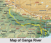
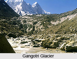
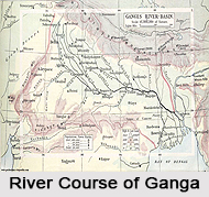
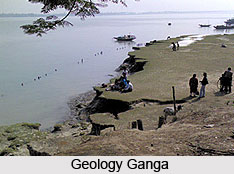
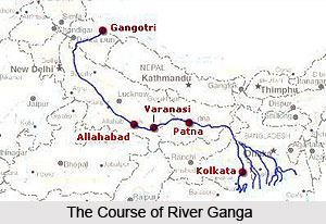
The Ganga River basin is affluent with perennial rivers and streams having special significance in the region it flows. Some of the important rivers in the Ganga River Basin are as follows -

The Hooghly River or the Bh?girathi-Hooghly is an approximately 260 km long distributary of the Ganges River in West Bengal, India. The river divides from the Ganges as a canal in Murshidabad District at the Farakka Barrage. The town of Hugli-Chinsura was formerly known as Hooghly. This town is located on the river, in the Hooghly (district). The origins of the name of Hooghly River are not known, whether the city or the river derived the name first.

The Damodar River rises near Chandwa village in the Palamau district of Jharkhand. This region is the Chota Nagpur Plateau region of India. The river flows through the states of Jharkhand and West Bengal for nearly five hundred and ninety two kilometers and then merges with the Hooghly River, which is in the south west of Kolkata. The Damodar River has a number of tributaries and distributaries. They are Barakar, Konar, Guaia, Jamania, Usri, Bokaro, Haharo, Khadia and Bhera. The Barakar is the most important tributary of the Damodar River. This River arises near Padma in Hazaribagh district, flows through Jharkhand, and meets the Damodar River in Dishergarh in West Bengal.

The Rupnarayan River is a river in eastern India. It begins as the Dhaleswari (Dhalkisor) in the Chhota Nagpur plateau foothills northeast of the town of Purulia. It then follows a tortuous southeasterly course past the town of Bankura, where it is known as the Dwarakeswar River.

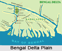
The Meghna River is an essential river in Bangladesh, one of the three that forms the Ganges Delta, the largest on earth. The Meghna River is formed within Bangladesh by the merging of different rivers originating from the hilly areas of eastern India. The river converges with the Padma River in Chandpur District. The river finally flows into the Bay of Bengal in Bhola District.

The Padma River is a major trans-boundary river between Bangladesh and India. It is the main distributary of the Ganges that originates in the Himalayas. The Padma enters Bangladesh from India near the place called Chapai Nababganj. The river meets the Jamuna near Aricha and retains its name. However, finally meets the Meghna River near Chandpur and takes up the name `Meghna` before emptying into the Bay of Bengal. Rajshahi, a major city in western Bangladesh lies on the north bank of the Padma.

Kosi River, one of the main rivers in Bihar and a prominent tributary of the Ganges, originates in the Himalayas. Along with its tributaries the Kosi River traverses along parts of Tibet including the Mount Everest region and also one third of the eastern part of Nepal. The river has shifted its course from east to west about 120 kilometers in the last two hundred years.

The Gandak River is also known as the Kali Gandaki and Narayani after the confluence with Trisuli in Nepal. Gandak River is a tributary of the Ganga or Ganges River. It is one of the major rivers in Nepal and India. It is a north bank tributary of the Ganga in India. It rises at 7620 m in Tibet near the Nepal border and overlooks the Dhualagiri peak. It is distinguished for the deep gorge across which it flows and for a large hydroelectric facility in Nepal.

One of the largest southern tributaries of the Ganges is the Son River of central India. The Son River originates in the state of Chhattisgarh in the east direction of the origin of Narmada River. It then flows in the north-northwest direction through Madhya Pradesh before turning in the east direction where it meets the Kaimur range. The river starts flowing in the parallel direction of the Kaimur range in the east-northeast direction through Uttar Pradesh and Bihar and joins the Ganges just above Patna, the capital of Bihar.
Ganga River Basin
Ghaghara River is also called the Gogra, Ghaghra or Ghagra, Nepali Kauriala or Manchu or the Karnali. However, the literal meaning of the river is ` holy water from the sacred mountain`, the term Karnali also means "Turquoise River" and is a trans-boundary perennial river that originates on the Tibetan plateau. The Karnali is called K`ung-ch`iao Ho in Chinese. This river near Manasarovar, cuts through the Himalayas in Nepal on its way to the convergence with the Sarda River at Brahmaghat in India where it forms the Ghaghra River. The Ghaghra River is a major left bank tributary of the Ganges.

River Yamuna is a major river of the northern India; this river has a total length of about 1370 km. Also known as the `Jumna`, its source is at the Yamunotri glacier near Banderpoonch peaks, in the Mussourie range of the lower Himalayas at an elevation of about 6387 meters above mean sea level in district Uttarakashi, the Uttarakhand Himalaya This river, flows in a southerly direction through the Himalayan foothills, onto the northern Indian plain, and a series of valleys for about 200 Kms, along the Uttar Pradesh-Haryana state border.

The origin of Koel River is in the Palamu Tiger Reserve and flows in the western part of Palamu District. The river divides into two - the North Koel River and the South Koel River.

The Rihand river flows in east-central India and is a tributary of the Son River. The Rihand`s headwaters originate in the Bagelkhand region of Madhya Pradesh state, and flow towards the north into Sonbhadra District of Uttar Pradesh.
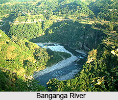
Ban-Ganga River is a prominent river in the Bharatpur district of the Indian state of Rajasthan. Betwa river is a north Indian river and a tributary of the Yamuna originating in the Vindhya Range just north of Hoshangabad in Madhya Pradesh. In Sanskrit `Betwa` is called `Vetravati` which means containing reeds. The Dhasan River is a distinguished tributary of the Betwa River.

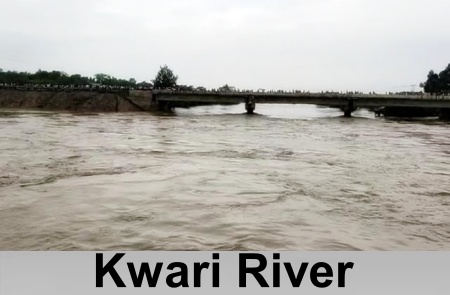
The Halalai River is an Indian river, flowing across the state of Madhya Pradesh. Kaliasote River is a prominent river flowing in Madhya Pradesh. The Sindh river flows in the state of Madhya Pradesh of central India. Kwari River is also spelled as Kuwari or Kunwari River. This river flows in Morena, Bhind districts of Madhya Pradesh in central India. Pahuj River is an Indian river flowing in Bhind District of Madhya Pradesh in central India.

A principal tributary of the Yamuna River is the Chambal River (also known as Charmanwati, or Charmawati), which is an important river of the Malwa Plateau. Banas river flows in Rajasthan and a major confluent of the Chambal River, which flows into the Yamuna, which is again a tributary of the Ganges. A major tributary of the Banas River is the Berach River, which flows in Rajasthan. Ahar River is considered as a significant river in India, since the cradle of Udaipur Civilization was built. Kali Sindh river flows in the Malwa region of Madhya Pradesh and joins the Chambal River at downstream of Sawai Madhopur in Rajasthan. An important river in the Indian state of Himachal Pradesh is the Parbati River. This river rises from the Man Talai Glacier below the Pin Parbat pass.

Ganga River Basin The Shipra River also spelt, as Kshipra is a river in that flows in the state of Madhya Pradesh, which is located in central India. The Gambhir River rises in the hills near Karauli village of Sawai Madhopur District in the western state of India, Rajasthan. The Gomti River originates from the east of Pilibhit town at a height of 200 meters. The river is also known by the names as Gumti or Gomati. The Mahananda River is a major confluent of the Ganges in eastern part of India.

Mahakali River is also known as Sarda river and flows in between the border of Nepal and India. The Bhagirathi River arises at Gomukh and is considered as a mythological river in India. The River Alakananda flows in the region of Uttaranchal.


Religious Importance of Ganga River

Religious Importance of Ganga RiverThe religious significance of Ganga River is established at the origin itself. The gangotri is the spot of origin of River Ganges. Many pilgrimages for the Hindus are settled along the banks of River Ganges. The Hindus religiously worship the river. Situated on the banks of River Ganges, Varanasi is considered by some to be the most holy city in Hinduism. The Ganga is mentioned several in the Rig-Veda, which is the earliest of the Hindu scriptures. The reference of this river also appears in the nadistuti or Rig Veda 10.75, which lists the rivers from east to west. In RV 6.45.31, the word Ganga is also mentioned, but it is not clear whether this reference is to the river.

According to Hindus the river Ganga is sacred and a feminine river. The river is worshiped by Hindus and personified as a Devi goddess, who holds a significant place in the Hindu religion. Hindu faith holds that bathing in the river, especially on certain occasion causes the forgiveness of sins and helps to attain salvation. Many people believe that this will come from bathing in the Ganga at any time. People come from distant places to submerge the Cremation and ashes collection ashes of their family or relatives in the waters of the Ganga; this immersion also is believed to send the deceased soul to heaven. Several places revered to Hindus lie along the banks of the river Ganga, including Haridwar and Varanasi. People carry holy water from the Ganges that is preserved in copper pots after making the pilgrimage to Varanasi. It is believed that drinking water from the Ganga with one`s last breath will take the person`s soul to heaven for sure.

Religious Importance of Ganga River Hindus also believe that life is incomplete without having a bath in the Ganga at least once in one`s lifetime. Most Hindu families keep a vessel of water from the Ganga in their house. This is done because it is esteemed to have water of the Holy Ganga in the house, and also if someone is dying, that person will be able to drink this holy water. Many Hindus believe that the water from the Ganga can purify and cleanse a person`s soul of all past sins, and that it can also cure the ill. The ancient scriptures mention that the water of Ganges carries the blessings of Lord Vishnu`s feet; hence Mother Ganges is also known as Vishnupadi, this term means "Emanating from the Lotus feet of Supreme Lord Sri Vishnu."

Some of the most important Hindu festivals and religious worship happen at the river Ganges. Many festivals are celebrated on the banks of the river Ganga, such as the Kumbh Mela every twelve years at Allahabad and the Chhat Puja.

Varanasi has hundreds of temples along the bank of the Ganges, which are often flooded during the rains. This city, especially along the bank of the Ganges, is a chief place of worship for the Hindus as well as a cremation ground.

Indian Mythology states that Ganga is the daughter of Himavan - the king of the Mountains She had the power to purify anything that touched her. According to myths Ganga flowed from the heavens and purified the people of India. After the funeral, Indians often submerge the bodies of their dead in the Ganga, which is thought to purify them of their sins.


Course of River Ganges

Course of River GangesCourse of River Ganges can be classified into three parts: Upper Course, Middle Course and Lower Course. Ganges originates in the Himalayan Mountain Range at the confluence of six rivers. The Alaknanda River meets the Dhauliganga at Vishnuprayag, the Pindar at Karnaprayag, the Nandakini at Nandprayag, the Mandakini at Rudraprayag and finally the Bhagirathi River at Devprayag. Since these confluences, the river flowing is known as the River Ganga.

Upper Course of Ganga River
The Bhagirathi River is considered the source stream and the stream originates at the Gangotri Glacier, at a height of 7,756 m or 25,446 ft. The melting snow and ice from glaciers including glaciers from peaks such as Nanda Devi and Kamet Peak feed these rivers. After travelling 200 km through the Himalayas, the Ganges emerges at the pilgrimage town of Haridwar in the Shivalik Hills. At Haridwar, a dam diverts some of its waters into the Ganges Canal, which links the Ganges with its main tributary, the Yamuna. The Ganges, whose course has been roughly south-western until this point, now begins to flow southeast through the plains of northern India.

Middle Course of Ganga
The river Ganga follows an 800 km curving course passing through the city of Kanpur before being merged by the Yamuna River at Allahabad from the southwest direction. This point is known as the Sangam at Allahabad. Tribeni Sangam, is considered as a sacred place in Hinduism. According to ancient Hindu texts, at one time a third river - the Sarasvati met the other two rivers at this place.

Course of River GangesLower Course of Ganga River
Numerous tributaries and distributaries such as the Kosi River, Gandak River, Son River and Ghaghra River join the Ganga River and form an alarming current in the stretch between Allahabad and Malda District in West Bengal. On its way it passes the towns of Mirzapur, Patna, Varanasi, and Bhagalpur. At Bhagalpur, the river moves across the Rajmahal Hills, and begins to run southwards. At Pakur, the river begins its erosion with the moving away of its first distributaries, the Bhgirathi-Hooghly, which goes on to form the Hooghly River. Near the border with Bangladesh the Farakka Barage was built in 1974. This barrage controls the flow of the Ganges, diverting some of the water into a feeder canal linking the Hooghly to keep it comparatively free of silt.

Division of Ganga River and Padma River
After entering Bangladesh, the main branch of the Ganges is known as the Padma River until the Jamuna River joins the largest distributaries of the Brahmaputra River. Even more downstream, the Meghna River feeds the Ganges. The Meghna River is the second largest tributary of the Brahmaputra, and takes on the Meghna`s name as it enters the Meghna Estuary. Fanning out into the 350 km wide Ganges Delta, it finally empties into the Bay of Bengal. The Amazon and the Congo are the only two rivers that have greater discharge than the combined flow of the Ganges, the Brahmaputra River and the Surma-Meghna river system.


Economic Significance of Ganga River

Ganga River is an important source of fertile soil and significantly affects lives and settlement in the Indo-Gangetic Plain. Agriculture in India and Bangladesh depends on Ganga River. Ganga River and its tributaries provide water for irrigation to an extensive area. The chief crops cultivated in the area include rice, sugarcane, lentils, oil seeds, potatoes and wheat. Along the banks of the river, swamps and lakes provide a rich growing area for crops such as legumes, chillies, mustard, sesame, sugarcane and jute. Fishing along the Ganga is a possibility, but it is important to note that the river remains highly polluted.


Jahnavi - Rover Ganga

Jahnavi, Ganga river coming out of sage Jahnu`s earJahnavi is a name of River Ganga. Jahnavi is known as the daughter of Jahnu. There is a legend behind this name of Ganga. It is said that the ascetic Bhagiratha brought Ganga or Jahnavi on the earth. After the propitiation, Ganga was brought from heaven and then the sage Jahnu was disturbed in his devotions by the passage of the river. The sage Jahnu was angered very much and drank up all the waters of Jahnavi or Ganga. But, later he relented and allowed the river to come out of his ear. Therefore, the river Ganga is also called Jahnavi that means the daughter of Jahnu.


Share this Article:

Related Articles

More Articles in Geography of India


Geography of Uttar Pradesh
The fourth largest State in India UP is located in the Northern part of India whose area is 2,36,286 sq Kms.
Geography of Maharashtra
Covering an area of 308,000 sq. km, Maharashtra, the third largest state in India.
Geography of Kerala
Geography of Kerala includes plains, hills, valleys and coasts. With the Arabian Sea in the west, the Western Ghats in the east and networked by several rivers, Kerala enjoys diverse geographical features.
Geography of West Bengal
The geography of West Bengal is unique with high peaks of the Himalayan range in the north, the Bay of Bengal in the south and the remaining region is covered with both plains and plateaus.
Geography of Jharkhand
Geography of Jharkhand is comprised of the rich mineral resources and the highly agricultural prospect in this state.
Geography of Sikkim
Geography of Sikkim is characterised by a vast array of magnificent hillock that extends from one corner of the state to the other.
Geography of Meghalaya
The suitable climate, highland plateaus, rivers and the flora and fauna together forms the geography of Meghalaya.
Geography of Mizoram
Mizoram is surrounded by hills, valleys, rivers, waterfalls and lakes. The hills range from 1000 meters to 2000 meters. Rivers, lakes and waterfalls also play major role in forming the land of Mizoram.
Geography of Jammu & Kashmir
Jammu and Kashmir is encompassed by valleys. Some of the dominant valleys of the state are Kashmir Valley, Tawi Valley, Chenab Valley, Poonch Valley, Sind Valley and Lidder Valley etc. Jhelum River is the only major Himalayan River which flows through the Kashmir valley. Indus, Tawi, Ravi and Chenab Rivers are the major ones flowing through the region.
Geography of Daman and Diu
Daman and Diu is situated on the west coast of India and are the smallest union territories of India.
Geography of Goa
Geography of Goa occupies a prime location along the Konkan coastal belt on the western coast of India. The state is bordered by Maharashtra in the north and Karnataka in the south. The Western Ghats in the east contribute to the flora and fauna of Goa.
Geography of Arunachal Pradesh
Geography of Arunachal Pradesh reveals that it is a hilly tract nestled in the foot of Himalayas.
Geography of Kutch
Geography of Kutch District is covering an area of 45,612 km. Kutch District is the largest district in the state of Gujarat.
Geography of Ladakh
Geography of Ladakh mainly comprises the huge Karakoram Range with long stretch of cold desert which mark the region separately from the rest of the states of Indian subcontinent. Surrounded with the mountain ranges from all corners this small region separates Indian subcontinent from rest of the Asian continent.
Geography of Rajasthan
Geography of Rajasthan defines the dry topography with arid climate of the western mountain region.
Geography of Tamil Nadu
The Indian state of Tamil Nadu is located in the Northern hemisphere in the hot zone.
Ganga River
Ganga River is a trans-boundary river which has religious, economic and historic significance. The river is considered to be the third largest river in the world by discharge. In 2007, Ganga River was ranked as the fifth most polluted river in the world.
Narmada River
Narmada River is regarded as the 5th longest river of India and the life line of Madhya Pradesh. Narmada River basin spreads over an area of about 98,796 square kilometers. It comes next to Ganga River in terms of holiness and it has several legends associated with its origin.
Bhima River
The Bhima River is the largest tributary of the Krishna River and is significant in the western and southern Indian states.
Cauvery River
The Kaveri River or Cauvery River is one of the most important rivers in southern India.