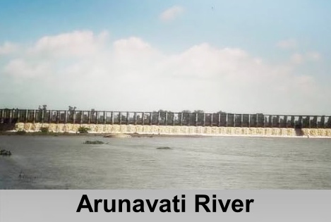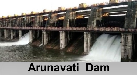
Arunavati River

Arunavati River is a seasonal right-bank tributary of the Tapi River, flowing through parts of Madhya Pradesh and Maharashtra. Originating in the Satpura Range, it supports agriculture through irrigation projects such as the Karwand Dam.

Introduction

Arunavati RiverArunavati River is a seasonal right-bank tributary of the Tapi River in India. Originating near the village of Sangvi, it flows through the region before joining the Tapi River near the village of Uparpind in Shirpur tehsil. The river carries a substantial volume of water primarily during the monsoon season, reflecting its seasonal nature. Several dams have been constructed along its course, the most prominent among them being the Arunawati Dam.

Arunavati River drains a diverse landscape that includes the hilly terrain of the northern and northeastern regions as well as the flatter plains to the south, extending across parts of Madhya Pradesh and Maharashtra. Like many ephemeral rivers originating in the Satpura region of central India, the Arunavati exhibits significant seasonal variations in its flow patterns. During the southwest monsoon, the river experiences substantial increases in discharge as a result of intense rainfall. However, with the onset of the dry season, water levels decline considerably, and the river may cease to flow altogether in certain sections.

Course of Arunavati River

Arunavati River originates in the rugged and hilly terrain of the Satpura Range in central India. From its source, the river follows a generally southwesterly course, initially forming a short stretch of the boundary between the states of Madhya Pradesh and Maharashtra before entering the Dhule district of Maharashtra. As it flows onward, the river passes through the outer ranges of the Satpura Hills, traversing deeply dissected and uneven landscapes in its upper reaches before gradually entering the flatter plains of the southern region. The Arunavati extends for approximately 70 kilometres along this course. 

The river is characterized by a distinctly seasonal flow pattern shaped by the tropical climate of the region. In the hilly areas near its source, the Arunavati maintains a perennial flow throughout the year. However, water levels decline considerably in the middle reaches during the dry season, and the riverbed often becomes dry as water infiltrates the porous basaltic bedrock. Eventually, the Arunavati joins the Tapi River as a right-bank tributary near Vanaval village in the Shirpur tehsil of Dhule district, where it contributes to the hydrological system of the wider Tapi basin in the foothills of the Satpura Range.

Arunavati River Basin

Arunavati River basin covers an area of approximately 738 square kilometres and is located predominantly in the northwestern part of Maharashtra, with smaller portions extending into the neighbouring state of Madhya Pradesh. The basin is characterized by a varied landscape, consisting of hilly terrain in the northern and northeastern regions that gradually gives way to plains in the south. Its elongated form reflects the influence of the surrounding topography, which is largely influenced by the Deccan Trap formations and their associated hydrological characteristics. 

The drainage network of the basin displays sub-dendritic to dendritic patterns, indicating the presence of relatively uniform lithological conditions and only limited structural control, with moderate evidence of tectonic influence. The Arunavati River is sustained chiefly by numerous small seasonal streams that originate in the surrounding hills, and it does not possess any major named perennial tributaries. Among its notable sub-basins are Ambad Nala, Chondi Nala, and Jhibavi Nala, all of which contribute to the river's seasonal flow regime.

Irrigation and Water Management on Arunavati River

Arunavati RiverSeveral water-management structures have been developed along the Arunavati River to support irrigation and local water supply in the surrounding region. Among the most significant of these is the Arunawati Dam, an earthfill and gravity dam constructed near Digras in the Yavatmal district of Maharashtra. The structure rises to a height of approximately 29.5 metres above its lowest foundation and extends for about 5,170 metres in length. 

Another important reservoir on the river is the Karwand Dam, situated near Shirpur in the Dhule district. Constructed as an earthfill dam, it has a maximum height of 39.3 metres above its lowest foundation and a total length of 2,966 metres. Completed in 1970 and operated by the Government of Maharashtra, the dam plays an essential role in supporting irrigation throughout the region. In addition to these larger structures, a number of smaller check dams and water-retention systems have been established in the upper reaches of the basin to promote groundwater recharge and maintain water availability during dry periods. Unlike many major river systems, the Arunavati does not possess any large hydropower facilities, and its infrastructure is primarily designed to serve irrigation needs and provide water for local communities. 

The river is an important source of irrigation in the Dhule district, particularly through the network supported by the Karwand Dam. Water supplied by the project contributes significantly to agricultural activities in areas such as Shirpur tehsil, where crops including cotton, soybean, and pulses are widely cultivated. In this semi-arid region, the river plays a vital role in reducing the effects of drought and supporting farming in predominantly rain-fed landscapes. 

Water management within the basin depends largely on the seasonal inflow generated by the southwest monsoon. The storage capacity of the reservoirs allows water to be allocated during periods of summer scarcity, thereby ensuring a more reliable supply for agricultural and domestic purposes. At the same time, local programmes focusing on watershed management and soil conservation have been implemented to promote the sustainable use of water resources.

Biodiversity of Arunavati River

Arunavati River basin supports ecosystems that are characteristic of the dry deciduous forests of central India. The surrounding landscape is marked by hilly terrain covered with teak and a variety of other deciduous tree species, interspersed with agricultural lands that occupy the more level areas of the basin. This mosaic of natural vegetation and cultivated fields contributes to the ecological diversity of the region. 

Despite the river's predominantly seasonal flow regime, the basin provides important habitats for a range of plant and animal species. The riparian zones become particularly productive during the monsoon season, supporting wildlife such as deer and numerous bird species that are adapted to these periodically inundated environments. Aquatic biodiversity is largely composed of resilient organisms capable of surviving the intermittent flow conditions and temporary drying that characterise the Arunavati River.

Environmental Threats to Arunavati River

Arunavati River is subjected to a range of environmental pressures arising from its geomorphological setting and catchment characteristics. The basin's predominantly dendritic drainage pattern reflects a landscape prone to high surface runoff and active erosion. These processes are further influenced by neo-tectonic activity, steep topographic gradients, and variations in the underlying lithology, all of which contribute to significant soil erosion and stream incision. Together, these features illustrate the structural complexity of the Satpura Range through which the river flows. 

Human activities within the catchment, particularly agricultural expansion and cultivation, have also affected the river basin by increasing sediment input and contributing to habitat degradation. Although there are no widely documented reports of severe pollution or major ecological impacts directly associated with dam construction along the Arunavati River, ongoing land-use changes continue to influence the basin's environmental condition. 

Conservation initiatives within the broader Tapi River basin primarily emphasize watershed management, soil conservation, and erosion-control measures. These efforts are intended to reduce land degradation, preserve the river's seasonal flow regime, and promote the sustainable management of water and natural resources throughout the catchment.

Recently updated articles in Geography of India

Pahuj River
Pahuj River Thumbnail

Pahuj River

Pahuj River is an important tributary of the Sindh River that flows through the Indian states of Madhya Pradesh and Uttar Pradesh. Originating in the...

Arunavati River
Arunavati River Thumbnail

Arunavati River

Arunavati River is a seasonal right-bank tributary of the Tapi River, flowing through parts of Madhya Pradesh and Maharashtra. Originating in the Satp...

Nira River
Nira River Thumbnail

Nira River

Nira River is an important tributary of the Bhima River flowing through Maharashtra. Originating in the Western Ghats, it traverses Pune, Satara, and...

Vena or Wena River
Vena or Wena River Thumbnail

Vena or Wena River

Vena, also known as the Wena River, is a tributary of the Wardha River in Maharashtra, India. Originating from the Mahadagad Hills in Nagpur district,...

Kwari or Kuwari/ Kunwari River
Kwari or Kuwari/ Kunwari River Thumbnail

Kwari or Kuwari/ Kunwari River

Kwari River, also known as Kuwari or Kunwari, is a significant river of central India, flowing through Madhya Pradesh and Uttar Pradesh. Originating n...