
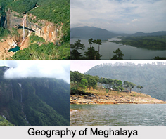
 Spreading over an area of 22,429 sq. km, Meghalaya is located between Bangladesh in the south and the Brahmaputra Valley in the north. The state is one of the seven sister states of north east India and is a hill station with stretches of valley and highland plateaus. The geography of Meghalaya mainly consists of Archean rock formations, which are geologically rich with high deposits of valuable minerals like coal, limestone, uranium and sillimanite.
Plateaus of Meghalaya
Meghalaya is often termed as the Shillong Plateau or the Meghalaya Plateau. Among other things, the geography of Meghalaya consists of highland plateaus which stand at an elevation that ranges between 150 m to1, 961 m. The Khasi Hills are part of the central plateaus, which has the highest elevation, followed by the eastern section comprising the Jaintia Hills region. The highest point in Meghalaya is the Shillong Peak, standing at an altitude of 1,961 m in the Khasi Hills. The western section of the plateau is mostly plain and comprise of the Garo Hills region. The highest point in the Garo Hills is Nokrek Peak with an altitude of 1, 515 m.
Rivers of Meghalaya
The rivers form an important aspect of the geography of Meghalaya. Most of the rivers of the state are rain fed and seasonal. The important rivers in the Garo Hills region are Ganol, Daring, Sanda, Kalu, Bugai, Krishnai, Simsang, Nitai and the Bhupai. Among them, the navigable rivers are Kalu, Krishnai and Nitai. And in the eastern and central parts of the Meghalaya Plateau, the major rivers are Digaru, Umkhri Kynchiang and Myntdu.
Climate of Meghalaya
The high altitude and other physical features greatly influence the state"s climate and are a major aspect of the geography of Meghalaya. The average annual rainfall the state receives is 12,000 mm and is thus called the wettest place on earth. The town of Sohra in Cherrapunji holds the world record for most rain in a month, while the village of Mawsynram holds the record for the most rain in a year.
Places with lower elevation like the Garo Hills experience high temperatures most of the year. Shillong, the capital of Meghalaya has the highest elevations but experiences generally low temperatures. The maximum temperature in Meghalaya rarely rises above 28 degree Celsius.
Flora and Fauna of Meghalaya
About 9,496 sq. km of the total area of Meghalaya is dense primary subtropical forest and thus, there is a large number of floral and faunal biodiversity. With a suitable climate and the presence of several small seasonal rivers supports the existence of flora and fauna in abundance.
Due to diverse climatic and topographic conditions, Meghalaya forests support a vast floral diversity, including a large variety of parasites, epiphytes, succulent plants and shrubs. The state also has a large variety of mammals, birds, reptiles and insects including elephants, bear, red pandas, civets, mongooses, weasels, rodents, gaur, wild buffalo, deer, wild boar and a number of primates.









