Districts of Gujarat
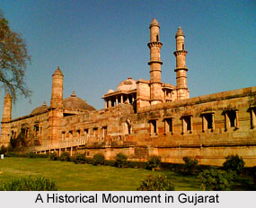
 Districts of Gujarat include 33 districts which are now developing. Gujarat is an Indian state that has a coastline of 1,600 km, mostly on the Kathiawar peninsula, with a population of more than 60 million. Gandhinagar is the capital of Gujarat, whereas Ahmedabad is the largest city. The state is amongst the most industrialised states in the country and has the fastest growing economy. The GDP of the state is double the national average. Situated on the western part of India, Gujarat is well known for its handicrafts, historical monuments, mouth-watering delicacies, wildlife sanctuaries and also as the major industrial and commercial state of India. The state has as many as four national parks and eleven sanctuaries.
The 33 districts of Gujarat have been discussed below in brief:
Gandhinagar District: It is the commercial and cultural thread of Gujarat.
Ahmedabad District: It is situated in central India and it is the hub of textile industries in the country and was earlier known as the Manchester of India.
Vadodara District: It is a major industrial district of Gujarat with its pharmaceutical, glass and fertilizer industries.
Rajkot District: It is the producer of important crops like groundnut, cotton, sugarcane.
Surat District: It is famous for zari work and cutting and polishing of diamonds.
Anand District: The largest milk cooperative of Asia, the Amul Dairy is located in this district.
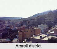
Amreli District: It is largely dependent on agriculture and the main crops grown here are bajra, jowar and cotton. The nearby attractions of the district are Sasan Gir Wildlife Sanctuary, Khodiyar mandir and Pipavav port.
Banaskantha District: It has a rich deposit of marble quarries and copper. This town is famous for developing India`s diamond industry and trade.
Bharuch District: It is a fourth major cotton producing district in Gujarat and is one of the oldest towns of the state.
Bhavnagar District: It is an ideal tourist destination and the major attractions are Gandhi Smriti, Takhteshwar Temple, Velavadar National Park, Barton Library and Museum, Sri Ghogha Teerth, Mahuva Teerth and Palitana etc.
Dahod District: It covers an area of 5,300 sq km, with the headquarters at Dahod.
Dang District: It is covered with vast stretches of forest reserves which are dominated by the tribal communities. Mahal Bardipara wildlife sanctuary and the spectacular Gira Waterfalls are suitable short excursion sites in the district.
 Jamnagar District: It is renowned for Gujarat`s traditional handicraft Bhandej or Bandhani. One of the sacred pilgrim centres of the Hindus, Dwaraka comes under the jurisdiction of this district. The main crops grown in the district are groundnut and jowar.
Junagadh District: It is an idyllic tourist destination with its Buddhist caves, rock edicts of Emperor Ashoka, ancient forts, Jami mosque, and step wells.
Kheda District: It is known as the land of the golden leaf because it is a major tobacco growing district of Gujarat. Lasundra, a small town of the district is famous for its hot springs.
Kutch District: It is the biggest district of Gujarat covering an area of 45,652 sq km with its administrative headquarters in the town of Bhuj. The major attractions in the district include the Aina Mahal, Sharad Baugh palace, the Royal Cenotaphs Chattris, the Kutch museum and the Ethnology museum.
Mehsana District: It covers an area of 9,027 sq km. with its administrative headquarters in Mehsana town. The district is dotted with a number of temples and the important ones are the Modhera Sun temple, Becharaji temple and the Hatkeswar temple in Vadnagar.
Narmada District: It is located in the southern part of Gujarat with its administrative headquarters in Rajpipla.
Navsari District: The district, with its headquarters at Navsari is spread over an area of 2,209 sq km.
Panchmahal District: It is located in the eastern part of Gujarat with the district headquarters at Godhra.
 Patan District: It is situated on the banks of the Saraswati river and the prime attractions of the district are Ranakivav (step-well) and Sahasraling Lake.
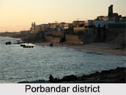
Porbandar District: It is based on agriculture as well as industries. Cement industry and Soda-ash industry are the two major industries and the main crops grown here are cotton, groundnut, bajra, gram, wheat, and jowar.
Sabarkantha District: It has its headquarters at Himmatnagar. Shamlaji a small town of the district is a famous pilgrim centre.
Surendranagar District: It is a major cotton growing area in Gujarat. The other crops grown here are bajra, jowar and groundnut.
Tapi District: This district shares its border with the state of Maharashtra and the district headquarters is in the town of Vyara.
Valsad District: An important industry of the district is salt making as the place is connected with Gandhi`s Salt Satyagraha movement.
Aravalli District: The district has been carved out of the Sabarkantha district. Its headquarters are at Modasa.
Botad District: It was created from the southwestern part of Ahmedabad District and the northwestern part of Bhavnagar District. Botad consists of four talukas- Botad, Gadhada, Barvala and Ranpur. Botad city is the administrative headquarters of the district.
Chhota Udaipur District: This tribal dominated district was carved out of the Vadodara district with its headquarters at Chhota Udaipur town.
Devbhumi Dwarka District: This district is located on the southern coast of the Gulf of Kutch. Its headquarters are located in Jamkhambhaliya. It was carved out of Jamnagar District.
Gir Somnath District: It is located on the southern portion of the Kathiwar peninsula with its headquarters at Veravai. The Gir Forest of this district is the abode of many wildlife creatures including lions, deer, and monkeys. Asiatic Lions can only be found here.
Mahisagar District: The district has been carved out of Panchmahal District and Kheda District. It has been named after the Mahi River. Lunawada is the district headquarters of Mahisagar.
Morbi District: Morbi city is the district headquaerters. It has five talukas naming Morbi, Maliya, Tankara, Wankaner and Halvad.
Districts of South Gujarat
 Districts of South Gujarat consist of the districts like Dang District, Navsari District, Surat District, Tapi District and Valsad District. These districts of southern part of Gujarat bear many tourist attractions.
Dang District : Dang District, which is also known as The Dangs, is a district in the state of Gujarat. The administrative headquarters of Dang District are located in Ahwa. The Dangs have an area of 1,764 square km and a population of 226,769. As of 2011, it is the least populous district of Gujarat (out of 33).
Navsari District : Navsari District is an administrative district in the state of Gujarat. Navsari has its headquarters at Navsari city. The district covers an area of 2,211 square kilometers, and has a population of 1,229,250 in 2001. Dudhia Talao is a popular tourism destination here. It had been a lake in medieval era. It has become a major market area with a shopping center in modern India. The Ashapuri Temple is on Dudhia Talao. Part of the Dudhia Talao was given to J.N. Tata Navsari Memorial Trust and they filled up the pond and built one of the finest auditoriums in Navsari where performing arts and meetings take place. It is known as J.N. Tata Memorial Hall.
Surat District : Surat District is a district in the state of Gujarat, with Surat city as the administrative headquarters of this district. It is surrounded by Bharuch District, Narmada District (North), Navsari District (South) and east Tapi district. To the west is the Gulf of Cambay, which makes Surat an important developed industrial city from the ancient era. It is the second-most advanced district in Gujarat. It had a population of 6,079,231 of which 79.68% were urban as of 2011.
Tapi District : Tapi district is one of the 33 districts of Gujarat state in western India. Vyara town is the district headquarters.
Valsad District : Valsad district is one of the 33 districts in Gujarat. It is bounded by Navsari district to the north, Nashik district of Maharashtra state to the east, and Dadra and Nagar Haveli union territory and Palghar district of Maharashtra to the south. The Arabian Sea lies west of the district. The coastal Daman enclave of Daman and Diu union territory is bounded by Valsad district on the north, east, and south. The district`s administrative capital is Valsad. The district`s largest city is Vapi.
Districts of Central Gujarat
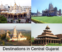 Districts of Central part of Gujarat include Ahmedabad District, Anand District, Bharuch District, Chhota Udaipur district, Dahod District, Kheda District, Mahisagar district, Narmada district, Vadodara District and Panchmahal District.
Ahmedabad District : Ahmedabad District comprises the city of Ahmedabad, in the central part of the state of Gujarat in western India. It is the seventh most populous district in India.
Anand District : Anand District is an administrative district of Gujarat and is popularly known as Charotar. It was carved out of the Kheda district in 1997. Anand is the administrative headquarters of the district. Anand District is bounded by Kheda District to the north, Vadodara District to the east, Ahmedabad District to the west, and the Gulf of Khambhat to the south. The major towns in Anand District are Khambhat, Tarapur, Petlad and Sojitra.
Bharuch District : Bharuch District is a busy district in the southern part of Gujarat on the west coast of the state of Gujarat with a size and population comparable to that of Greater Boston. The Narmada River outlets into the Gulf of Khambat through its lands and that shipping artery gave inland access to the kingdoms and empires located in the central and northern parts of the sub-continent of India.
Chhota Udaipur District : Chhota Udaipur district is a district in the state of Gujarat in India. It was carved out of the Vadodara district on 26th January 2013 with its headquarters at Chhota Udaipur town and is the 28th district of Gujarat.
Dahod District : Dahod District is located in Gujarat state in western India. Dahod is called as its administrative capital.
Kheda District : Kheda District is one of the thirty-three districts of Gujarat state in western India. Nadiad city is the administrative headquarters of the district.
Mahisagar District : Mahisagar district is a district in the state of Gujarat in India that came into being on 26th January 2013, becoming the 28th district of the state. The district has been carved out of the Panchmahal district and the Kheda district. The name Mahisagar is given from "Mahi River".
Narmada District : Narmada district is an administrative district in the state of Gujarat. The district headquarters are located at Rajpipla. Narmada district is bounded by Vadodara district in the north, by Maharashtra in the east, by Tapi district in the south and by Bharuch district in the west.
Panchmahal District : Panchmahal District, which is also Panch Mahals, is a district in the western India, in the eastern portion of Gujarat. The Panch-mahal means five tehsils or talukas and refers to the five sub-divisions that were transferred by the Maharaja Jivajirao Scindia of Gwalior State to the British East India Company. The towns like Godhra, Dahod, Halol, Kalol and Jhalod are the capital cities in Panchmahal District.
Vadodara District : Vadodara District is a district in the eastern part of the state of Gujarat in western India. The city of Vadodara, located in the western part of the district is the administrative headquarters. Vadodara District covers an area of 7,794 square km. It had a population of 3,641,802 of which 45.20 percent were urban as of 2001 census. As of 2011 it is the third most populous district of Gujarat after Ahmedabad and Surat.
Districts of Saurashtra Region
 Districts of Saurashtra Division include Amreli district, Bhavnagar District, Botad District, Dwarka District, Gir Somnath District, Junagadh District, Morbi District and Porbandar District.
Amreli District : Amreli district is one of the 33 administrative districts of the state of Gujarat in western India. The district headquarters are located at Amreli. Amreli is land of Yogiji Maharaj, Danbapu, Sage Muldas, Sage Bhojalrambapa, Sage Muktanand Swami, Magician K.Lal, Zaverchand Megahani`s place (Bagasara), Dr. Jivaraj Mehata etc. Amreli covers Gir National forest sanctuary area.
Bhavnagar District : Bhavnagar District is a district of southeastern Gujarat, India, on the Saurashtra peninsula.
Botad District : Botad District is a district of the state of Gujarat, India. It was created on 15th August 2013 from the southwestern part of Ahmedabad District and the northwestern part of Bhavnagar District.
Dwarka District :
 Dwarka District which is better known as the Devbhumi Dwarka District is a district of India located on the southern coast of the Gulf of Kutch in the state of Gujarat. Its headquarters are located in the city of Khambhalia.
Gir Somnath District : Gir Somnath District- the land of temples and forests is a district of Gujarat. It is located on the southern corner of the Kathiawar peninsula with its headquarters at the town of Veraval.
Jamnagar District : Jamnagar District is a district of India located on the southern coast of the Gulf of Kutch in the state of Gujarat. Its headquarters are located in the eponymous city of Jamnagar.
Junagadh District : Junagadh District- the land of Mughal fort is a district of the Indian state of Gujarat. Its administrative headquarters is the city of Junagadh.
Morbi District : Morbi District is in the state of Gujarat, India. It was formed on August 15 2013, along with several other districts, on the 67th Independence Day of India.
Porbandar District : Porbandar district had a population of 5,86,062 of which 48.77% were urban as of 2011 census. This district was carved out of Junagadh District.
Rajkot district : Rajkot district is one of the 33 districts of the Indian state of Gujarat. Rajkot city is the administrative headquarters of the district. It is the third-most advanced district in Gujarat.
Surendranagar District : Surendranagar is an administrative district in the state of Gujarat. It has a population of approximately 1.7 million people. Surendranagar is also known as Jhalawad, as Jhala Rajputs ruled many principalities of Surendranagar district in medieval era.


