Home > Travel > States of India > Palghar district
Palghar district
Palghar District is a district in Maharashtra of Konkan Division has many tourist destinations.

Share this Article:

Palghar district, MaharashtraPalghar District is a district in the state of Maharashtra in Konkan Division.

History of Palghar District
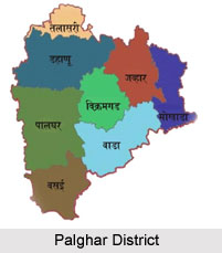
On 1st August 2014, the Maharashtra State government announced the formation of the 36th district of Maharashtra, when a new Palghar District was carved out of the old Thane district; it comprised the talukas of Palghar, Vada, Vikramgad, Jawhar, Mokhada, Dahanu, Talasari and Vasai-Virar.

Demography of Palghar District
Palghar has an urban population of 1,435,210, which is 48% of total population living in Urbanized Area. Palghar District comprises 8 talukas.

Geography of Palghar District
Palghar District is bounded by Thane and Nashik Districts on the east and northeast, and by Valsad District of Gujarat state and Union Territory of Dadra and Nagar Haveli on the north. Arabian Sea forms the western boundary, while Vasai-Virar is part of Mumbai Metropolitan Region. Palghar District is the northernmost part of the Konkan lowlands of Maharashtra. It comprises the wide amphitheatre like Ulhas basin on the south and hilly Vaitarna valley on the north together with plateaus and the slopes of Sahyadri. From the steep slopes of the Sahyadri in the east, the land falls through a succession of plateaus in the north and centre of the district to the Ulhas valley in the south. The distance from the parts of different palaces to headquarters Palghar by road is as follows: Khodala 138 km, Mokhada 112 km, Jawhar 75 km, Vikramgad 60 km.Palghar district, Maharashtra

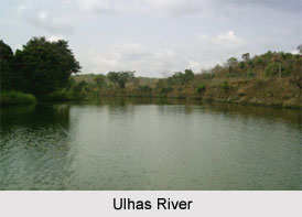
Rivers of Palghar District
The main river of Palghar District flowing through the district is the Vaitarna. The river has many tributaries; the most important of them are Barvi and Bhatsa, Pinjal, Surya, Daherja and Tansa. Vaitarna, the largest of Konkan Rivers, rises in the Tryambak hills in Nashik district, opposite to the source of Godavari River. The river flows across Shahapur, Vada and Palghar talukas and enter the Arabian Sea through a wide estuary of Arnala. Vaitarna River is 154 km long and has a drainage area that practically covers the entire northern part of the district. Ulhas River which flows to Arabian see is Vasai creek, district`s southern border. Arnala Island is located in Vasai taluka, at the entrance to the Vaitarna estuary.

Economy of Palghar District
Palghar District has India`s first atomic power plant located at Tarapur. The industrial town of Boisar is also home to one of largest industrial areas at Tarapur MIDC in Maharashtra. The largest fishing port of Maharashtra is Satpati; Dahanu, Arnala, Vasai and Datiware are also major fishing ports. Dahanu and Palghar are best known for their chickoo production in the whole of India.


Share this Article:

Related Articles

More Articles in States of India


East Indian States
East Indian States comprises of Bihar, Jharkhand, West Bengal, Odisha and also the Union Territory of Andaman and Nicobar Islands. It defines the cultural heritage, rich historical background and the linguistic unity.
Erode District
Erode District is one of the districts in the state of Tamil Nadu. The district of Erode is having a land-locked area with no sea coast.
Purnia District in Bihar
Purnia District is located in Bihar and extends from River Ganga to Nepal. The district has a rich Hindu history and glorious past.
South Delhi District
South Delhi District is the third largest district of Delhi as far as its area is concerned. South Delhi District is known for its economic, historical, cultural and social significance.
North Indian States
North Indian States formed the cultural and religious unity in spite of having many foreign invasion and the political disturbances from the early era till the British gained supremacy in Indian sub continent.
Kendujhar District
Kendujhar District, spread over an area of 8,240 sq kms, is as varied as the whole of Orissa with waterfalls roaring gorges, mountains and minerals. The manifold expressions of nature in Kendujhar District are considered as unique.
Hooghly district
Hooghly District along the bank of the river Hooghly is one of the principal trading ports of West Bengal.
Districts of South Tamil Nadu
Districts of South Tamil Nadu consist of many tourism destinations like archaeological sites and the history of Pandyas and Cholas. Considering their proximity to the sea, many districts also boast of serene beaches and coastal beauty.
Flora of Arunachal Pradesh
Flora of Arunachal Pradesh includes infinite species and is a subject of great interests for the botanists.
Districts of South Gujarat
Districts of South Gujarat are the epicenter of Jain pilgrimages and the early Hindu kingdoms.
North West States of India
North West States of India consist of three states, which are Rajasthan, Punjab and Haryana. All of them are culturally and traditionally diverse and they have been ruled by different dynasties in historical time.
Geography Of Chittoor District
Geography of Chittoor district is spread along the topography of the land which is divided into two natural divisions; Chittoor has a dry and healthy climate.
Districts of North Rajasthan
District of Northern part of Rajasthan is dotted with ancient forts and medieval villages.
Districts of North Odisha
District of North Odisha has Bengal boundary and shares the same culture. These are reachable if one pays a weekend visit to Digha.
Districts of West Bihar
Districts of West Bihar is comprised of medieval monuments that were built by the different governors of Mughal era.
Districts of South Haryana
Districts of South Haryana consists of many cities of industrial excellence. These districts are dotted with popular tourism destinations.
Medieval History of Assam
Medieval history of Assam narrates the advent and rule of a number of kingdoms in the region. The prominent dynasties of the kingdom left an everlasting imprint on the socio cultural heritage of India.
Geography of Meghalaya
The suitable climate, highland plateaus, rivers and the flora and fauna together forms the geography of Meghalaya.
Districts of Rayalaseema
Districts of Rayalaseema in Andhra Pradesh state has urban population and rural settlements as well.
Districts of South Punjab
Districts of Southern part of Punjab depict medieval history of Punjab and the rise of Sikhs.