Districts of Coastal part of
Andhra Pradesh include the districts like
East Godavari district, West Godavari district, Krishna district, Guntur district, Prakasam district, Nellore district, Srikakulam district and
Visakhapatnam district.
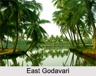
East Godavari District
East Godavari district is a district in Coastal Andhra region of Andhra Pradesh. Its district headquarters is at Kakinada.
Rajahmundry and Kakinada are the two largest cities in the Godavari district in terms of population. Rajahmundry was reorganized in 1859 into two districts of Godavari and Krishna. Godavari district was further bifurcated into East and West Godavari districts in 1925.
West Godavari District
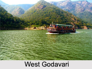
West Godavari district is one of the 13 districts in Andhra Pradesh. The district is situated in Coastal Andhra region of the state. Eluru is the administrative headquarters of the district. As of 2011 census of India, West Godavari district has an area of 2,989 sq miles and a population of 3,936,966. West Godavari district is bounded by
Krishna district on the west, East Godavari district on the east,
Bay of Bengal on the south and the state of
Telangana on the north.
Krishna District
Krishna district is an administrative district in the Coastal Andhra region.
Machilipatnam is the administrative headquarters.
Vijayawada is the most populated city in the district. It has an area of 3,370 sq miles. It is bounded by West Godavari District on the east, Bay of Bengal on the South,
Guntur District and Nalgonda district in the west and a portion of it also borders with the state of Telangana.
Guntur District
Guntur district is an administrative district in the Coastal Andhra. The administrative seat of the district is located at Guntur, the largest city of the district in terms of area and population. It has a coastline of approximately 100 km and is situated on the right bank of Krishna River that separates it from Krishna district and extends till it falls into the Bay of Bengal. Guntur is bounded on the south by Prakasam district and on the west by the state of Telangana. It has an area of 11,391 4,398 sq miles and is the 2nd most populous district in the state a population of 4,889,230.
Prakasam District
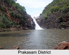
Prakasam district is an administrative district in the Coastal Andhra region. The headquarters of Prakasam district are located at
Ongole. Prakasam district is located on the west coast of Bay of Bengal and is bounded by Guntur district on the north, Kurnool district on the west, Kadapa District and Nellore district on the south. A part of north west region also borders the Mahabubnagar district of Telangana. Prakasam district is the 3rd largest district in the state with an area of 6,805 sq miles and had a population of 3,392,764.
Nellore District
Nellore district which is officially known as Sri Potti Sriramulu Nellore district, located in Coastal Andhra region. The population of Sri Potti Sriramulu Nellore district was 2,966,082. Nellore city is its administrative headquarters. Sri Potti Sriramulu Nellore district is bordered by the Bay of Bengal to the east, Kadapa district to the west, Prakasam District to the north,
Chittoor district and
Thiruvallur district of
Tamil Nadu to the south.
Srikakulam District
 Srikakulam district
 in the northern part of Andhra Pradesh is well known for the
Sangameswara Temple at Sangam, Bilvamangala Temple, Sri Sita Rama Swamy Temple, and Sri Mukhalingeswara Temple. The Dantapuri Buddhist remnant site, Mukhalingam Temple, Srikurmam Temple, Asaravalli Temple, Baruva Beach, Kallepalli Beach, Bhavanapadu Beach,
Navdurga Temple, Naarayana Tirumala Temple and many other tourist places are existent in the Srikakulam district.
Vizianagaram District
Vizianagaram district is a northern coastal district. The town of Vizianagaram is the district headquarters. The district is bounded on the east by the district of Srikakulam, southwest by the district of
Visakhapatnam, southeast by the Bay of Bengal, and northwest by the state of
Odisha. Vizianagaram district was formed on 1st June 1979, with some parts carved from the neighboring districts of Srikakulam and Visakhapatnam.
Visakhapatnam District
The
National Highway 5 (
Howrah to
Chennai) passes through Visakhapatnam district which consists of several flourishing industries which include oil refineries,
fertilizers,
steel plants, and
sugar refining and
jute industries. The district has some of the beautiful beaches, which are ideal tourist destinations.

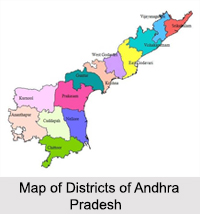 Districts of Andhra Pradesh, the third largest state of India consist of thirteen separate districts. The state was created in 1956. The districts of Andhra Pradesh are divided into two categories; they are the Coastal Andhra and Rayalaseema. Coastal Andhra includes nine districts of East Godavari, West Godavari, Krishna, Guntur, Prakasam, Sri Potti Sri Ramulu Nellore, Srikakulam, Vizianagaram, and Visakhapatnam. While on the contrary, Rayalaseema is comprised of four districts like Kurnool district, Chittoor district, Kadapa district and Anantapur district.
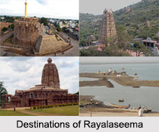 Districts of Rayalaseema in








