
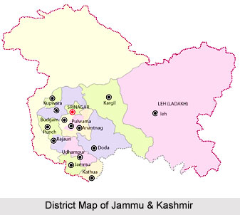
 Strategically located Jammu and Kashmir State constitutes the northern most extremity of India. Situated between 32.17 degree and 36.58 degree north latitude and 37.26 degree and 80.30 degree east longitude, the total area of the State is 22,22,236 sq. kms including 78114 sq kms under the illegal occupation of Pakistan and 42,685 sq kms under that of China, of which Pakistan illegally handed over 5130 sq kms to China.
The State is bounded by Pakistan, Afghanistan and China from the West to the East. The State ranks 6th in area and 17th in population among the States and Union Territories of India. The State consists of 14 districts, 59 tehsils, 119 blocks, 3 municipalities, 54 towns and notified area committee, 6477 inhabited villages and 281 uninhabited villages. It has four geographical zones:
 1. Sub-mountain and semi-mountain plain known as kandi or dry belt`
2. The Shivalik ranges;
3. The high mountain zone constituting the Kashmir Valley, Pir Panchal range and its off-shoots including Doda, Poonch and Rajouri districts and part of Kathua and Udhampur districts; and
4. The middle runs of the Indus River comprising Leh and Kargil.
The State of Jammu and Kashmir is the northern most state of India comprising three distinct Climatic regions- Arctic cold desert areas of Ladakh, temperate Kashmir valley and sub-tropical region of Jammu. There is a sharp rise of altitude from 1000 feet to 28250 feet above the sea level within State`s four degree of latitude.
Climate of Jammu & Kashmir
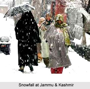
The climate varies from tropical in Jammu plains to semi-arctic cold in Ladakh with Kashmir and Jammu mountainous tracts having temperate climatic conditions. The annual rainfall also varies from region to region with 92.6 mm in Leh, 650.5 mm in Srinagar and 1115.9 mm in Jammu. A large part of the State forms part of the Himalayan Mountains. The State is geologically constituted of rocks varying from the oldest period of the earth`s history to the youngest present day river and lake deposits.









