
Girna River is an important river in the state of Maharashtra in western India.
It derives its name from the goddess Giraja, also known as Parvati, as well as from
Sarp Ganga. The river is a left-bank tributary of the Tapi River and
originates in the Western
Ghats mountain range in Nashik district.
Girna River
Girna River is an important tributary of the Tapi River in Maharashtra, India. Originating from Kem Peak in the Western Ghats, it flows through Nashik and Jalgaon districts before joining the Tapi near Yawal. The river supports agriculture, drinking water supply, and regional ecosystems.
Introduction
Course of Girna River
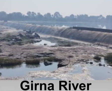 Girna River originates at Kem Peak in the Western Ghats and
flows eastward across Nashik district, where it is joined by the Mausam River before
passing through Malegaon.
From there, the river turns north and eventually merges with the Tapi River.
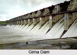
Two major dams have been constructed on the Girna, namely the Chankapur Dam, at
the confluence of the Sarpganga and Girna rivers, and the Girna Dam,
completed in 1969. The river basin is situated on the Deccan Plateau, and
its fertile valley supports extensive agricultural activities.
Girna River originates at Kem Peak in the Western Ghats and
flows eastward across Nashik district, where it is joined by the Mausam River before
passing through Malegaon.
From there, the river turns north and eventually merges with the Tapi River.
Two major dams have been constructed on the Girna, namely the Chankapur Dam, at
the confluence of the Sarpganga and Girna rivers, and the Girna Dam,
completed in 1969. The river basin is situated on the Deccan Plateau, and
its fertile valley supports extensive agricultural activities.
Girna River flows for approximately 241 kilometers and drains a basin covering about 10,061 square kilometers across the Nashik and Jalgaon districts of Maharashtra. It joins the Tapi River as a left-bank tributary near Yawal town in Jalgaon district, contributing to the hydrology of the larger Tapi basin before the Tapi River continues its westward course to the Arabian Sea.
Tributaries of Girna River
River. Originating in the Satmala Hills, it flows eastward before joining the Girna near Malegaon in Nashik district, where the confluence effectively divides the city into two parts. The Mosam River significantly increases the Girna’s discharge in its middle course, supporting irrigation and water supply for the surrounding agricultural areas.
In addition to the Mosam River, the Girna basin is drained
by numerous smaller streams and nalas that originate in the foothills of the
Western Ghats and the upland regions of Nashik and Jalgaon districts. Most of
these tributaries are seasonal in nature and collectively form a sixth-order
drainage network. They play an important role in transporting sediment,
replenishing water flow during the monsoon,
and influencing seasonal flooding within the basin.
Characteristics of Girna River Basin
Girna River basin is situated on the Deccan Plateau and is characterized by a predominantly flat landscape with gentle slopes and broad plains along the river's course. The river flows eastward and later turns north before joining the Tapi River near Yawal. The fertile valleys of the basin support intensive agriculture, with crops such as cotton and sugarcane widely cultivated.
 Geologically, the basin is underlain by the Deccan Traps, an
extensive sequence of basaltic lava flows formed during the Late Cretaceous to
Early Paleogene period. These basaltic formations strongly influence the
region's landforms, weathering processes, and soil characteristics. The basin
is dominated by black cotton soils (Vertisols), which develop from weathered
basalt and are noted for their high fertility, clay-rich composition, and
excellent moisture-retention capacity. Along the Girna River and its
tributaries, including the Anjani and Jhiri rivers, alluvial deposits
consisting of sands, brownish-yellow silts, and calcrete (locally known as
kankar) form narrow stretches that enhance groundwater recharge. Red soils
occur in limited upland areas and are generally productive only in regions
receiving comparatively high rainfall.
Geologically, the basin is underlain by the Deccan Traps, an
extensive sequence of basaltic lava flows formed during the Late Cretaceous to
Early Paleogene period. These basaltic formations strongly influence the
region's landforms, weathering processes, and soil characteristics. The basin
is dominated by black cotton soils (Vertisols), which develop from weathered
basalt and are noted for their high fertility, clay-rich composition, and
excellent moisture-retention capacity. Along the Girna River and its
tributaries, including the Anjani and Jhiri rivers, alluvial deposits
consisting of sands, brownish-yellow silts, and calcrete (locally known as
kankar) form narrow stretches that enhance groundwater recharge. Red soils
occur in limited upland areas and are generally productive only in regions
receiving comparatively high rainfall.
Girna River basin exhibits a dendritic drainage pattern and
is classified as a sixth-order watershed, with an extensive network of
interconnected streams. It’s moderate to fine drainage density reflects an
advanced stage of geomorphic development and enables efficient runoff across
the plateau. This drainage system contributes to seasonal flooding in the lower
reaches of the basin while influencing sediment transport and the hydrological
characteristics of the region under its semi-arid climatic conditions.
Irrigation Projects on Girna River
Several dams and reservoirs have been constructed on the Girna River to support irrigation, drinking water supply, and limited hydroelectric power generation in the Nashik and Jalgaon districts of Maharashtra. These water resource projects regulate the river's flow, reduce the impact of seasonal flooding, and store monsoon runoff for use during the dry season, thereby playing a vital role in the basin's water management.
Among the major structures is the Chankapur Dam, an earthfill dam constructed by the British government between 1903 and 1911 near Abhona village in Kalwan tehsil of Nashik district. Rising to a height of 41 meters, the dam has a gross storage capacity of approximately 68.72 million cubic meters. It primarily provides irrigation to nearby agricultural lands and supplies drinking water to Malegaon and surrounding areas. Owing to recurring water scarcity in the region, a significant portion of its stored water is reserved for domestic consumption.
Further downstream is the Girna Dam, an earthfill structure completed in 1969 near Nandgaon in Nashik district. With a gross storage capacity of about 608 million cubic meters, it serves multiple purposes, including irrigation, hydroelectric power generation, and municipal water supply. The dam irrigates more than 50,000 hectares of farmland across six talukas in Jalgaon district and two talukas in Nashik district, while also supplying water to urban centers such as Jalgaon and Malegaon. Its storage is supplemented by inflows from upstream projects, including the Chankapur Dam and the Punad Dam on the Punad River, improving water availability during years of below-average rainfall.
The upper reaches of the Girna basin also contain several medium-scale irrigation projects, including the Haranbari, Kelzar, and Nagya-Sakya dams. These reservoirs store and divert water for local irrigation needs, strengthening the basin's overall water management system while minimizing the submergence of surrounding land.
Biodiversity of Girna River
Girna River supports a diverse freshwater ecosystem comprising a wide range of aquatic flora and fauna. Its biodiversity is influenced by seasonal variations in water quality, nutrient availability, and human activities, resulting in a moderately rich aquatic habitat across the river basin.
The river's aquatic flora includes numerous species of green algae, particularly those belonging to the orders Volvocales and Chlorococcales. Around 22 species have been documented in the river and associated water bodies. These algae thrive in nutrient-rich, sunlit freshwater environments, including stretches affected by pollution, and play an essential role in primary production and oxygen generation. Among the recorded species is Characium philiposii.
The Girna River also supports a diverse fish species. Surveys have identified 35 fish species representing 8 orders, 17 families, and 27 genera, with the family Cyprinidae being the most dominant. The Girna Dam reservoir in the upper basin is home to 24 recorded fish species belonging to 5 orders and 11 families, where members of the Cyprinidae family likewise constitute the largest proportion of the fish population.
The river's biodiversity is further enriched by its zooplankton
communities. Studies conducted at locations such as Thengoda in Nashik
district have documented 10 zooplankton species, including six species of
rotifers. These microscopic organisms form an important component of the
aquatic food web by serving as a food source for fish and other aquatic
animals. Their abundance and seasonal distribution, particularly from the
monsoon to winter
months, also serve as useful indicators of water quality and the ecological
health of the river.
Cultural and Historical Significance of Girna River
Girna River holds considerable cultural and historical significance for the communities of Nashik and Jalgaon districts. It serves as an important source of drinking water for urban centers such as Malegaon and Jalgaon, while also sustaining agriculture across the fertile soils of the Deccan Plateau. For centuries, the river has supported human settlement and economic activity, making it a vital component of the region's development.
The Girna Valley also possesses significant archaeological importance. Excavations at sites such as Bahal and Tekevada have uncovered Chalcolithic-era artifacts dating from the first millennium BCE to around 500 BCE, including pottery, burial remains, and evidence of a long-blade tool industry. These discoveries indicate that the river valley supported early human settlements and played an important role in the cultural development of prehistoric communities.
Additional archaeological
findings from locations such as Changdev and Patan include microlithic
tools crafted from agate and chalcedony, including scrapers and arrowheads.
Together, these artifacts highlight the archaeological richness of the Girna
basin and provide valuable insights into the technological advancements and
societal evolution of ancient communities in present-day Maharashtra.
Pollution in Girna River
Girna River has experienced considerable environmental degradation as a result of increasing human activities, particularly along its approximately 180-kilometre stretch between Malegaon and Jalgaon. Industrial effluents from small-scale industries, including power loom and textile dyeing units in Malegaon and Jalgaon, are major sources of pollution. In many instances, untreated wastewater containing high levels of chemical oxygen demand (COD) and biochemical oxygen demand (BOD) is discharged into the river, reducing dissolved oxygen levels and adversely affecting aquatic ecosystems.
The river is also impacted by the discharge of untreated domestic sewage from urban settlements. This has resulted in elevated concentrations of total dissolved solids (TDS) and faecal coliform bacteria, with water quality in certain stretches exceeding permissible limits and becoming unsuitable for bathing and the sustenance of aquatic life.
Agricultural activities within the fertile Deccan Plateau basin further contribute to the river's pollution. Runoff carrying fertilizers and pesticides from intensively cultivated fields enters the river, increasing its chemical load. The prolonged use of contaminated river water for irrigation has also led to the accumulation of heavy metals, including lead (Pb) and cadmium (Cd), in soils and groundwater, affecting agricultural lands and settlements across dozens of villages in the basin.
Rapid urbanization has added to the environmental pressures on the Girna River. The expansion of unplanned settlements and slum areas has resulted in the dumping of solid waste, plastics, and biomedical waste along the riverbanks. During the monsoon season, stormwater drains (nallahs) carry additional urban waste into the river, further degrading aquatic habitats and increasing the risk of flooding in surrounding areas.
Construction of major water infrastructure, including the
Girna Dam and Chankapur Dam, has significantly altered the natural flow regime
of the Girna River. Downstream of these structures, the river has become
largely non-perennial, with continuous flow occurring mainly during the monsoon
season or when water is released from the reservoirs. The reduced flow in other
periods promotes water stagnation, allowing pollutants to accumulate and
increasing the concentration of contaminants.
Recently updated articles in Geography of India

Vembakottai Reservoir
Vembakottai Reservoir, located on the Vaippar River in Tamil Nadu, is an important source of irrigation and drinking water. Surrounded by greenery, it...

Krishnaveni River
The Krishnaveni River, presently known as the Krishna River, is one of India’s major rivers. Originating in the Western Ghats of Maharashtra, it flows...

Wakal River
The Wakal River is an important tributary of the Sabarmati River, originating in Rajasthan’s Aravalli Range and flowing through Rajasthan and Gujarat....

Pahuj River
Pahuj River is an important tributary of the Sindh River that flows through the Indian states of Madhya Pradesh and Uttar Pradesh. Originating in the...

Arunavati River
Arunavati River is a seasonal right-bank tributary of the Tapi River, flowing through parts of Madhya Pradesh and Maharashtra. Originating in the Satp...
Related articles in Geography of India

Geography of Sikkim
Geography of Sikkim is characterised by a vast array of magnificent hillock that extends from one corner of the state to the other.

Geography of Meghalaya
The suitable climate, highland plateaus, rivers and the flora and fauna together forms the geography of Meghalaya.

Geography of Jammu & Kashmir
Jammu and Kashmir is encompassed by valleys. Some of the dominant valleys of the state are Kashmir Valley, Tawi Valley, Chenab Valley, Poonch Valley,...

Narmada River
Narmada River is regarded as the 5th longest river of India and the life line of Madhya Pradesh. Narmada River basin spreads over an area of about 98,...

Bhima River
The Bhima River is the largest tributary of the Krishna River and is significant in the western and southern Indian states.