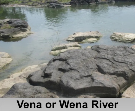
Vena or Wena River

Vena, also known as the Wena River, is a tributary of the Wardha River in Maharashtra, India. Originating from the Mahadagad Hills in Nagpur district, it flows through Nagpur and Wardha districts before joining the Wardha River. The river supports agriculture, groundwater recharge, and local ecosystems within the Godavari basin.

Introduction

Vena or Wena RiverVena, also known as the Wena River, is a non-perennial left-bank tributary of the Wardha River in the Indian state of Maharashtra. It originates in the Nagpur District and flows past the city of Hinganghat before joining the Wardha River near the village of Dhiwri Pipri. The Wardha River subsequently merges with the Pranhita River, which eventually joins the Godavari River, making the Vena River part of the larger Godavari River basin. 

Vena River primarily carries water during the monsoon season, with additional flow sustained through periodic releases from upstream dams for irrigation and domestic use. These water resources play a vital role in supporting agriculture and meeting the water requirements of rural and semi-urban communities along the river. Among the notable hydraulic structures on the river is the Wunna Dam, also known as the Wena Dam, located near Suraburdi in Nagpur district. The dam provides irrigation and reservoir-based water supply while also contributing to groundwater recharge in areas with moderate to high groundwater yield potential. The river's catchment extends across villages and towns, including Kawadghat and Hinganghat, where it is increasingly affected by various environmental challenges.

Course of Vena or Wena River

Vena River originates in the Mahadagad Hills of Nagpur district at an elevation of approximately 400 metres above mean sea level. From its source, the river initially flows southward before turning southeast across the Deccan Plateau. It traverses the districts of Nagpur and Wardha, passing near settlements such as Kawadghat on its right bank and Hinganghat on its left bank. The river flows through a landscape of gentle slopes and is non-perennial in nature, with its channel frequently remaining dry outside the monsoon season due to the climatic and topographic characteristics of the Deccan Plateau. 

The Vena River joins the Wardha River as a left-bank tributary near Dhiwri Pipri village, close to Hinganghat in Wardha district, thereby forming part of the larger Godavari River basin. Its catchment encompasses predominantly agricultural lands and rural settlements across Nagpur and Wardha districts. The river basin is drained by several minor tributaries, including the Pothra Nadi, which rises in the Girar Hills and joins from the left bank, and the Bor Nadi, which originates near Bazargaon in Nagpur district and joins from the right bank. Other tributaries, such as the Dham River, also contribute to the basin, collectively forming a dendritic drainage pattern that is characteristic of the Deccan Plateau.

Geography of Vena or Wena River

Vena River flows through the basaltic terrain of the Deccan Traps where the underlying geology is dominated by horizontally bedded basaltic and doleritic lava flows interspersed with layers of intertrappean sediments. This volcanic geological formation exerts a significant influence on the river's channel stability and has contributed to the development of extensive black cotton soils across the basin. These clay-rich Vertisols, characterized by high concentrations of iron and the clay mineral montmorillonite, cover much of the undulating plateaus and valley landscapes within the catchment. Their tendency to swell during the monsoon season and shrink and crack during prolonged dry periods influences bank stability, surface runoff, and erosion processes along the river. The hydrological regime of the Vena River is strongly governed by the tropical monsoon climate, which is marked by a distinct wet season and prolonged dry periods. 

Morphologically, the Vena River exhibits a dendritic drainage pattern that is characteristic of basaltic terrains. Its channel remains relatively narrow in the upper reaches before gradually widening and developing meandering sections in the lower reaches as it traverses the gently sloping, flat-topped landscape of the Deccan Plateau. The river experiences a gradual decline in elevation from its source in the Mahadagad Hills of Nagpur district to its confluence with the Wardha River, reflecting the low-gradient topography that typifies the plateau region.

Biodiversity of Vena or Wena River

Vena River supports a diverse range of aquatic and riparian biodiversity, particularly within its perennial reaches, where favourable hydrological conditions sustain a variety of freshwater organisms. Studies have documented the presence of 17 fish species belonging to five taxonomic orders. The aquatic food web is further enriched by diverse zooplankton communities, with 18 species of copepods, cladocerans, and rotifers recorded across different seasons. Zooplankton abundance generally reaches its peak during the winter months, while a diverse assemblage of algal flora forms the primary producer base of the riverine ecosystem. 

The riparian zones of the Vena River are characterized by mixed deciduous vegetation typical of the Nagpur Forest Division. Dominant tree species include teak in well-drained alluvial soils, while bamboo occurs extensively along stream channels and riverbanks. These communities are interspersed with grasses belonging to the Poaceae family and are complemented by a variety of wetland vegetation. Approximately 29 species of aquatic and semi-aquatic plants have been recorded within the river basin, where they contribute to bank stabilization, improve habitat complexity, and provide important microhabitats for aquatic organisms. The riparian vegetation also supports a range of terrestrial fauna, including deer species that utilize these corridors for browsing, as well as numerous bird species that depend on the vegetation for nesting, shelter, and foraging. 

The Wunna (Vena) Dam and Reservoir in Nagpur district constitute an important biodiversity hotspot within the basin. The reservoir supports a rich assemblage of odonates, with 52 species of dragonflies and damselflies documented, indicating the ecological health of its freshwater habitats. Avifaunal diversity is similarly high, with more than 200 bird species recorded, including numerous migratory waterfowl that visit the reservoir during the winter season to feed on aquatic organisms. Seasonal hydrological variations strongly influence biodiversity patterns within the basin. Monsoon flooding expands wetland habitats, enhancing breeding and feeding opportunities for fish, aquatic insects, and other freshwater organisms, whereas dry-season conditions concentrate aquatic species within perennial pools, increasing local population densities while placing ecological stress on ephemeral river stretches. 

Despite its ecological importance, the biodiversity of the Vena River is increasingly threatened by anthropogenic pressures. Water pollution, habitat degradation, and other human-induced disturbances, particularly in the Hingna region, have adversely affected aquatic ecosystems and contributed to declines in fish populations, highlighting the need for improved conservation and river management measures.

Dams and Reservoirs on Vena or Wena River

Vena or Wena RiverThe principal hydraulic infrastructure on the Vena River is the Wunna Dam, an earthen dam situated near Hingana in Nagpur district. Constructed primarily to support irrigation, the dam was completed in 1966 and serves to regulate the river's seasonal flow regime through controlled water storage and releases. Its operations are designed to meet agricultural and domestic water requirements, particularly in the downstream regions of Wardha district, thereby reducing the variability of natural river flows and enhancing water availability for local farming communities. 

Further development of the basin was undertaken through the Lower Wunna Irrigation Project, which was completed in 1990. The project includes major hydraulic structures such as the Wadgaon Dam on the Wunna River and the Nand Dam on the Nand River, strengthening irrigation infrastructure within the basin. In addition to these major reservoirs, the Vena River basin contains numerous minor check dams and weirs that facilitate local water harvesting. These structures play an important role in groundwater recharge and provide supplemental irrigation for agricultural lands in the rural areas of Nagpur and Wardha districts.

Irrigation Facilities on Vena or Wena River

Vena River and its associated water infrastructure, including the Wunna Dam and the Lower Wunna Irrigation Project, play a significant role in supporting irrigation and water resource management in the Nagpur and Wardha districts of Maharashtra. Through an extensive canal network, the Lower Wunna Irrigation Project supplies water primarily to the Umred taluka of Nagpur district, facilitating the cultivation of major crops such as cotton, soybean, and pulses, including pigeon pea (tur) and gram. These crops constitute the principal kharif and rabi agricultural produce of the region, and the availability of irrigation water contributes substantially to agricultural productivity within the Wardha River basin, of which the Vena River forms an important tributary. 

The river system also serves as a source of domestic water for settlements located along its course, including the towns of Hinganghat in Wardha district and Kawadghat in Nagpur district. Domestic water availability depends largely on regulated releases from upstream reservoirs, which help meet the basic water requirements of these rural and semi-urban communities. However, water supply is often subject to interruptions during the non-monsoon season, when reduced river flows and limited reservoir storage constrain water availability. 

In addition to its agricultural and domestic functions, the Vena River supports limited industrial activities within the basin. The textile industry in Hinganghat, historically recognized as a major cotton-processing centre, utilizes river water for various industrial processes. Furthermore, the river contributes to groundwater recharge through the infiltration of surplus monsoon runoff, thereby enhancing aquifer replenishment and supporting the long-term sustainability of groundwater resources in the Nagpur–Wardha valley.

Historical Significance of Vena or Wena River

Vena River forms part of the ancient Wardha (Varada) river system, which has been referenced in several historical and literary sources associated with the Deccan region. In Malavikagnimitra, composed by the Sanskrit poet Kalidasa during the fifth century A.D., the Varada River is described as a political boundary separating the territories of Vidarbha following the conflict between the Shunga viceroy Agnimitra and the local rulers Yajnasena and Madhavasena. This account places the Wardha basin, including tributaries such as the Vena River, within the sphere of influence of the Satavahana dynasty, which exercised political control over large parts of the Deccan between the first century B.C. and the third century A.D. 

During the subsequent Vakataka period (c. 250–600 A.D.), the Wardha (Varada) River continued to hold strategic importance within the Vidarbha region. Literary accounts in Dashakumaracharita, attributed to Dandin, describe the river as the site of the decisive conflict that marked the decline of the Vakataka dynasty. According to the narrative, the last Vakataka ruler was defeated on the banks of the Varada by invading forces and disloyal feudatories, bringing an end to more than two and a half centuries of Vakataka rule over the region, including the basin of the Vena River. 

Archaeological investigations within the wider Wardha basin provide evidence of much earlier human occupation. Excavations at sites such as Paunar, situated on the Dham River, a sub-tributary within the Wardha river system, have revealed early iron age settlements dating to approximately 1000–800 B.C. The river valleys also preserve evidence of Chalcolithic habitation, indicating that these fertile landscapes supported early pastoral and agricultural communities that utilized stone and copper implements. Collectively, these historical and archaeological records demonstrate the long-standing cultural and strategic significance of the Vena River basin within the broader Wardha River system.

Pollution on Vena or Wena River

Vena River experiences its most significant pollution along the stretch extending from Kawadghat to Hinganghat in Wardha district. Water quality assessments indicate that this section of the river is moderately polluted and is generally considered unsuitable for bathing without prior treatment. Monitoring conducted at upstream and downstream stations near Mohata Mills has reported elevated biochemical oxygen demand (BOD) levels, indicating the presence of organic pollution. Chemical oxygen demand (COD) has also been recorded, suggesting that the river is affected predominantly by organic contaminants rather than heavy industrial pollutants. 

The principal source of pollution is the discharge of untreated domestic sewage from Hinganghat town. In addition, limited industrial effluents from nearby industries contribute to the degradation of water quality. Non-point sources of pollution further exacerbate the condition of the river and include agricultural runoff carrying fertilizers and pesticides, indiscriminate dumping of solid waste, and anthropogenic activities such as open defecation and bathing along the riverbanks. During the non-monsoon season, reduced river discharge lowers the natural dilution capacity of the river, resulting in increased concentrations of pollutants and further deterioration of water quality.

Conservation Efforts of Vena or Wena River

The Maharashtra Pollution Control Board (MPCB) has developed a comprehensive action plan for the restoration of the Vena River stretch extending from Kawadghat to Hinganghat, which has been classified as a Priority III polluted river segment. The restoration strategy primarily focuses on mitigating pollution arising from untreated domestic sewage discharged from Hinganghat town and Kawadghat village. To address this issue, the plan proposes the construction of two sewage treatment plants (STPs) at Hinganghat to facilitate the treatment of municipal wastewater before its discharge into the river. 

The restoration programme also incorporates watershed management measures aimed at maintaining environmental flows (e-flows) through periodic releases of water from upstream reservoirs managed by the Water Resources Department, Government of Maharashtra. To ensure effective implementation of the restoration initiatives, a River Rejuvenation Committee (RRC) was constituted in December 2018 under the Environment Department, Government of Maharashtra. The committee comprises representatives from municipal authorities, industrial establishments, and the Maharashtra Pollution Control Board and is responsible for coordinating and monitoring restoration activities across identified polluted river stretches. As part of its regulatory functions, the committee has enforced restrictions on environmentally detrimental activities along the riverbanks, including vehicle washing, cloth washing, and open defecation, with specified timelines for compliance ranging from one to six months. 

Implementation of the restoration plan has included the installation of Online Continuous Effluent Monitoring Systems (OCEMS) for the principal industrial unit affecting the river, R.S.R. Mohata, to ensure continuous monitoring of effluent quality. The industry has also been directed to achieve Zero Liquid Discharge (ZLD) compliance within the prescribed timeframe. In addition, improvements have been undertaken in the municipal solid waste (MSW) management system at Hinganghat to reduce the discharge of pollutants into the river. Water quality is monitored on a monthly basis at stations located upstream and downstream of Hinganghat, while groundwater quality assessments are conducted twice annually to evaluate the effectiveness of pollution control and river restoration measures.

Recently updated articles in Geography of India

Pahuj River
Pahuj River Thumbnail

Pahuj River

Pahuj River is an important tributary of the Sindh River that flows through the Indian states of Madhya Pradesh and Uttar Pradesh. Originating in the...

Arunavati River
Arunavati River Thumbnail

Arunavati River

Arunavati River is a seasonal right-bank tributary of the Tapi River, flowing through parts of Madhya Pradesh and Maharashtra. Originating in the Satp...

Nira River
Nira River Thumbnail

Nira River

Nira River is an important tributary of the Bhima River flowing through Maharashtra. Originating in the Western Ghats, it traverses Pune, Satara, and...

Vena or Wena River
Vena or Wena River Thumbnail

Vena or Wena River

Vena, also known as the Wena River, is a tributary of the Wardha River in Maharashtra, India. Originating from the Mahadagad Hills in Nagpur district,...

Kwari or Kuwari/ Kunwari River
Kwari or Kuwari/ Kunwari River Thumbnail

Kwari or Kuwari/ Kunwari River

Kwari River, also known as Kuwari or Kunwari, is a significant river of central India, flowing through Madhya Pradesh and Uttar Pradesh. Originating n...