
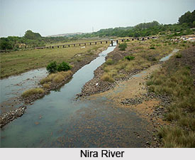
 Nira River is an important river flowing through the Indian
state of Maharashtra.
It is a tributary of the Bhima
River, which in turn is a major tributary of the Krishna River.
Originating in the Western
Ghats, the Nira River flows eastward through the Pune and Solapur
districts, providing a vital source of water for irrigation
across the region. The Karha River is one of its significant tributaries,
further contributing to the Nira River's drainage system and supporting agricultural practices
in the surrounding areas.
Nira River is an important river flowing through the Indian
state of Maharashtra.
It is a tributary of the Bhima
River, which in turn is a major tributary of the Krishna River.
Originating in the Western
Ghats, the Nira River flows eastward through the Pune and Solapur
districts, providing a vital source of water for irrigation
across the region. The Karha River is one of its significant tributaries,
further contributing to the Nira River's drainage system and supporting agricultural practices
in the surrounding areas.
Nira River
Nira River is an important tributary of the Bhima River flowing through Maharashtra. Originating in the Western Ghats, it traverses Pune, Satara, and Solapur districts before joining the Bhima River. The river supports agriculture, irrigation, and local livelihoods through its water resources, dams, and tributary network across the Deccan Plateau.
Introduction
Etymology of Nira River
The name “Nira” is believed to derive from the Sanskrit word
“Neer”, meaning “water.” In classical Indian literature, the term is often
associated with purity and life-giving, nectar-like qualities. This
etymological origin reflects the historical perception of the Nira River as a
source of clear, sustaining water that originates in the Western Ghats and
supports the communities and landscapes along its course.
Course of Nira River
Nira River originates in the Western Ghats in Pune district, Maharashtra, and begins its journey through the Bhor taluka. It then flows across the Shirwal taluka of Satara district before continuing through Solapur district. From its source in the Western Ghats, the Nira River initially flows northeast through the undulating valleys and rugged spurs of the mountain range, passing near the historic Torna Fort before gradually turning southeast to cross the Deccan Plateau. The river eventually joins the Bhima River at Nira Narsingpur near Akluj.
From this confluence, the combined waters of the Nira and Bhima Rivers continue flowing through Solapur district. The confluence of the Nira and Bhima Rivers lies between Nira Narsingpur in Pune district and Malshiras taluka in Solapur district, marking an important point in the Bhima River basin. Along its course, the river undergoes a distinct geomorphological transition, flowing through narrow, deeply incised channels with steep elevation gradients in its upper reaches before widening into broad, meandering channels across the fertile alluvial plains of the lower basin.
Nira river basin: The Nira River basin extends over
6,900 square kilometers, encompassing parts of the Pune, Satara, and Solapur
districts of Maharashtra. It drains a semi-arid plateau landscape characterized
by steep slopes, entrenched valleys, and seasonal streams that are primarily
influenced by the southwest monsoon. As a non-perennial river, the Nira depends
largely on monsoon
rainfall, which averages about 722 mm annually, as well as regulated
releases from upstream dams to sustain its flow. These water resources play a
crucial role in supporting irrigation, agriculture, and domestic water supply
across the fertile regions of the Deccan Plateau.
Tributaries of Nira River
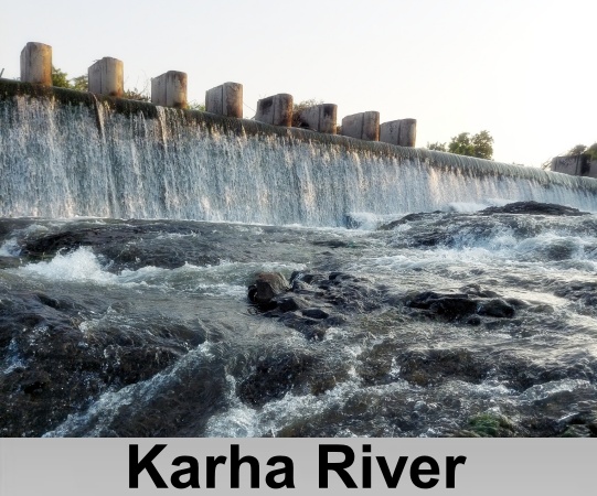
Karha River is the longest and most significant left-bank tributary of the Nira River. It originates in the Western Ghats near the Purandar hill range, close to Saswad in Pune district, and is recognized for its relatively rapid flow compared to the other tributaries of the Nira.
 Another important left-bank tributary is the Gunjavani
River, which rises in the Western Ghats within the Velhe taluka of Pune
district. Flowing approximately 40 kilometers eastward before joining the Nira
River, the Gunjavani traverses steep gradients that generate high-velocity
flows during the southwest monsoon, contributing substantially to the Nira's
discharge from its upland catchments. The Gunjavani river system also includes
smaller feeder streams, notably the Shivganga,
which originates on the southern slopes of Sinhagad Fort.
After merging with the Khanind stream near Nasrapur, the combined watercourse
continues under the name Gunjavani.
Another important left-bank tributary is the Gunjavani
River, which rises in the Western Ghats within the Velhe taluka of Pune
district. Flowing approximately 40 kilometers eastward before joining the Nira
River, the Gunjavani traverses steep gradients that generate high-velocity
flows during the southwest monsoon, contributing substantially to the Nira's
discharge from its upland catchments. The Gunjavani river system also includes
smaller feeder streams, notably the Shivganga,
which originates on the southern slopes of Sinhagad Fort.
After merging with the Khanind stream near Nasrapur, the combined watercourse
continues under the name Gunjavani.
In addition to these major tributaries, several smaller left-bank streams contribute to the Nira River's drainage network. Among them are the Velvandi and Purnaganga rivers, both of which originate in the Western Ghats of Satara district and join the Nira farther downstream, including near the Phaltan region.
Nira River receives several important right-bank tributaries
from the southern watersheds of Satara district. Among these, the Yelwadi River
is a prominent contributor, originating from the local plateau region before
joining the Nira. Its waters enhance the river's flow, contribute to sediment
transport, and help sustain the Nira during the dry season. Other notable
right-bank tributaries include the Banganga
and Khemwati rivers, both of which originate from similar plateau landscapes in
the Satara region and further strengthen the Nira River's drainage network.
Economic Significance of Nira River
Nira River plays a significant role in supporting
agriculture in the districts through which it flows. Its waters sustain the
cultivation of major crops such as sugarcane
and wheat,
making it an essential resource for the region's agricultural economy. To
maximize its water resources, several irrigation projects and dams have been
developed along the river. Among the most prominent are the Devdhar Dam and the
Veer Dam, located in the Satara and Pune districts. These water management
structures are crucial for irrigation, contributing to local livelihoods and
the overall economic development of the region.
Irrigation Projects on Nira River
Nira River is regulated by a network of dams and reservoirs that have been constructed primarily to support irrigation, flood control, and, in some cases, hydropower generation. Among the most significant of these is the Veer Dam, located near Shirwal in Satara district. Built across the main course of the Nira River, the dam was completed in 1965 as a rubble-concrete gravity structure. It has a height of 35.81 meters and a gross reservoir storage capacity of approximately 287 million cubic meters, making it a key component of the region's water resource infrastructure.
Another major water management structure is the Nira Deoghar Dam (also known as the Niradevghar Dam), situated near Bhor in Pune district. Construction of this earthfill dam began in 1984 and was completed in 2007. The dam stands 59 meters high and extends 2,320 meters in length, providing a live storage capacity of approximately 332.13 million cubic meters.
In addition to these major dams, several smaller structures
have been developed on the river's tributaries. The Bhatghar Dam, built across
the Yelwandi River near Bhor, is a masonry gravity dam that was completed in
1927. Its reservoir has long supported irrigation in the surrounding
agricultural areas. Similarly, the Gunjawani Dam, constructed across the
Gunjawani River near Velhe in Pune district, was completed in 2000. Designed as
a combination earthfill and gravity dam, it contributes to flood mitigation
while also supporting local water resource management within the Nira River
basin.
Biodiversity of Nira River
The upper reaches of the Nira River, originating in the Western Ghats within Maharashtra's Satara Forest Division, are characterized by southern moist mixed deciduous forests. These forests support a diverse range of deciduous tree species, with teak occurring only rarely and bamboo found in scattered patches along the slopes.
The riparian ecosystems along the Nira River, particularly the wetland areas near Phaltan and Akluj, serve as important ecological corridors for a variety of avian and amphibian species. These habitats support species such as the Indian pond heron, which is commonly observed foraging in shallow waters for fishes and insects.
The tributaries of the Nira River flowing through the Western Ghats also support a range of endemic species adapted to the unique environmental conditions of this biodiversity hotspot. These include regionally restricted freshwater fishes belonging to genera such as Hypselobarbus and Puntius, along with rare orchids and grass species found along plateau margins.
Pollution in Nira River
Nira River faces several water quality challenges arising from agricultural and industrial activities along the Pune–Solapur corridor. Agricultural runoff from extensive sugarcane cultivation introduces pesticides and nutrient-rich effluents into the river, resulting in elevated concentrations of phosphates and sulphates. In addition, industrial discharges from manufacturing facilities and nearby sugar factories, have contributed to episodes of water contamination. These pollution events have adversely affected the river's ecosystem, with some incidents leading to widespread fish mortality and raising concerns about the long-term health of the river and its aquatic biodiversity.
Conservation of Nira River
Efforts to manage and improve the water quality of the Nira River are primarily coordinated by the Maharashtra Pollution Control Board (MPCB) under the National Water Monitoring Programme (NWMP). The board conducts regular monthly water quality assessments at designated monitoring stations, including Sarola Bridge and locations downstream of major industrial discharge points, to ensure compliance with prescribed bathing water quality standards.
As part of its pollution control strategy, measures have been implemented to intercept wastewater drains and divert sewage to sewage treatment plants (STPs), including facilities in Phaltan. Industrial pollution is addressed through the enforcement of zero-liquid-discharge practices, requiring seven major industries to operate captive effluent treatment plants (ETPs) before releasing treated wastewater. The MPCB has also issued compliance notices to local governing bodies to strengthen adherence to environmental regulations to improve river management.
Groundwater management also forms an important component of
the Nira River basin's environmental strategy. Situated in a semi-arid region,
the basin benefits from groundwater recharge through water-harvesting
structures constructed within micro-watersheds. Geospatial analyses have been
used to identify and map potential groundwater recharge zones, supporting
sustainable water resource management across the basin.
Recently updated articles in Geography of India

Krishnaveni River
The Krishnaveni River, presently known as the Krishna River, is one of India’s major rivers. Originating in the Western Ghats of Maharashtra, it flows...

Wakal River
The Wakal River is an important tributary of the Sabarmati River, originating in Rajasthan’s Aravalli Range and flowing through Rajasthan and Gujarat....

Pahuj River
Pahuj River is an important tributary of the Sindh River that flows through the Indian states of Madhya Pradesh and Uttar Pradesh. Originating in the...

Arunavati River
Arunavati River is a seasonal right-bank tributary of the Tapi River, flowing through parts of Madhya Pradesh and Maharashtra. Originating in the Satp...

Nira River
Nira River is an important tributary of the Bhima River flowing through Maharashtra. Originating in the Western Ghats, it traverses Pune, Satara, and...
Related articles in Geography of India

Geography of Sikkim
Geography of Sikkim is characterised by a vast array of magnificent hillock that extends from one corner of the state to the other.

Geography of Meghalaya
The suitable climate, highland plateaus, rivers and the flora and fauna together forms the geography of Meghalaya.

Geography of Jammu & Kashmir
Jammu and Kashmir is encompassed by valleys. Some of the dominant valleys of the state are Kashmir Valley, Tawi Valley, Chenab Valley, Poonch Valley,...

Narmada River
Narmada River is regarded as the 5th longest river of India and the life line of Madhya Pradesh. Narmada River basin spreads over an area of about 98,...

Bhima River
The Bhima River is the largest tributary of the Krishna River and is significant in the western and southern Indian states.