Karha River basin extends across parts of Pune district,
encompassing an area of approximately 1,197 km². Situated within the
rain-shadow region of the Deccan Plateau, the basin experiences semi-arid
climatic conditions that strongly influence its hydrological characteristics.
Geomorphologically, it is classified as a seventh-order drainage basin
exhibiting predominantly dendritic to sub-dendritic drainage patterns,
indicative of a well-developed fluvial network controlled by the underlying
basaltic formations of the Deccan Volcanic Province.
The drainage network of the basin is composed primarily of
numerous small, largely unnamed streams that originate in the hilly uplands of Purandar and
Velhe talukas. These tributary streams converge into the main channel of the
Karha River, resulting in a relatively high drainage density and a
well-integrated watershed. The basin's bifurcation ratio reflects the
structural influence of jointed basaltic rock formations on stream development.
Unlike many larger river systems, the Karha lacks prominent named tributaries,
giving the basin a comparatively direct drainage morphology that facilitates
the rapid collection and conveyance of monsoon runoff.
 Hydrologically, the Karha River is regarded as the
fastest-flowing tributary of the Nira River, owing to its relatively steep
channel gradients and limited meandering in the upper reaches. Its flow regime
is highly seasonal, with substantial discharge occurring during the southwest monsoon
season (June to September). Periods of intense rainfall frequently
result in flooding, as demonstrated during the 2019 flood events in Pune
district, when precipitation exceeding 200 mm within 24 hours, combined with
reservoir releases, caused widespread inundation in areas along the Karha
River. Conversely, during the dry season (October to May), streamflow declines
significantly, leading to severe water scarcity, particularly in the lower
basin around Baramati taluka. Reduced baseflow, coupled with high rates of
evaporation, contributes to the depletion of both surface water and groundwater
resources. On average, annual runoff accounts for only about 10–15% of the
basin's annual rainfall, highlighting its susceptibility to climatic
variability and recurring drought conditions.
Hydrologically, the Karha River is regarded as the
fastest-flowing tributary of the Nira River, owing to its relatively steep
channel gradients and limited meandering in the upper reaches. Its flow regime
is highly seasonal, with substantial discharge occurring during the southwest monsoon
season (June to September). Periods of intense rainfall frequently
result in flooding, as demonstrated during the 2019 flood events in Pune
district, when precipitation exceeding 200 mm within 24 hours, combined with
reservoir releases, caused widespread inundation in areas along the Karha
River. Conversely, during the dry season (October to May), streamflow declines
significantly, leading to severe water scarcity, particularly in the lower
basin around Baramati taluka. Reduced baseflow, coupled with high rates of
evaporation, contributes to the depletion of both surface water and groundwater
resources. On average, annual runoff accounts for only about 10–15% of the
basin's annual rainfall, highlighting its susceptibility to climatic
variability and recurring drought conditions.
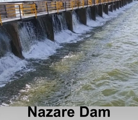
The Nazare Dam, also known as the Malhar Sagar Dam,
constitutes the principal hydraulic structure within the Karha River basin.
Constructed across the Karha River near Jejuri, the earthfill dam was developed
after India's independence to provide irrigation and domestic water supply for
more than 70 settlements in Purandar and Baramati talukas. The reservoir
irrigates approximately 3,200 hectares of agricultural land and has a gross
storage capacity of about 0.78 thousand million cubic feet (TMC), with a live
storage capacity of approximately 0.59 TMC. In addition to supporting
agricultural production and meeting domestic water requirements, the reservoir
plays a vital role in regulating seasonal water availability and promoting
watershed management within the semi-arid Karha River basin.

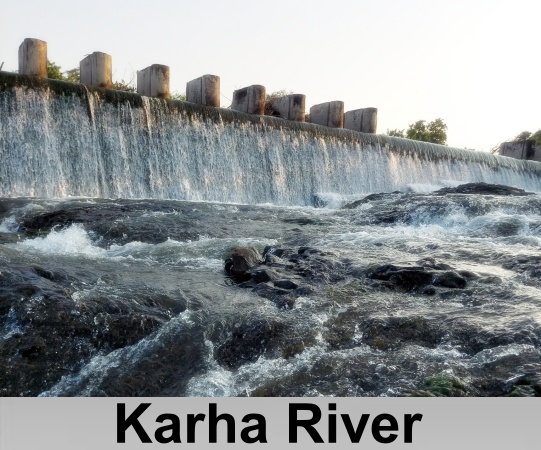 Karha River flows through the Indian
state of Maharashtra,
with its basin extending across parts of Pune district.
Several important towns and cities, including Baramati, Saswad, and Jejuri, renowned
as the sacred abode of Lord
Khandoba, are situated along its banks. The river is a tributary of the
Nira River
and is traditionally believed to have the fastest-flowing waters among all of other
tributaries of Nira River.
Karha River flows through the Indian
state of Maharashtra,
with its basin extending across parts of Pune district.
Several important towns and cities, including Baramati, Saswad, and Jejuri, renowned
as the sacred abode of Lord
Khandoba, are situated along its banks. The river is a tributary of the
Nira River
and is traditionally believed to have the fastest-flowing waters among all of other
tributaries of Nira River. 








