
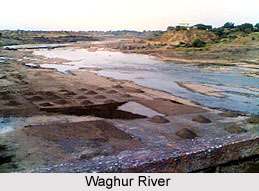
 Waghur River is a seasonal river that flows through the
state of Maharashtra
in western India.
Fed primarily by the monsoon,
it plays an important role in supporting local agriculture and irrigation across
the region. Originating near Ajanta, the river traverses the Khandesh region
before joining the Tapi
River near Jalgaon.
One of its most notable landmarks is the UNESCO World
Heritage-listed Ajanta Caves,
which are situated along its banks. As a significant seasonal tributary of the
Tapi River, the Waghur contributes to both the cultural and ecological
landscape of the region.
Waghur River is a seasonal river that flows through the
state of Maharashtra
in western India.
Fed primarily by the monsoon,
it plays an important role in supporting local agriculture and irrigation across
the region. Originating near Ajanta, the river traverses the Khandesh region
before joining the Tapi
River near Jalgaon.
One of its most notable landmarks is the UNESCO World
Heritage-listed Ajanta Caves,
which are situated along its banks. As a significant seasonal tributary of the
Tapi River, the Waghur contributes to both the cultural and ecological
landscape of the region.
Waghur River
Waghur River is a seasonal tributary of the Tapi River that flows through Maharashtra's Khandesh region. Originating in the Ajanta Hills, it supports agriculture and irrigation while enhancing the region's natural beauty. The river is also renowned for flowing past the UNESCO World Heritage-listed Ajanta Caves, a celebrated historical landmark.
Introduction
Course of Waghur River
The Waghur River originates in the renowned Ajanta Hills near
Jalki village in Maharashtra's Aurangabad district.
It flows through the rugged terrain of the Ajanta Hills for approximately 21
kilometres before entering the plains of Jamner Taluka in Jalgaon district. The
river then passes through another hilly stretch of more than 14 kilometres
before its final 25.6-kilometre course across the plains. As the second-largest
left-bank tributary of the Tapi River, the Waghur eventually joins the Tapi
near Bankheda village in Jalgaon district, making it an important seasonal
watercourse in the Khandesh region.
Waghur Dam
Located approximately 78 kilometres downstream from the source of the Waghur River, the Waghur Dam is an earth-fill dam situated near the villages of Kandari and Varadsim in Maharashtra's Jalgaon district. Construction of this major irrigation project began in 1978 under the Maharashtra Water Resources Department with the primary objective of supplying water for irrigation in the downstream regions. To support agricultural activities, canal networks were developed along both the left and right banks of the river.
In 2006, exceptionally heavy rainfall
in the Waghur catchment caused nearly 40 TMC of water to overflow the dam. By
2008, the reservoir had a storage capacity of 8.5 TMC. The dam measures 13.6 metres
(45 feet) in height and 690 metres (2,260 feet) in length. Plans to install 20
additional spillway gates were expected to increase the reservoir's storage
capacity by another 1.5 TMC. Beyond irrigation, the project was designed to provide
drinking water to approximately 500,000 people and support the irrigation of
nearly 64,000 acres (about 260 square kilometres) of drought-prone farmland.
Tourism Along Waghur River Bank
The expansive reservoir of the Waghur Dam has become a
popular recreational destination for local residents, offering a picturesque
setting for picnics, birdwatching, and leisurely walks. Surrounded by abundant
natural greenery, the area is admired for its tranquil atmosphere and scenic
beauty. During the evenings, many visitors gather at the reservoir to enjoy a
peaceful stroll and the refreshing surroundings.
Recently updated articles in Geography of India

Vembakottai Reservoir
Vembakottai Reservoir, located on the Vaippar River in Tamil Nadu, is an important source of irrigation and drinking water. Surrounded by greenery, it...

Krishnaveni River
The Krishnaveni River, presently known as the Krishna River, is one of India’s major rivers. Originating in the Western Ghats of Maharashtra, it flows...

Wakal River
The Wakal River is an important tributary of the Sabarmati River, originating in Rajasthan’s Aravalli Range and flowing through Rajasthan and Gujarat....

Pahuj River
Pahuj River is an important tributary of the Sindh River that flows through the Indian states of Madhya Pradesh and Uttar Pradesh. Originating in the...

Arunavati River
Arunavati River is a seasonal right-bank tributary of the Tapi River, flowing through parts of Madhya Pradesh and Maharashtra. Originating in the Satp...
Related articles in Geography of India

Geography of Sikkim
Geography of Sikkim is characterised by a vast array of magnificent hillock that extends from one corner of the state to the other.

Geography of Meghalaya
The suitable climate, highland plateaus, rivers and the flora and fauna together forms the geography of Meghalaya.

Geography of Jammu & Kashmir
Jammu and Kashmir is encompassed by valleys. Some of the dominant valleys of the state are Kashmir Valley, Tawi Valley, Chenab Valley, Poonch Valley,...

Narmada River
Narmada River is regarded as the 5th longest river of India and the life line of Madhya Pradesh. Narmada River basin spreads over an area of about 98,...

Bhima River
The Bhima River is the largest tributary of the Krishna River and is significant in the western and southern Indian states.