
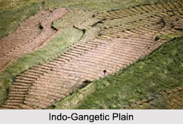
 Indo-Gangetic Plain is wholly composed of sediment deposited by great rivers of northern India. The older alluvium deposited by the river forms the uplands and the newer alluvium in the riverbeds forms the lowlands. The lowlands become more prominent as one approaches in delta of the Ganga. This plain is the gift of the Himalayan Rivers, the Ganga and the Indus. The Ganga rises on the southern side of the Himalayas while the Indus and the Brahmaputra are on its northern side. Near the source of the Ganga there rises its tributary i.e. the Yamuna. For centuries the 2400 kilometers of the course of the Ganga was the chief road and its water became the source of wealth to the farmers. At its mouth in the Bay of Bengal the Ganga is joined by the Brahmaputra. Their delta is overrun with jungle plants and wild animals.
History of Indo-Gangetic Plain
The region is known for the Indus Valley Civilization, which was responsible for the birth of ancient culture of the Indian subcontinent. The flat and fertile terrain has facilitated the repeated rise and expansion of various empires, including the Magadha dynasties, Imperial Kannauj, the Mughal Empire and Maratha Empire. All of them had their demographic and political centers in the Indo-Gangetic plain.
Classifications of Indo-Gangetic Plain
Different types of Indo-Gangetic Plains are as follows:
The Eastern Coastal Plain may be considered in two sections. The lower section consists of the deltas of rivers and the upper section consists mostly of the plains lying in the upper courses of the rivers. The lower section is entirely alluvial while the upper section is partly alluvial and partly a plain. The lower section is fringed by a series of sand dunes in the vicinity of the sea. This coastal plain is broader as compared to that on the west.
The Western Coastal Plain is very narrow towards the south and is characterized by a number of long and narrow lagoons. To the north of Maharashtra the Western Coastal Plain broadens into the alluvial plains of the Tapti and the Narmada and further north into Gujarat. Gujarat and Kathiawar plains are partly covered by the black cotton soil. The monsoon floods bring enormous silts and help the growth of forests and plantations.
The Western Coastal Plains merge in the extreme north into the Thar and Rajasthan deserts. These parts are characterized by vast deposits of sand partly due to the dry old river courses and partly to the emergence of vast plains from under the sea, which is receding in this part.
The Thar and Rajasthan deserts in their western and northern sections are marked by sand dunes covering hundreds of square kilometers of area.









