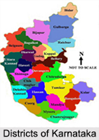
 Districts of Karnataka have an industrial and an agricultural base. Karnataka consists of 30 districts and 4 administrative divisions. Karnataka is the 6th largest state of India. Bengaluru, the capital of Karnataka is the nucleus of all IT activities in India.
History of Districts of Karnataka
When the state of Karnataka was formed, it had around 27 administrative districts. Rest of the three districts was formed later on by the re-organizing of the existing districts.
Districts of Karnataka
The 30 districts of Karnataka are as follows:
Bagalkot District
Bagalkot district is located in the northern part of Karnataka sprawling over an area of 6,593 sq. km. It is renowned for temples like the Mahakuteshwara Temple in Mahakuta, and Upper Shivalaya Temple and the Banashankari Temple in Badami.
Bengaluru Urban District
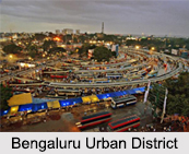
Bengaluru Urban district is located in the south of the Deccan Plateau. Some of the major attractions of the district are Cubbon Park, Visvesvaraya Industrial and Technological Museum, Vasanthapura and Bannerghatta National Park.
 Bengaluru Rural District
Bengaluru Rural district includes the rural areas around the city of Bengaluru. The soil and climate of the district favours the cultivation of ragi, rice, groundnut, sugarcane, castor seeds, grapes and mulberry.
Belgaum District
Belgaum district is an important district of the state. INDAL (Indian Aluminium Company) aluminium factory is located here. The district is dotted with numerous temples and mosques.
Bellary District
Bellary district is located on the eastern side of Karnataka and has an agricultural base. The main crops grown here are cotton, jowar, groundnut, paddy, sunflower and cereals. The important rivers flowing through the district are Tungabhadra River and Hagari River.
Bidar District
Bidar district is situated in the north-eastern corner of Karnataka spread over an area of 5,448 sq. km. The district has several religious centres like the famous Gurudwara Nanak Jhira Sahib-Bidar, Narasimha Jhira Water Cave Temple and Papanaash Shiva Temple.
Bijapur District
Bijapur district is located in the northern part of Karnataka. It is famous for its Ilkal sarees. The major attractions of the district are Gol Gumbaz, Juma Masjid, Anand Mahal, Gagan Mahal, Jahaz Mahal and Bara Kaman.
Chamrajnagar District
Chamrajnagar district is situated in the southern part of Karnataka. The major attractions of the district are Biligiri Ranganathaswamy Hills and the Shivasamudram falls on the Kaveri River.
Chikkamagaluru District
Chikkamagaluru district is located in the south-western part of Karnataka. The hills of Chikkamagaluru are the source of number of rivers like Bhadra River, Tunga River, Hemavati River, Netravathi River and Vedavati River.
Chikballapur District
Chikballapur district is a newly created district of Karnataka carved out of the Kollar district. The town of Chikballapur is the district headquarters.
Chitradurga District
Chitradurga district is surrounded with rocky hills, which houses many ancient temples some of which are Ekanathamma, Phalguneswara, Gopalakrishna, Anjaneya, Subbaraya and Siddeswara.
Dakshina Kannada District
Dakshina Kannada district has its district headquarters in the city of Mangalore. The district is famous for Yakshagana, a beautiful dance form; Kambala, the sport of buffalo racing by farmers; Korikatta, cockfight and Bootha Kola.
 Davangere District
Davangere district is famous for its textile industry. Anagodu, Anaji, Hadali, Harihar and Mayakonda are places of tourist interest in the district.
Dharwad District
Dharwad district is located in the northern part of the state and is well known for its pedas. Hubli is an important industrial city of the district.
Gadag District
Gadag district is an agricultural district. It has a semi arid climate, which favours the growth of seasonal crops like maize, sorghum, greengram, groundnut, sunflower, onion and chilli.
Gulbarga District
Gulbarga district is situated in the north-eastern part of Karnataka. An important religious destination on the banks of the Bhima River is Jevargi. The major attractions of the district are Gulbarga Fort, Sharana Basveshwara Temple and Sri Ram Mandir.
Hassan District
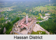
Hassan district is an ideal religious destination as the temple towns of Belur, Halebid and Sravanabelagola is situated here. Some of the chief crops grown here are black pepper, potato, paddy and sugarcane.
Haveri District
It is situated in the southern part of Karnataka spread over an area of 4,851 sq. km. Haveri town is an important commercial and educational centre of the district.
Kodagu District
One of the smallest districts of Karnataka is the Kodagu district, which is also known as the Coorg district with its headquarters in Madikeri, a hill station. It is surrounded with rocky hills such as the Tadiyandamol, Brahmagiri and Pushpagiri hills.
Kolar District
Kolar district is situated in the southern plains of Karnataka spread over an area of 3,180 sq. km. It is called the land of` silk, milk and gold". The district headquarters is at Kolar, which is famous for its Gold mines.
Koppal District
Koppal district was formed after the split of Raichur district and is the best seed production centre in the state. Places of interest in the district are Anegundi, Kanakagiri, Navabrindavana and Kuknur.
 Mandya District
Mandya district is situated in the south-eastern part of Karnataka spread over an area of 4,850 sq. km. Major attractions of this district are Ranganathittu Wildlife Sanctuary, Karighatta Temple, Kuntibetta hill, Bluff Waterfalls, Tirumalasagara Lake and Cauvery Waterfalls.
Mysore District
In the southern part of the Deccan Plateau is the Mysore district with its headquarters at Mysore. Mysore is famous for its silk, sandalwood and handicrafts. Mysore Palace, Chamundi Hills, Mysore Zoo, Brindavan Gardens, Bandipur National Park, Jaganmohan Palace and Keshava Temple at Somnathpur are suitable tourist attractions.
Raichur District
Raichur district is located in the north-western part of Karnataka. The Krishna River and the Tungabhadra River are two important rivers flowing through the district, which contribute to abundant agricultural produce and generate colossal growth in hydroelectric production.
Ramanagara District
Ramanagara district is also a newly created district carved out of the Bangalore Rural district. The district is part of Bengaluru Division.
Shimoga District
Shimoga district is spread over an area 10,550 sq. km. filled with vast unending stretches of forests, green paddy fields and captivating waterfalls. Jog Falls, Vanake-Abbey Falls, Achakanya Falls and Hidlamane Falls are the major attractions of the district.
Tumakuru District
Tumakuru district is located in the eastern part of Karnataka. The soil and the climate of the place favour the cultivation of crops such as millets, rice, pulses and oil seeds.
Udupi District
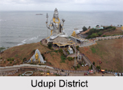
Udupi district was formed by joining three northern taluks of Dakshina Kannda district, Kundapur and Karkal. Barakuru Hasta Shilpa Heritage Museum, Karavali, Krishna Mutt and St Mary`s Island are the main tourist spots in the district.
Uttara Kannada District
Uttara Kannada district is spread over an area of 10,291 sq. km. and is dominantly rural. The district headquarters is located at Karwar. It is an ideal tourist destination and some of the major tourist destinations are the Devbagh Beach, Dandeli Wild life Sanctuary, Kurumgad Beach, Unchalli Falls and Magod Falls.
Yadgir District
Yadgir District was carved out from the erstwhile Gulbarga district as the 30th district of Karnataka on 10th April 2010. Yadgir town is the administrative headquarters of the district.


