 Dams in India have been constructed across various perennial rivers as a part of several multi-purpose river valley projects to serve a variety of needs. The aims of a multi-purpose project are storing water for irrigation, generating hydroelectricity, preventing floods and facilitating afforestation in the catchments areas of the reservoirs. In the year 1947, there were around 300 large dams in India and the number gradually increased by the year 2000, when the dam count reached almost 4000.
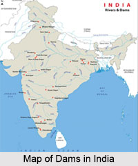
India holds a strong position in the list of dam building countries, after US and China. Some of the main multi-purpose projects constituting construction of dams in India are the Bhakra-Nangal Project in Himachal Pradesh, Rihand Project in Uttar Pradesh, Damodar Valley Project in Bihar and West Bengal, Hirakud Dam Project in Odisha and Tungabhadra Project in Karnataka. Discussed below is a list of dams in India as per their geographical division:
Dams in Northern India
The dams in the Northern Indian states not only serve the purpose of power generation, they are also tourist attractions. The dams of Jammu and Kashmir are namely the Baglihar Dam and Salal Dam, both on the Chenab River in the districts of Doda and Reasi respectively. Then there is the Cholal Dam on Cholal Choe River in Hoshirapur, Shahpur Kandi Dam on Ravi River in Pathankot and lastly there is the Uri Dam on the Jhelum River in Baramulla.
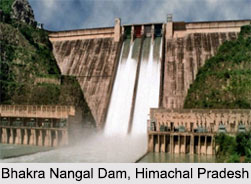
North India has other states like the dams of Himachal Pradesh, which includes the famous Bhakra Nangal Dam, that benefits three other Indian states namely Punjab, Haryana and Rajasthan. It is one of the largest dams in Asia and is located on the Sutlej River in Bilaspur. The other dams of the state are the Chamera Dam on the Ravi River in Dalhousie, the Maharana Pratap Sagar Dam and the Pandoh Dam, both on Beas River in the districts of Kangra and Mandi respectively.
Then there are the dams of Uttar Pradesh, which includes the Rihand Dam on the Rihand River, the Matatila Dam, Parichha Dam and the Rajghat Dam, all three of them on the Betwa River. Other important dams include the dams of Uttarakhand like the Tehri Dam, the Dhauliganga Dam, the Haripura Dam and Ichari Dam.
Dams in Eastern India
The dams in Jharkhand mainly cater to the irrigation system of the state and some of these dams are the Maithon Dam on the Barakar River near Dhanbad, the Chandil Dam on Subarnarekha River in the Saraikela Kharsawan district, the Panchet Dam on the Damodar River. Some of the other dams of the state are the Khandoli Dam, Getalsud Dam and the Tenughat Dam.
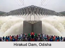
 The dams in Odisha include the longest dam in India, the Hirakud Dam on the Mahanadi River, along with few other dams like the Indravati Dam, Kapur Dam, Mandira Dam, Muran Dam, Podagada Dam, Rengali Dam and the Upper Kolab Dam. Then there are the dams in West Bengal that includes the Durgapur Barrage on the Damodar River, the Farakka Barrage on Ganges River and the Kangasabati Dam in the Bankura district.
Dams of Western India
The chief five dams of Gujarat are the Sardar Sarovar Dam, Ukai Dam, Dantiwada Dam, Kadana Dam and the Dharoi dam. Then are the dams of Maharashtra which includes the Bhandardara Dam, Gangapur Dam, Nandur Madhmeshwar Dam, Yeldari Dam, Manair Dam, Girna Dam, Wilson Dam, Mula Dam, Koyna Dam, Jaikwadi Dam, Ujani Dam, Mulshi Dam, Khadakwasla Dam, Kolkewadi Dam, Pansheet Dam, Radhanagari Dam, Bhatsa Dam, Tansa Dam, Vaitarana Dam and finally the Pawna Dam. Western India also includes the states of Rajasthan and Goa, together which has few dams like the Kota Barrage, Rana Paratap Sagar Dam, Bilaspur Dam and Meja Dam.
Dams of Southern India
The dams of Andhra Pradesh are quite a few and includes the Nagarjuna Sagar Dam, Srisailam Dam, Nizam Sagar Dam, Rajolibanda Dam, Polavaram Dam, Osman Sagar Dam, Shriram Sagar Reservoir, Lower Manair Reservoir, Dindi Reservoir, Somasila Dam, Gandipalem Reservoir, Dowleswaram Barrage, Prakasam Barrage, Tatipudi Reservoir, Singur Dam, Dummaguden Dam, Sunkesula Barrage, Musi Reservoir and the Ramagundam Dam.
 Then there are the dams of Kerala, which includes the Mattupetty Dam, Banasura Sagar Dam, Malampuzha Dam, Chalakkudy Dam, Peechi Dam, Vazhani Dam, Mangalam Dam, Mattupatti Dam, Kundala Dam, Parambikulam Dam, Pothundi Dam, Walayar Dam, Idukki Arch Dam, Mullaperiyar Dam, Neyyar Dam, Siruvani Dam, Meenkara Dam, Kanjhirapuzha Dam and the Chulliyar Dam. In the southern states of India, there are also the dams of Tamil Nadu and the dams of Karnataka, which stand to provide sufficient water for irrigation and to generate hydroelectric power.
Advantages of Dams in India
Dams in India have been built to harness the river water, which can be utilized according to different needs. Dams provide drinking water and facilitate pisciculture. They help in utilizing the canals for navigation thus, reducing pressure on the railways to some extent. Recreational activities at the dam site are also common. Owing to the construction of dams in India, the country`s food grain production has increased rapidly over the past few decades. As a result import rate has also increased significantly.
Construction of dams in India is considered to be one of the greatest investments in the field of irrigation. Most irrigation dams in India are embankment dams. Such a dam consists of a wall built across a river valley to impound water so as to form a reservoir upstream. It has a system of spillways and gates to bypass the wall so as to maintain normal river flow and pass water to a network of canals feeding irrigated regions downstream. The upstream areas that feed the dam and the areas submerged in the dam"s reservoir are called the catchments area. The downstream area fed by the dam"s irrigation canals is known as the command area.
Disadvantages of Dams in India
Disadvantages of dams in India relate to large scale contamination of water, which raises chances of several vector-borne diseases like, filarial disease, malaria, schistosomiasis and river blindness.


