Geography of Kerala includes the Arabian Sea to the west, Karnataka to the north and northeast, and Tamil Nadu to the east. The state comprises of 38,863 square kilometres of land mass which is around 1.18 percent of India and stretches five hundred and fifty kilometres along the southwester coast of India and is about one hundred and twenty kilometres at its broadest point. The world famous backwaters are located on the coastal belts. The nature of the terrain and its physical features, divides geography of Kerala into three district regions - hill and valleys, midland plains and coastal region.
Kerala has a tropical climate and enjoys the four climatic seasons - summer, winter, North East Monsoon and South West Monsoon. The summer season falls in the months April to June when temperature gets to a maximum of about thirty three degrees centigrade. The summer season is followed by the South West Monsoon which starts to pour during the months of June and it goes on till the month of September. With the advent of the winter season, a considerable drop in the environmental temperature is witnessed and one can get to feel a little chill because of cold wind. The winter season in Kerala begins from the month of November and lasts till the month of January or February.
 During the monsoon season, the Vaithiri-Kuttiyadi range in Malabar and the Peerumedu in Idukki district experience the highest rainfall. The rainfall is relatively low in the Lakshadweep islands. In the southern parts of the state, monsoon is about forty to fifty percent. The North East Monsoon starts in the month of October in Kerala. The Kuttiyadi area and the Kanjirappalli-Peerumedu range witness the abundance of Northeast Monsoon. The average rainfall experienced in Kerala is comparatively much greater as compared to other states of the country. Rainfall here is about three times more than in that of Karnataka and about twice to that of in Tamil Nadu.
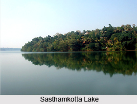
Kerala is popularly called a land of water bodies because of its backwaters and waterfalls, thirty four lakes with gleaming azure and emerald waters and several rain-fed rivers with distributaries and tributaries. Akkulam Lake, Vembanad Lake, Sasthamkotta Lake, the Ashtamudi Lake and Pookot Lake are some of the famous lakes in Kerala.
The backwaters are the interconnected system of river estuaries and brackish water lakes. Canals link the lakes and backwaters to facilitate an uninterrupted inland water navigation system from Thiruvananthapuram to Vadakara. This interconnection helps in the inland travel in the region which is roughly surrounded by Thiruvananthapuram to the south and Vadakara to the north. Vembanad Lake is the largest water body of Kerala which dominates the backwaters and it lies in between Kochi and Alappuzha town and is more than two hundred square kilometres in area.
Kerala possesses a wide variety of soil like ferruginous, red soil, regur soil, sandy, peat and loamy soil due to its wide range of topographical features including coastlines along the Arabian Sea, valleys, abundant water bodies and hills of the Western Ghats. The Western Ghats form an almost continuous mountain wall, except near Palakkad.
 There is a variety of flora and various other plantation crops which are grown in its soils. The flora of Kerala also comprises several plants of rich medicinal value. The forest areas include tropical wet evergreen, arid deciduous and tropical damp as well as mountainous temperate and subtropical forests in the precipitous hills. The state depends basically on agriculture and the major crops are cassava, coconut, pepper, paddy, cashew and cash crops like coffee and tea, spices, vanilla, nutmeg and cashew nut and plantation crops like rubber.
Kerala is endowed with a number of deposits such as heavy mineral sand, china clay, iron ore, graphite, bauxite, silica sand, lignite, lime shell, granite etc. However mining activities on large scale are confined mainly to a few minerals such as heavy mineral sand, china clay, silica sand, limestone and graphite. Heavy mineral sand and china clay contribute more than 90 per cent of the total value of mineral production in the state.


