
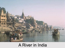
 Water Resources in India are part of the key, affluent and huge variety of natural resources in the country. Water is a fundamental human requirement and a valuable asset for the nation. It is an important source of creating food security in the country. Agricultural output is largely dependent on regulation and improvement of Water Resources in India. Total Water Resources in India are around 167 million hectare-meters, which have been derived after considering the total area and the average annual rainfall of around 50 cm. Out of this, only 66 million hectare-meters are available for irrigation in India.
Water Resources in India
Water Resources in India are unevenly distributed in the country. They affect lives, standard of living and settlement in a particular region of the country. They play an important role in the economy of the country, due to their utility value in various sectors.
Introduction
Water Resources in India are part of the key, affluent and huge variety of natural resources in the country. Water is a fundamental human requirement and a valuable asset for the nation. It is an important source of creating food security in the country. Agricultural output is largely dependent on regulation and improvement of Water Resources in India. Total Water Resources in India are around 167 million hectare-meters, which have been derived after considering the total area and the average annual rainfall of around 50 cm. Out of this, only 66 million hectare-meters are available for irrigation in India.Sources of Water Resources in India
About 80 percent of the area of India experiences rains of about 750 millimeters or more in a year. But rainfall in India shows very high sequential and spatial inconsistency. In India, the monsoon period generally lasts for around 3 to 4 months. More specifically, it is the monsoon season during which most of the rains occur. At this time, north east India and north India receive far more rains than west India and south India. Melting snow also acts as a source of water in India. Melting snow over the Himalayan Mountain Range after winter season adds water in the northern rivers in varying amounts. Thus, it can be comprehended that there is variation in the availability of water from different sources in different parts of India.
Indian rivers have a total average annual flow of about 1953 cubic kilometers per year. It has been estimated that the annual usable ground and surface water resources are around 396 cubic kilometers and 690 cubic kilometers, respectively. Along with rivers, reservoirs, tanks, canals, ponds and other small Indian water bodies form inland water resources in India. These are mostly present in the Indian states of Uttar Pradesh, Madhya Pradesh, Jammu and Kashmir, Tamil Nadu, Andhra Pradesh, Karnataka, Rajasthan, West Bengal, Gujarat, Maharashtra and Odisha, amongst others. The entire length of canals and rivers is about 31.2 thousand kilometers in Uttar Pradesh and Odisha has the highest area for salty water bodies. Lakes, wetlands, dams, barrages, lagoons, gulfs, estuaries and straits, etc are other sources of water in India.
Indian rivers have a total average annual flow of about 1953 cubic kilometers per year. It has been estimated that the annual usable ground and surface water resources are around 396 cubic kilometers and 690 cubic kilometers, respectively. Along with rivers, reservoirs, tanks, canals, ponds and other small Indian water bodies form inland water resources in India. These are mostly present in the Indian states of Uttar Pradesh, Madhya Pradesh, Jammu and Kashmir, Tamil Nadu, Andhra Pradesh, Karnataka, Rajasthan, West Bengal, Gujarat, Maharashtra and Odisha, amongst others. The entire length of canals and rivers is about 31.2 thousand kilometers in Uttar Pradesh and Odisha has the highest area for salty water bodies. Lakes, wetlands, dams, barrages, lagoons, gulfs, estuaries and straits, etc are other sources of water in India.
Water Resources Shortage in India
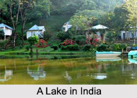 Around 9.7 million hectare-meters of water was available for agriculture in India before 1951. By 1973, almost 18.4 million hectare-meters of water was being supplied for agriculture and irrigation. India has extensive river systems, but safe and clean drinking water and water for irrigation and agriculture is inadequate across India. Although in the coastal plains of India and plains of northern India water resources are abundant, but in other regions supply of water is significantly insufficient.
In India, the utilizable ground water resources are considered to be approximately 40 million hectare-meters. In general, in particular areas, ground water can be drained from a depth of almost 15 meters. A vast portion of the nation faces shortage of surface water resources for most part of the year. Even areas like Konkan and Meghalaya which receive adequate rainfall, face deficiency of water during winter and summer months. Mawsynram in Cherrapunjee gets the world`s highest rainfall in the rainy season, yet it also experiences water shortages during other seasons. Water resources that are safe for ingestion cannot be provided in most of the Indian villages in the rural areas. Furthermore, villagers have to cover vast distances to gather water.
Improvement of Water Resources in India
With improvements in standard of living and growing population, demand for water resources increased along with reduction in the availability of water throughout India. Change in climatic conditions and rising pollution levels, deteriorated the quality of Water Resources in India. Thus, proper improvement and competent utilization of water resources became immensely important. In 1954, surface water exploration programme was initiated and drilling actions were undertaken in river basins and lower Himalayan areas. This programme gained further momentum during the 1990s, with the introduction of open-hole drilling equipments. Drilling was carried out in areas of Arunachal Pradesh and Jammu and Kashmir. Numerous wells were drilled to counter water deficiency in India, particularly in drought prone regions. Around 27,500 wells have been established by drilling, around the nation. These well are managed by the State Governments in India for providing water to the public.
Government of India has undertaken few programs and policies. More specifically, framing of policy guidelines, technical examination, sectoral planning, techno-economic appraisal and coordination of projects are part of the efforts made by the government. The programmes and policies support particular projects, facilitate exterior assistance, help in solving regional disputes related to water, help in the management of irrigation and aid in expansion and improvement of Water Resources in India. In order to accumulate river waters and improve ground water recharging, about 5,000 major or medium dams, barrages, etc have been constructed in India. For a stable development in Indian economy and improvement of environment, management of water resources should be integrated, as per the National Water Policy, 2002.
Government of India has undertaken few programs and policies. More specifically, framing of policy guidelines, technical examination, sectoral planning, techno-economic appraisal and coordination of projects are part of the efforts made by the government. The programmes and policies support particular projects, facilitate exterior assistance, help in solving regional disputes related to water, help in the management of irrigation and aid in expansion and improvement of Water Resources in India. In order to accumulate river waters and improve ground water recharging, about 5,000 major or medium dams, barrages, etc have been constructed in India. For a stable development in Indian economy and improvement of environment, management of water resources should be integrated, as per the National Water Policy, 2002.
Ministry of Water Resources
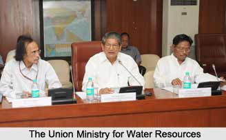 Ministry of Water Resources is responsible for looking to the maintenance of the water supply in the country and its efficient monitoring. Prior to independence it was the department of industries and labour, inter-alia, which was looking after the subjects of `Irrigation & Power`. A Central Board of Irrigation and Power was created in 1927. With the bifurcation of Department of Industries and Labour in 1937 into the Department of Communication and Department of Labour, the latter was assigned the work relating to `Irrigation and Power`. Following this, there were a number of organisations and re organisations of the ministry. Finally in 1985, the then Ministry of Irrigation and Power was bifurcated and the Department of Irrigation was re-constituted as the Ministry of Water Resources. This recognition of the necessity of planning for the development of the country`s water resources in a coordinated manner resulted in a change in the character of the Ministry and the Ministry has been assigned a nodal role in regard to all matters concerning the country`s water resources.
With the re-designation of the Ministry of the Water Resources, purposive steps were taken to fulfil the role expected of the Ministry with this new perspective calling for overall planning and coordination of all aspects of the development of the country`s water resources. The imperative need was to formulate a water policy laying down, inter-alia, priorities for the various uses of water. Therefore, a National Water Resources Council was constituted under the Chairmanship of Prime Minister to look into this aspect. This Council adopted the National Water Policy in September, 1987.
Functions of Ministry of Water Resources
The Ministry of Water Resources is responsible for laying down policy guidelines and programmes for the development and regulation of country`s water resources. The Ministry has been allocated the following functions- Overall planning, policy formulation, coordination and guidance in the water resources sector; Technical guidance, scrutiny, clearance and monitoring of the irrigation, flood control and multi-purpose projects (major/medium); General infrastructural, technical and research support for sect oral development; Providing special Central financial assistance for specific projects and assistance in obtaining external finance from World Bank and other agencies; Overall policy formulation, planning and guidance in respect of minor irrigation and command area development, administration and monitoring of the Centrally Sponsored Schemes and promotion of participatory irrigation management; Overall planning for the development of ground water resources, establishment of utilizable resources and formulation of policies of exploitation, overseeing of and support to State level activities in ground water development; Formulation of national water development perspective and the determination of the water balance of different basins/sub-basins for consideration of possibilities of inter-basin transfers; Coordination, mediation and facilitation in regard to the resolution of differences or disputes relating to inter-state rivers and in some instances, the overseeing of the implementation of inter-state projects; Operation of the central network for flood forecasting and warning on inter-state rivers, the provision of central assistance for some State Schemes in special cases and preparation of flood control master plans for the Ganga River and the Brahmaputra River; Talks and negotiations with neighbouring countries, in regard to river waters, water resources development projects and the operation of the Indus Water Treaty.
Water Resources in Northern India
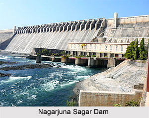 Water Resources in Northern India owes a great deal of its presence and affluence to the numerous water bodies, rivers, estuaries, lakes, dams, and other notable Water Projects of India. Owing to the necessity of the natural water in the northern part of India, water being an inexhaustible natural resource and valuable too, the Central Government has indulged in a major project and series of minor ones to execute in order to make the river Ganga pollution-free because the Ganga is witnessed as one of the holiest rivers ever since ancient times and a source to the water of India. The water of the Ganga River and its tributaries makes the whole of north-India fertile and productive. However the unusable and the polluted water of the towns and industries situated on the banks of this river mingle with the pure water of the Ganga. Again the water is still more polluted as people throw into this river the dead bodies and corpses of animals.
Along with the inland water-bodies a huge amount of water is stored in the form of ice on the mighty peaks of the Himalayan ranges and under the ground. Even one-third of this potential water resource has not yet been developed. India is an agricultural country. Water is essential for agriculture. Our country gets rainfall by the monsoons, but this rainfall is not equally distributed all over the country. Even though the annual average rainfall is satisfactory, it is unequal and uncertain. India is bordered in the northern side by the 2,500- kilometre long Himalayan Mountains. The melting snow and glaciers deftly provide a continuous flow for numerous rivers running south from the Himalayas into the vast Indo-Gangetic Plain, which is dominated by the Ganges River and its tributaries. Heavy rains are typical in the Himalayas during the monsoon months between June and October, causing frequent floods.
Water Resources of Central India
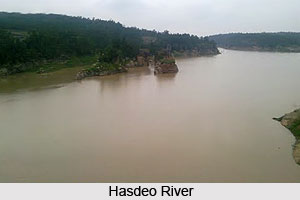 Central India has been blessed with ample water resources. As compared to other states, Chhattisgarh is affluent in terms of rainfall. The average rainfall of the state has been recorded around 1400 mm. Rainfall in Chhattisgarh mainly occurs during monsoon, during the period of July to September. Apart from rainfall, the major water resource of the state comprises of rivers and ground water. The significant rivers of the state include Mahanadi, Indravati, Hasdeo, Sheonath, Arpa, Rehar, Kelo etc. These rivers form the lifeline of the socio economic development of Chhattisgarh. Mainly the total area of the state can be geographically divided in five river basins viz. Mahanadi Basin, Godavari Basin, Ganga Basin, Narmada Basin and Brahmani Basin.
Man Made Water Resources
Since ancient times, a number of man made water resources have served the people of the state. History of the state states that many tanks were built in villages during the reign of Kalchuri Kings. Till date, the various daily needs of the villagers are served by small tanks constructed almost in all the villages. Man made water resources also play an important role in irrigating the fields of the state. About 75 percent of the irrigation is carried out with the aid of canals and the rest 25 percent is done with the help of tanks, tube wells and wells.
Central India is rich in terms of water resources. They form the life line of the states of this region. But the states do not solely dependent on natural resources and owing to the upcoming problems of drought, a number of artificial water resources have also been built to combat the problems of drought and water scarcity.
Recently updated articles in Geography of India

Krishnaveni River
The Krishnaveni River, presently known as the Krishna River, is one of India’s major rivers. Originating in the Western Ghats of Maharashtra, it flows...

Wakal River
The Wakal River is an important tributary of the Sabarmati River, originating in Rajasthan’s Aravalli Range and flowing through Rajasthan and Gujarat....

Pahuj River
Pahuj River is an important tributary of the Sindh River that flows through the Indian states of Madhya Pradesh and Uttar Pradesh. Originating in the...

Arunavati River
Arunavati River is a seasonal right-bank tributary of the Tapi River, flowing through parts of Madhya Pradesh and Maharashtra. Originating in the Satp...

Nira River
Nira River is an important tributary of the Bhima River flowing through Maharashtra. Originating in the Western Ghats, it traverses Pune, Satara, and...
Related articles in Geography of India

Geography of Sikkim
Geography of Sikkim is characterised by a vast array of magnificent hillock that extends from one corner of the state to the other.

Geography of Meghalaya
The suitable climate, highland plateaus, rivers and the flora and fauna together forms the geography of Meghalaya.

Geography of Jammu & Kashmir
Jammu and Kashmir is encompassed by valleys. Some of the dominant valleys of the state are Kashmir Valley, Tawi Valley, Chenab Valley, Poonch Valley,...

Narmada River
Narmada River is regarded as the 5th longest river of India and the life line of Madhya Pradesh. Narmada River basin spreads over an area of about 98,...

Bhima River
The Bhima River is the largest tributary of the Krishna River and is significant in the western and southern Indian states.