
 The Indian subcontinent located mostly on the Indian Plate has varied topography. Its topographical features are labeled as unique and distinguished and range from the northern mountains to the coastal plains. Gulfs also form a part of Indian subcontinent. Some of them are described below.
Gulf of Mannar
Gulf of Mannar is located between the southeastern tip of India and the west coast of Sri Lanka in the Coromandel Coast Region and forms a part of the Laccadive Sea in the Indian Ocean. It is defined as a large shallow bay which has maximum length of about 160 km, maximum width of about 130-275 km and average depth of about 1,335 m. This gulf is drained by the estuaries of Thamirabarani River of South India and the Malvathu River (Malvathu Oya) of Sri Lanka. It provides habitat to over 3,600 species of flora and fauna. There is a Gulf of Mannar Biosphere Reserve which is spread over an area of about 10,500 square kilometers of ocean, islands and the adjoining coastline.
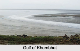
Gulf of Khambhat
Gulf of Khambhat or Gulf of Cambay is located in the state of Gujarat, along the west coast of India. It can be defined as an inlet of the Arabian Sea. It has a length of about 130 kilometers miles and is fed by the rivers namely, Narmada, Tapti, Mahi and Sabarmati. Kathiawar peninsula to the west is separated from the eastern part of Gujarat by the Gulf of Khambhat. A dam across the Gulf of Khambat has been proposed to be built under the Kalpasar Project. Such an establishment is aimed at providing a huge fresh water reservoir for irrigation, drinking and industrial purposes.
Gulf of Kutch
Gulf of Kutch is located in the state of Gujarat, along the west coast of India. It is defined as an inlet of the Arabian Sea. It is about 99 miles in length and has maximum depth of about 401 feet. The gulf region is prone to severe daily tides, which makes it suitable for tidal energy generation. It also functions to separate Kutch and Kathiawar peninsula regions of Gujarat. Under a joint venture of Gujarat forest department, Wildlife Trust of India and Tata Chemicals, the Gulf of Kutch will be adorned with a coral garden near Mithapur and will be utilized as a tourism product.









