
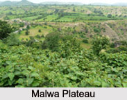
 Central Highlands in India can be defined as a bio-geographic zone. These highlands have been formed by the disjunct ranges of the Satpura and Vindhya Hills. The Malwa Plateau in the west, the Deccan Plateau in the south (covering majority of the Indian peninsula) and the Chota Nagpur Plateau in the east are the most important regions of the Indian subcontinent and the Central Highlands in India.
Malwa Plateau
The Malwa Plateau is located in Rajasthan, Madhya Pradesh and Gujarat. The average altitude of the Malwa Plateau is about 500 meters and the landscape generally slopes towards the north. The Chambal River and its tributaries drain most of the region. The upper reaches of the Mahi River drain the western part.
Deccan Plateau
Deccan Plateau is a large triangular plateau, surrounded by the Vindhyas to the north and flanked by the Eastern and Western Ghats. It covers a total area of about 1.9 million square kilometers. It is mostly flat, with elevations ranging from 300 to 600 m (1,000 to 2,000 ft).
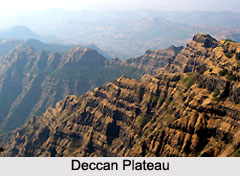 The average elevation of the plateau is about 2,000 feet (600 m) above sea level. The surface slopes from 3,000 feet (900 m) in the west to 1,500 feet (450 m) in the east. It slopes gently from west to east and gives rise to several peninsular rivers such as the Godavari, the Krishna, the Kaveri and the Narmada, which drain into the Bay of Bengal. This region is mostly semi-arid as it lies on the lower side of both Ghats. Much of the Deccan is encompassed by thorn scrub forest scattered with small regions of deciduous broadleaf forest. Climate in the Deccan ranges from hot summers to mild winters.
Chota Nagpur Plateau
Chota Nagpur Plateau is located in eastern India and is one of the central highlands in India, covering much of the Indian state of Jharkhand and adjacent parts of Odisha, Bihar and Chhattisgarh. Its total area is approximately 65,000 square kilometers and it is made up of three smaller plateaus, namely the Ranchi, Hazaribagh, and Kodarma plateaus. The Ranchi Plateau is the largest, with an average elevation of about 700 m (2,300 ft). Much of the plateau is forested, covered by the Chota Nagpur dry deciduous forests. The Hazaribagh Plateau is divided into two parts namely, the higher plateau and the lower plateau. The Hazaribagh town has been built on the Hazaribagh Plateau. It has an average elevation of about 610 m (2,000 ft). The Koderma Plateau or the Hazaribagh Lower Plateau has uniform and gentle slope towards the east. The northern face of the Kodarma Plateau looks like a range of hills, but in actuality it is the edge of a plateau, which is about 240 meters from the level of the Gaya Plain. Huge reserves of metal ores and coal have been found in the Chota Nagpur Plateau.









