
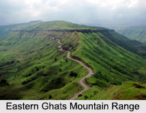
 Eastern Ghats mountain ranges are a series of discontinuous low ranges along the Bay of Bengal coast running from the Mahanadi River valley for about 500 metres up to the Nilgiri Hills in the south and forms the eastern edge of the divided Deccan plateau. Eastern Ghats are not as elevated as the Western Ghats. It is also known as "Purbagha?a". These major rivers cut the Eastern Ghats into various discontinuous hills. They are separated from the Bay of Bengal by the coastal plains. Mahanadi River, Godavari River and Krishna River have cut gaps from side to side Eastern Ghats.
Location of Eastern Ghats Mountain Range
The Eastern Ghats start from the state of West Bengal in the north and culminates in Tamil Nadu in the south. On the way Eastern Ghats mountain ranges cover several states including Odisha and Andhra Pradesh. Eastern Ghats in Odisha starts from North of Similipal in Mayurbhanj district and runs throughout Malkangiri.
Geography of Eastern Ghats Mountain Range
Eastern Ghats are older than the Western Ghats, and have a complex geological history related to the assembly and disintegration of the ancient supercontinent of Rodinia and the meeting of the Gondwana supercontinent. These are made up of "charnockites", "granite gneiss", "khondalites", "metamorphic gneisses" and "quartzite" rock formations. The construction of the Eastern Ghats comprises thrusts and strike-slip faults all along its variety.
Characteristics of Eastern Ghats
One of the greatest features of Eastern Ghats lies at its being extremely rich in nature. The Eastern Ghat is said to have the division of waterways. Due to larger rain falls, the area produces better plants. Like European Ghats, therefore, the Eastern aspects of Ghats also bring a pile of environmental significance.
The different ecological situation presents a wealthy wildlife. Eastern Ghat is the home of biggest extensive range of Asiatic animals in the world. Other animals like Nilgiri Tahr, Gaurs, Leopards, Sambar, and lion are ample here. Apart from these, this is recognized for wide range of chicken varieties.
Notable Mountains of Eastern Ghats Mountain Range
Notable Mountains of Eastern Ghats Mountain Range are "Deomali Parvat", "Malayagiri", "Mahendragiri", "Chandragiri", "Turiakonda", "Devagiri", "Dharakonda", "Sambari Konda", "Hatimali", "Mettur", "Shevaroy", "Nallamalla", "Kalrayan", "Pachamalai" Mountains and others. Hills like "Kalrayan", "Palamalai", "Pachaimalai", "Mettur" and "Shevaroy" at Tamil Nadu are some with larger heights of Eastern Ghats. "Jindhagada" is the highest mountain in the Eastern Ghats located in Araku, Vishakhapatnam.
People of Eastern Ghats Mountain Range
Eastern Ghats Mountain Range is inhabited by few communities such as "Jatapu", "Savara", "Konda Dora", "Khond", "Gadaba", and "Manne Dora". They are dependent on forests and create a tremendous use of remedial plants. It is the home for many Buddhist ruins from Odisha to south Andhra.
Waterways of Eastern Ghats Mountain Range
The important waterways of Eastern Ghats Mountain Range, namely, "Godavari", "Mahanadi", "Krishna" and "Kaveri" have cut through the Eastern Ghat landscapes. The "Ponnaiyar" as well as "Palar" Rivers flow through the headwaters on Kolar Level eastward through holes in Eastern Ghats to empty into the Bay of Bengal.
Wildlife Sanctuaries of Eastern Ghats Mountain Range
There are mixture of wildlife sanctuaries like the "Simlipal Nationwide Recreation area", "Sri Nationwide Venkateshwara Recreation" area, "Baissipalli Haven Wildlife", "Bhitarkanika Nationwide Recreation" area, "Satkoshia Stuff Haven" and others. The area of Eastern Ghats Mountain Range is also a house of ponds such as "Kolleru" lake, "Chilika" Pond, "Pullicat" Pond.
Hill Stations of Eastern Ghats Mountain Range
Eastern Ghat area also features mountain programs such as "Yercaud" at Tamil Nadu and environmental supplies at "Bilgiri" Mountains and remote drops like "Kiliyur Falls". The "Bilgiri" Mountains that run from the European Ghats to "Kaveri", forms the forested environmental field connecting Southern with European Ghats. Seventeen districts of Odisha come under the Eastern Ghats.









