
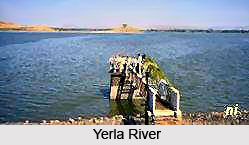
 Yerla River, also known as the Yerala River, is a tributary
of the Krishna River
in the Indian
state of Maharashtra.
It originates in the Mhaskoba Hills and flows for approximately 125 km before
joining the Krishna River. The river is fed by three major tributaries, namely the
Nandani River, the Karpur River, and the Chond River, which contribute
significantly to its flow. The Yerla River basin covers a total area of about
3,041 square kilometres, supporting agriculture and local livelihoods across
the region.
Yerla River, also known as the Yerala River, is a tributary
of the Krishna River
in the Indian
state of Maharashtra.
It originates in the Mhaskoba Hills and flows for approximately 125 km before
joining the Krishna River. The river is fed by three major tributaries, namely the
Nandani River, the Karpur River, and the Chond River, which contribute
significantly to its flow. The Yerla River basin covers a total area of about
3,041 square kilometres, supporting agriculture and local livelihoods across
the region.
Yerla River
Yerla River, also known as the Yerala River, is a tributary of the Krishna River in Maharashtra. Originating in the Mhaskoba Hills of Satara district, it flows through Satara and Sangli districts before joining the Krishna at Brahmanal. The river supports irrigation, agriculture, biodiversity, and several culturally significant religious sites.
Introduction
Course of Yerla River
Yerla River originates in the Mhaskoba Hills, situated in the extreme northern part of Khatav taluka in Maharashtra's Satara district. From its source, the river flows through a valley bordered by the Vardhangad Range on the right and the Mahimangad Range on the left. Along its course in Satara district, it passes through the settlements of Mol, Lalgun, Pusegaon, Khatav, Vaduj, and Nimsod before entering Sangli district.
The Yerla River basin extends across the districts of Satara
and Sangli
in Maharashtra. In Satara district, the basin covers the talukas of Khatav and
Karad, while in Sangli district it spans the talukas of Kadegaon, Khanapur,
Palus, and Tasgaon. After traversing these regions, the river ultimately joins
the Krishna River at Brahmanal in Sangli district. This confluence is regarded
as a scenic and culturally significant location, marking the end of the river's
journey.
History of Yerla River
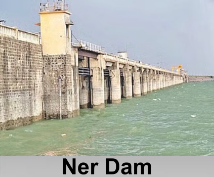
Yerla River was known as the Vedavati River in ancient times. According to local tradition, sages gathered along its banks to recite the Vedas, giving the river cultural and historical significance. Two small dams constructed during the British colonial period, the Ner Dam and the Yerlavadi Dam, are located on the river.
Since the 1980s, the communities living within the Yerla
River basin have experienced recurring and severe drought conditions. The
region receives relatively low rainfall,
making the river valley particularly vulnerable to water scarcity and its
adverse effects on agriculture and local livelihoods.
Geography of Yerla River
 Yerla River serves as a vital source of water for the people
living in the chronically drought-prone talukas of Khatav in Satara district
and Khanapur and Tasgaon in Sangli district, Maharashtra. Despite its
importance, the river is seasonal in nature, carrying water for only part of
the year while its riverbed remains dry for approximately six months.
Yerla River serves as a vital source of water for the people
living in the chronically drought-prone talukas of Khatav in Satara district
and Khanapur and Tasgaon in Sangli district, Maharashtra. Despite its
importance, the river is seasonal in nature, carrying water for only part of
the year while its riverbed remains dry for approximately six months.
Yerla River basin, together with the neighbouring Maan River basin, is regarded as one of the most drought-affected regions of western Maharashtra due to persistent water scarcity and low rainfall. To address these challenges, proposals for inter-basin river-linking projects have been put forward to improve water availability in the region. Supporters of these initiatives also argue that regulating or preventing excessive sand mining from the riverbed would help conserve the river's ecological health and contribute to maintaining its flow for a longer duration each year.
Irrigation and Agriculture Supported by Yerla River
Several irrigation projects have been developed along the Yerla River, including those at Vaduj, Mayni, and Bhakuchi Wadi, to support agriculture in the surrounding region. Further downstream, the river feeds the Ner Dam, which serves as a seasonal habitat for a variety of migratory bird species. Although the Yerla is a non-perennial river, it plays an important role in sustaining agricultural activities, particularly in Satara district.
Agriculture is the primary occupation in Satara district, where crops are cultivated during both the Kharif and Rabi seasons. Major Kharif crops include bajra (pearl millet), rice, groundnut, and ghewda (field beans), while wheat and gram are the principal Rabi crops. Jowar (sorghum) is grown in both seasons, with Kharif hybrid varieties cultivated mainly in the talukas of Karad, Khatav, Satara, and Patan, and Rabi jowar produced in Phaltan, Satara, Wai, Koregaon, and Khandala.
Millet is widely cultivated in the low-rainfall talukas of Man, Khatav, Khandala, Phaltan, and Koregaon. Wheat production is particularly significant in Phaltan, Khatav, and Jawali talukas. Groundnut is grown extensively in the talukas of Satara, Karad, Patan, Jawali, Wai, and Koregaon, while gram is cultivated across the district to varying extents.
The district also supports a variety of horticultural
and cash crops. Phaltan taluka is known for its grape and pomegranate orchards,
while the fertile banks of the Krishna River are renowned for brinjal
cultivation. Sugarcane
is the district's principal cash crop, and turmeric and ginger are also
grown in several areas. In addition, the hill regions of Panchgani, Mahabaleshwar,
and Wai are nationally recognized for their strawberry production.
Tourism Along the Banks of Yerla River
Yerla River is associated with several religious, cultural, and natural attractions along its course. Its first significant pilgrimage site is the Mhaskoba Temple, located near the village of Mol in the northern part of Khatav taluka, close to the river's source. As the river flows southeast, it passes the Nagnath Temple, a prominent shrine dedicated to Lord Shiva at Nagnathwadi near Lalgun.
At Pusegaon, the banks of the Yerla River are home to the well-known Shri Sevagiri Maharaj Temple, an important place of worship for devotees in the region. South of Vaduj, near Banpuri village, the Yeralwadi Dam has been constructed across the river.
The reservoir and its surrounding wetlands have become a
notable birdwatching destination in Satara district, supporting a rich
diversity of avian life, including greater flamingos, winter migratory ducks,
and various species of waders.
Recently updated articles in Geography of India

Krishnaveni River
The Krishnaveni River, presently known as the Krishna River, is one of India’s major rivers. Originating in the Western Ghats of Maharashtra, it flows...

Wakal River
The Wakal River is an important tributary of the Sabarmati River, originating in Rajasthan’s Aravalli Range and flowing through Rajasthan and Gujarat....

Pahuj River
Pahuj River is an important tributary of the Sindh River that flows through the Indian states of Madhya Pradesh and Uttar Pradesh. Originating in the...

Arunavati River
Arunavati River is a seasonal right-bank tributary of the Tapi River, flowing through parts of Madhya Pradesh and Maharashtra. Originating in the Satp...

Nira River
Nira River is an important tributary of the Bhima River flowing through Maharashtra. Originating in the Western Ghats, it traverses Pune, Satara, and...
Related articles in Geography of India

Geography of Sikkim
Geography of Sikkim is characterised by a vast array of magnificent hillock that extends from one corner of the state to the other.

Geography of Meghalaya
The suitable climate, highland plateaus, rivers and the flora and fauna together forms the geography of Meghalaya.

Geography of Jammu & Kashmir
Jammu and Kashmir is encompassed by valleys. Some of the dominant valleys of the state are Kashmir Valley, Tawi Valley, Chenab Valley, Poonch Valley,...

Narmada River
Narmada River is regarded as the 5th longest river of India and the life line of Madhya Pradesh. Narmada River basin spreads over an area of about 98,...

Bhima River
The Bhima River is the largest tributary of the Krishna River and is significant in the western and southern Indian states.