 The state of Uttar Pradesh is located in the northern part of India. It is the most populous state in the Republic of India as well as the most populous country subdivision in the world. This state has varied topography, vibrant culture, monuments, etc. They have not only beautified this state but have also helped Uttar Pradesh rank first in domestic tourist arrivals.
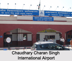
Chaudhary Charan Singh International Airport
Chaudhary Charan Singh International Airport is located in Amausi in the city of Lucknow. This public airport which is operated by the Airports Authority of India has the distinction of being the 12th busiest airport in India and also the second busiest and largest airport in North and Central India. This airport has been provided with domestic and international terminals, one runway which is 2,800m in length and landing amenities.
Allahabad Airport
 Allahabad Airport is located at a distance of about 12 km from the city of Allahabad. This airport is owned by the Indian Air Force and operated by Airports Authority of India and Indian Armed Forces. It occupies 1 acre of land or an area of about 4000 square meters. Its concrete apron has 2 parking bays which can accommodate 1 CRJ aircraft and 1 Q400 aircraft simultaneously.
Faizabad Airport
Faizabad Airport is located in the city of Faizabad between NH 28 and NH 96 at Sultanpur Naaka. This airport is owned and operated by Airports Authority of India. In February 2014, a memorandum of understanding was signed by the State Government with the Airports Authority of India for the development of this airport.
Meerut Airport
Meerut Airport is located at Partapur, about 9 km south of Meerut. This public airport is owned by the Airports Authority of India. This airport occupies 47 acres of land. In February 2014, Government of Uttar Pradesh and Airports Authority of India (AAI) joined hands for the development of this airport.
Moradabad Airport
Moradabad Airport is located midway between Moradabad and Rampur city on NH 24. This public airport is owned by the Airports Authority of India. This airport was constructed on 52 hectares of land. For the development of this airport also, a memorandum of understanding was signed by the State Government with the Airports Authority of India.
Other Airports in Uttar Pradesh
Lal Bahadur Shastri Airport, Sultanpur Airport, Azamgarh Airport, Muirpur Airport, Lucknow Air Force Station and Hindon Air Force Station are some of the other Airports in Uttar Pradesh.


