Introduction
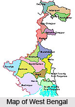
Bankura district, located in the state of West Bengal, finds mention in the ancient Buddhist and Jain scriptures. It lies in the heart of the ancient Summha area of Mahabharata or Rarh or Larh of the old Jain Acharanga-sutra. Mention has also been made of the district in the ancient Buddhist Jatakas as Summhabhumi. Bankura district today is bordered by the Purulia district, Bardhaman district, Hooghly district and Midnapore district. It is situated between the hilly terrain of Chotanagpur and Santal Parganas of Bihar on the one side and the fertile alluvial plains of West Bengal on the other. There are a number of temples located at Bankura district, especially in the district of Bishnupur, which are prime attractions of the district. Being a district with a very high tribal population, Bankura district abounds in cultural variety seen in the art, music and performing arts of the place.

History of Bankura District
History of Bankura district goes back a long way. It used to form a part of the Rarh district in ancient times. Initially, this area was occupied by the aboriginal tribes. It was Aryanised with the people and culture of the Proto-Indo-European group, who prevailed in northern India, substantially later than rest of Bengal. The two main groups of people at this point in time were the Nishadas (who were Proto-Australoid tribes) and Dasa-dasyus (related to Dravidians). The process of assimilation with Proto-Indo-Europeans took a long time in the making, centuries in fact, and was achieved through both conflict as well as cordiality.
The history of the district of Bankura from the 7th century AD right until the advent of British rule is dominated by the Hindu Rajas of Bishnupur. The origin of the Rajas of Bishnupur is quite unclear. Though they were acknowledged as the King of Bagdis, it has been claimed by their followers and even the Kings themselves that they were descended from the Kshatriya clans of Northern India. The Rajas of Bishnupur were also known as Malla kings. As a result, the area around Bishnupur was called Mallabhum. This area would approximately cover present day Bankura police station area (excluding Chhatna), Onda, Bishnupur, Kotulpur and Indas. In the north it stretched from Damin-i-koh in Santhal Parganas to Midnapore in the south. It included the eastern part of Bardhaman and parts of Chota Nagpur in the west.

The Malla dynasty was founded by Adi Malla. Also known as Bagdi Raja, his reign went on for 33 years. He was succeeded by his son, Jay Malla, who invaded Padampur and captured the fort, then the power-centre. Having increased the size of his kingdom, Jay Malla shifted the capital to Bishnupur. The various Malla Kings who followed Jay Malla steadily added to the dominions and further expanded the reach of the kingdom. Well known among the various Malla rulers were Kalu Malla, the fourth in line, Kau Malla, the sixth in line, Jhau Malla, the seventh in line, and Sur Malla, the eighth in line, who defeated the Raja of Bagri, a place now in northern Midnapore.
Having reached the pinnacle of success in the latter half of the 17th century, the reign of the Bishnupur Rajas started declining towards the first half of the 18th century. First, the Maharaja of Burdwan seized the Fatehpur Mahal. Following this, repeated Maratha invasions ruined the kingdom. Seobhat, the Maratha chief, made Bishnupur his headquarters in 1760. The Marathas attacked the border principalities of Bishnupur and Birbhum with great vigour, and subsequently, added to by varied taxations and exactions, the kingdom was reduced to poverty. People started to flee from the place and the place was struck with desolation. Intrigue, conspiracy and litigation ruined the Royal family, and ultimately the estate was sold for arrears of land revenue to the Maharaja of Burdwan.
In 1760, when Burdwan Chakla was ceded to the British, Bishnupur went along with it. The land was in complete ruins now. Lawlessness, destruction, poverty and to top it all the Bengal famine of 1769-1770 had rendered the land completely unmanageable. This led to the emergence of Chuars or robbers who started looting the people for food and money. In 1787, Bishnupur was united with Birbhum to form a separate administrative unit; the headquarters was shifted to Suri. It continued to be part of the Birbhum District till 1793 when it was transferred to the Burdwan Collectorate. Towards the end of the 18th century certain portions of the district around Raipur was affected by the Chuar rebellion. The police force was simply not in a position to control the situation.
The district of Bankura as it exists today acquired its shape in 1879. The thanas of Khatra and Raipur and the outpost of Simplapal were transferred here from Manbhum and the thanas of Sonamukhi, Kotulpur and Indas were re-transferred here from Burdwan. It was known as West Burdwan till 1881, when it finally came to be called Bankura district.
Geography of Bankura District
Bankura district is a part of Bardhaman Division of the State and is included in the area known as "Rarh" in Bengal. The Damodar River flows along the Northern boundary of the district. Bankura district is bounded by Bardhaman district in the north, Purulia district in the west and Paschim Medinapure district in the south. Bankura district is located in the western part of the state of West Bengal. The District of Bankura is located between latitude 22 degree 38 minutes North and longitude 86 degrees 36 minutes east to 87 degrees 47 minutes East.
The seasons in Bankura are generally distributed as hot summer (April-May), monsoon (June-September) and `Cold season` (November-February). The humidity is usually medium to high throughout the year and the rainfall, though not heavy, is usually well distributed. The average annual rainfall received by the district is around 1300 mm. The rainy months are generally July and August. 21.5 percent of the total geographical area of the district is made up of forest land, covering a total of 148177 hectares. Net cultivable area of the district is 4.30 lakh hectares.

In the Bankura District, there are two Agro-Climatic zones which have been classified based on climatic conditions, rainfall, temperature, humidity and altitude accompanied by complex land forms, hydrology and soil combinations. These two climatic zones are the Undulating Red and lataritic zone and the Vindhyan Alluvial zone. The former is tropical dry, sub-humid zone having rainfall ranging from 1100 to 1400 mm and a maximum temperature of 45 degree Celsius and a minimum temperature of 100 degree Celsius normally. This region is primarily made up of an undulating landform with mounds and valleys, exhibiting different grades of laterisation process in soil formation. The soils are well drained, susceptible to soil erosion due to rapid external drainage or run off, and the soil reaction ranges from acidic in ridges and near neutral in valleys. Organic carbon content, phosphate and patas are low. Agriculture in this region is mostly rain dependent. Prevalence of moisture stress on standing Kharif Crop in late monsoon period is very common.
In Vindhyan Alluvial Zone, soil in general is deep, texturally medium to fine, mostly acidic in soil reaction, moderately well drained, ground water deeply placed, and low in bases, organic matter, phosphate and medium in patas. Major part of the region harvests more than one crop utilizing canal irrigation as well as ground water.

Among the major crops grown here are rice, wheat, oilseeds and vegetables which occupy a major portion of the total cropped area. Among different oilseeds, rape and mustard, and sesamum are two important oilseeds grown in this district Sesamum is cultivated in 3 seasons while rape and mustard are cultivated during Rabi season. Wheat is the second most important cereal crop in the district and crop is cultivated in assured / limited irrigated areas. About 46 percent of the net cropped area is under irrigation. Most of the Pre-Kharif and Kharif rice are grown in rain-fed conditions. The gross cropped area is about 6 lakh hectares.
Economy of Bankura District
The economy of Bankura district is characterised by an overwhelming agro-economic base and low urbanisation and industrialisation. The district of Bankura can be broadly divided into two regions- the alluvial plains in the east and the undulating tract to the west. Within the district, and even within these regions, the villages vary not only in their geographical features but also in their physical forms and composition which affects their economic and social patterns. Agricultural activities and employment pattern are determined according to all these patterns.
Mines and minerals play a very important role in the economy of Bankura district. A number of mines and mineral based ventures have already come up on the stretch of land between Bankura to Satora. In areas like Chhatna, Saltora Khatra, Ranibundh, Bankura to Indpur stretch and Raipur and Taldangra, the prospects for setting up of mines and mineral based industries are quite bright, subject to environmental clearance.
The blocks like Bishnupur, Sonamukhi, Patrasayer, Indus, Joypur and Kotulpur have been setting up agriculture based industries like rice and oil mills. There is however scope for more. The climate is also conducive for food processing ventures.
The forest wealth of Khatra and Ranibandh areas has always been remarkable. Various forest produce and medicinal flora and fauna are routinely exported to neighbouring districts and also outside the state.
Cottage and small scale industries constitute a major segment of the district`s economy. It provides maximum employment opportunities next to agriculture and this accounts for nearly 9 percent of the district income. There is ample scope for development in this sector with provision of modern technology and other infrastructure facilities. Effort has been taken up for the improvement of designs, marketing assistance and finance etc. of these industries, specially in case of brass and bell metal craft, conch shell products, fishing hook, pottery and leather products etc. through different development agencies. New technology in Babui Rope Making and Sal leaf product has contributed immensely towards the economic upliftment of the rural people of tribal areas.

As regards the agricultural scenario in the district, climatic condition depending upon rainfall , temperature , humidity and altitude accompanied by various complex features like land form, hydrology and soil combination has greatly influenced the farming system of Bankura District. In Bankura District two Agro Climatic Zones, namely Undulating Red and lataritic in Sonamukhi , Joypur, Bishnupur, Ranibandh, Gangajalghati , Borjora, Saltora, Onda, Taldangra, Simlapal, Mejhia, Raipur, Sarenga, Chhatna, Indpur, Khatra, Hirbandh, Bankura-I and Bankura-II blocks and Vindhyan Alluvial Zone in Patrasayer, Indus, Kotulpur blocks, are found to exist.
The net cultivable area of the district is 4.30 lakh hectares. Among the major crops grown in the district are rice, wheat, oilseeds and vegetables which occupy a major portion of the gross cropped area. Most of the pre-Kharif and Kharif rice are grown in rainfed conditions. Use of HYV seeds in the district farming scene is about 9 percent. It may be noted here that wheat is the second most important cereal crop in the district and it is cultivated in assured/limited irrigated areas. Among oilseeds, rape, mustard and sesamum are the most important. Sesamum is cultivated in 3 seasons while rape and mustard are cultivated during Rabi season. Of the total cropped area, about 46 percent is under irrigation.
Due to continuous division and fragmentation of cultivated land, agriculture is becoming less remunerative. It is paradoxical that though Bankura lies in the sub-humid zone having a total annual rainfall of 1300 mm to 1400 mm yet agriculture is largely dependent on the vagaries of monsoon. Drought constitutes a major hazard in the district. Intermittent gaps in precipitation and moisture stress during the monsoon gives rise to serious setbacks in production during the Kharif season, which is the mainstay of agriculture in the district.
The land use pattern differs in a pronounced manner from west to east with varying soil conditions. The eastern alluvial tract is well cultivated and most of the area is double cropped. Uncultivable wastelands are not usually found in this part, except in the slopes and banks of drainage channels, which are not suitable for cultivation due to sheet and gully erosion. Baid type of land occurs at a lower level than the gullied waste lands and is covered with sandy loam soil on which paddy is grown. Kanali lands are at still lower level lands in the alluvial tract on which paddy is grown extensively with moderate to good yields. Sol or Bahal type of lands with loamy or clay soils and with ample surface moisture is best for cultivation of paddy and summer vegetables. Lands with laterite soil are generally covered by Sal forest except for cultivated patches within them.
Forest in Bankura District
Forests of Bankura District are the economic background in West Bengal. These forests are the protected forests. The total forest area of Bankura District comprises of three divisions, Bankura (North) Division, Bankura (South) Division and Panchet Division. The forest area is about 1463.56 square kilometres. The forest area is covering at about 21.27 percent of the total land area of the district. The forests of Bankura District comprise 44.48 square kilometres of reserved forest, 1391.95 square kilometres of protected forest, and 27.13 square kilometres of unclassified state forest.

Forestry in Bankura District is one of the wealth. The development of the district depends much on the forest and the products of forests. Bankura District is better known as "Jungle Mahal" of West Bengal. The forest of Bankura is the natural pride among the people.
Forests of Bankura District are administered by the officers of Indian Forest Services and State Service Officers. The headquarter is at Bankura. In forest areas of Bankura, the majority of the population of Bankura, who are underprivileged, depend on the forest for various purposes like grazing, firewood, collection of Sal leaves and seeds, mushrooms etc. The Sal industry is one of the major agriculture based industry in Bankura.
Forests of Bankura District are in threat for forest degradation. The climate of Bankura District is quite conducive for the production of lac. The woods are used as fuel by 60 percent of the people of the district. Kendu leaf is another product of the forest used in tobacco industry. The vast quantity of honey is also collected from forests of Bankura every year.
The areas of Bankura District, which are in the forests like Khatra, Ranibandh, Bishnupur, Sonamukhi, Borjora and Gangajalghati are covered with dense forest with lots of rare plants and animals. The district of Bankura, the sizeable part of the land both in forest areas and non-forest areas remain vacant. The land under the Forest Department is approximately 21.5 percent. At about 48 percent of the forest is of degraded type. Moreover the plant cover in non-forest area is depleting gradually. This builds up biotic pressure on the existing forest area. Also forest is an important source of livelihood for the poor people in rural areas. It provides not only employment and income but is also an important source of fuel and silage for those people.
Tourism in Bankura District
Tourism in Bankura district is a most relaxing experience as the district abounds in places of natural beauty. Located here are a number of calm and undisturbed places buried deep in the woods and forests. Apart from the beauty of the hills and forests, there are also certain religious spots located here, such as Bishnupur, which one can visit and pay homage to. The various places of tourism in Bankura district are discussed below.

Pilgrimage Tourism in Bankura District
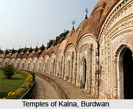
Bishnupur is famous for temples with terracotta art. There are approximately 16 temples in Bishnupur. Most of these temples, such as the Madanmohan Mandir, Shyam Roy Mandir (Panchcura), Chhinnmasta Mandir etc have been constructed in the decade of Mallaraja. Bishnupur is also famous for its own musical gharana( Classical Music). Joyrambati the birthplace of Sree Sree Maa Sarada Devi is a much revered place of pilgrimage. The famous temple of Singha Bahani Devi is a special attraction. Mayerepukur, in font of the residential house of Ma-Sarada is also a beautiful sight.
Nature Tourism in Bankura District
Susunia hill is quite popular as a trekking spot both within and outside Bankura district. It is also much visited by the people who come here to see the "Dhara" (Natural Spring) and Silialipi. Mukutmonipur- Jhilimili circuit has become one of the most attractive tourist sites in the Bankura District. The second biggest earthen dam of India,
Mukutmanipur, is 55 Km away from Bankura district headquarters. It is situated at the confluence of the Kangsabati River, and the Kumari forests encircle the vast blue tract of water. The place is famous for its remarkable natural beauty. The undulating terrain along the southern edge of the Kangsabati Water Reservoir spreads as a three-dimensional necklace of green and Terracotta colour. The stand-till water of the reservoir looks like a large, blue-tinted glass mirror reflecting the vast expanse of sky over it. The vastness of the lake stretches as far as the eye can see. The view of the sunset with the lake on the foreground is a breathtaking site.
Jhilimili is situated 70 Km away from Bankura Town. It is a beautiful place of undisturbed dense natural forest. Even the journey from Ranibund to Jhilimili offers a wonderful experience with a spectacular view of forests of varying heights on both sides of the route. The sparkle of micaceous soil adds to the beauty of the environment.
Eco Tourism in Bankura District
Eco Tourism in Bankura District appeals not only the local tourists, but also the foreign tourists. Bankura District is one of the most prominent places in tourism after Birbhum.

The Sal Forest of Bankura District creates the pastoral scenic beauty throughout the year. There are so many religious and natural locations that create immense scope for tourism in Bankura. It is because Bankura District is covered with medieval terracotta temples. In the eco-tourism, Bankura covers mostly the attraction sites like Susunia, Biharinath and Joypur Forest.
Susunia
Susunia is one of the most attractive tourism spot in Bankura District. It is located at Chhatna block in Chhatna Range under Bankura (North) Division. Susunia is about 24 Km from Bankura town. The forest department of Bankura had created tourism cottages with beautiful landscaping beauty. It has been well connected with Railways and Roadways. It takes five to six hours from Kolkata to Susunia. The isolated natural beauty is the centre of attraction to the tourists. The natural flow of spring water is one of the centre of attraction to that site among the tourists. Rock climbing, trucking and natural study walk are conducive in this region.
Biharinath
Biharinath serves as a religious and natural tourism site in Bankura District. Biharinath is the tallest hill of Bankura District of West Bengal. The main attraction is the forest area of the district. It is 451 metres (1,480 ft) high. It is situated at foot hills of Biharinath hills in Saltora block in Saltora Range under Bankura Division. The temple of Lord Shiva at the foot hills of Biharinath is most divine place for any tourists. The Forest Department under Bankura District had created very beautiful cottages with green landscaping adjacent to the Biharinath Temple. This place is paradise for the religious devotees to stay and get the blessing of Lord Shiva.
Joypur Forest
Joypur Forest is the dense forest of about 120 square kilometres with a watch tower to catch a glimpse of the greenery and the spotted deer. In Joypur forest, there is an age-old airstrip that was active during Second World War. This airstrip was maintained during war times by the Britons.