
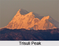
 Trishuli is a mountain peak of the Himalayas located in the Pithoragarh district of Uttarakhand. It is a part of a range of mountains which includes Trisuli West, Hardeol, Dunagiri, Changabang and Kalanka. All these mountains make up the northeast side of the Nanda Devi Sanctuary. This Himalayan range is a part of the Garhwal Division. Trisuli rises in the northern end of the MilamValley which flows in to the Ghori Ganga.
Trishuli is situated at an elevation of 7,074 metres (23,209 feet) above mean sea level. The geographic coordinates of the mountain are 30°34`48?North, 80°01`12?East. The mountain prominence ( it is a measure of vertical separation between mountains) of Trishuli is 624 metres (2,047 feet).









