Introduction
Satna district is one of the districts in Madhya Pradesh. It is rich in historical aspects. The district is an important distribution centre for agricultural products and cloth fabrics. Formed in the year 1948, Satna district has an area of 7,502 square kilometers.
History of Satna District
 History of Satna district forms a part of the history of the region known as Baghelkhand, a very large portion of which was ruled by the rulers of the Rewa District, while the feudatory chiefs, holding their states under the British East India Company, ruled a small part towards the West. The "Sanads"( a government deed granted to the princely states of India confirming them in their states, in return for their allegiance) are eleven in all and the important ones include Maihar, Kothi, Nagod (Princely State of Nagod), Jaso (Princely State of Jaso), Baraundha and Sohawal and the five "Chaube" Jagirs of Paldeo, Taraon, Pahra, Kamta-Rajula and Bhaisundha.
Early History of Satna District : The early Buddhist texts written in Pali Langauge, the Mahabharata, etc, connect the Baghelkhand tract with rulers of the Haihaya, Kalchuris or Chedi clan, who are believed to have gained considerable importance sometime in the third century A.D. Their original habitat is placed on the Narbada with Mahishmati (identified by some with Maheshwar in west Nimar district) as the capital; from where they seem to have been driven eastwards. They had acquired the fort of Kalinjara (some miles beyond the border of Satna district, in Uttar Pradesh), and with this as base, they extended their dominions over Baghelkhand. In the fourth and fifth centuries, the rulers of Gupta empire of Magadha was paramount over this region as is shown by the records of the feudatory chiefs of Uchchakalpa and the Parivrajak Rajas of Kot. The main stronghold of the Chedi clan was Kalinjara, and their proudest title was Kalanjaradhishwara (Lord of Kalanjar). The Kalchuris received their first blow at the hand of chief of Chandella dynasty, Yashovarmma, who seized the fort of Kalinjar and the tract surrounding it. The Kalchuris were still a powerful tribe and continued to hold most of their possessions until the twelfth century.
Medieval History of Satna District : The chiefs of Rewa District were Baghel Rajputs who descended from the Solanki dynasty, which ruled over Gujrat from the tenth to the thirteenth century. Vyaghra Deo, brother of the ruler of Gujrat, is said to have made his way into the northern parts of India about the middle of the thirteenth century and obtained the fort of Marpha, eighteen miles to the northeast of Kalinjar. His son Karandeo married a Kalchuri princess of Mandla and received in dowry the fort of Bandhogarh, which, until its destruction in the year 1597 by Akbar, was the Baghel Capital.
In the year 1298, Ulugh Khan, following the orders of Emperor of Delhi sultanate Ala-ud-din Khilji, drove the last Baghel ruler of Gujrat from his country and this is believed to have caused a considerable migration of the Baghels to Bandhogarh. Until the fifteenth century the Baghels of Bandhogarh were engaged in extending their possessions and escaped the attention of the Delhi Sultans. In 1498-99, Sikandar Lodi failed to take the fort of Bandhogarh. The Baghel king Ramchandra was a contemporary of Mughal Emperor Akbar. Tansen, the great musician, was in the court of Ramchandra and from there Akbar summoned him to his court. After the death of Birdhabra, Ramchandra`s son, a minor named Vikramaditya ascended the throne of Bandhogarh and his accession gave rise to disturbances. Akbar intervened, captured, and dismantled the Bandhogarh fort in the year 1597 after seizing for eight months. After that, the town of Rewa started gaining in importance.
Modern History of Satna District : In the year 1803, after the Treaty of Bassein, the British made overtures of alliance to the ruler of Rewa, but the latter rejected them. In the year 1812, during the time of Raja Jaisingh, a body of Pindaris raided Mirzapur District from Rewa territory. Upon this Jaisingh was called upon to accede to a treaty, in which he acknowledged the protection of the British Government, and agreed to refer all disputes with neighbouring chiefs to their arbitration and to allow British troops to march through or be cantoned in his territories. In the great Sepoy Mutiny of 1857, Maharaja Raghuraj Singh helped the British in quelling the uprisings in the neighbouring Mandla district and Jabalpur district, and in Nagod, which is now a part of Satna district. For this, the king was rewarded by the restoration of the Sohagpur (Shahdol District) and Amarkantak parganas, which had been seized by the Marathas in the beginning of the century. The rulers of Rewa State bore the title of `His Highness` and `Maharaja` and received a salute of seventeen guns. Most of the Raghuraj Nagar and entire Amarpatan tehsil of the present Satna district were in the Rewa State prior to the formation of Vindhya Pradesh.
Geography of Satna District
 Geography of Satna district in Madhya Pradesh comprises of mountains, hills, rivers, plateau, etc. The district of Santa is located in between twenty three degree fifty minutes and twenty five degree twelve minutes to the north latitude and eighty degree twenty one minutes and eighty one degree twenty three minutes to the east longitude in the mid-northern parts of Rewa Commissioner`s division in Madhya Pradesh state of India.
The district takes its name from Satna, the headquarters town. In the northern parts, the district boundary marches with that of Banda district in the state of Uttar Pradesh. Eastern boundary of the district runs with the Teonther, Sirmour and Huzur tehsils of Rewa district and a very small portion of the Gopadbanas tehsil of Sidhi district. The entire western boundary of the district is made by Panna district while the southern boundary abuts on the Murwara tehsil of Jabalpur district in the west and Bandhogarh tehsil of Umaria district and Beohari tehsils of Shahdol district on the east.
The total area covered by the Satna district is 74, 2432 hectares. This district is situated on the Vindhyan Plateau. The southern portion of Nagod tehsil below twenty-four degree and thirty minutes in the north latitude is a hilly country comprising a tangled mass of low hills, and enclosing considerable stretches of level ground. The general slope of the country of the tehsil is towards the east, inclined towards the north in the centre of the tehsil. Tons River, Son River, and Paisuni River are the important rivers of the district of Satna, which drain into the Bay of the Bengal through the Ganga River. The Kymore and the Panna hills act as water-divides. Most of the rivers flow towards the east, with an inclination towards the north. The Simrawal and the Satna rivers are, however, inclined towards the south.
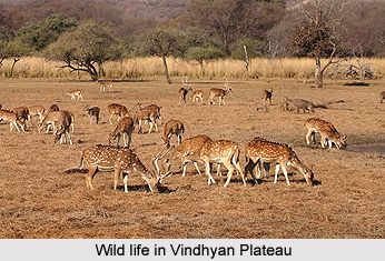
Forest in the district is included in the Rewa forest division with headquarters at Rewa. Forests are mostly mixed forests, which covers an area of nine hundred square miles in the district, extending over four ranges with headquarters at Satna, Majhgawan (both in Raghuraj Nagar tehsil) Maihar and Nagod. Common animals found in the forests are tiger (Felis tigris), panther (Felis pardus), chital (Axis axis), sambhar (Rusa unicolor), wild bear (Melursus ursinus), deer, etc.
Similar to other part of the state of Madhya Pradesh, the district of Satna receives its rainfall from the precipitation of the Arabian Sea monsoon. From the month of June to September are the months when most of the rainfall is received. The downpour, as well as the number of rainy days is more in the months of July and August. The year is more or less divided into three seasons; namely the hot season extending roughly from mid-February to mid-June; the rainy season from mid-June to September and the winter from November to mid-February. The month of October witnesses a transition from the rainy to cloudy weather.
Demography of Satna District
Satna district had a population of 2,228,619. This was revealed according to the population Census of India in 2011. Out of which the male and female were 1,156,734 and 1,071,885 respectively. The data released by Census India 2011 illustrates that density of Satna district is 297 people per sq. km.
Culture of Satna District
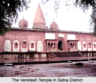
Satna district is proud to have two major religious tourist places- Chitrakoot and Maihar. Another popular place of attraction is the ancient Buddhist city of "Bharhut" (Bharhut Stupa), whose archeological remains have been gifted to the major museums in the country and the world. Tulsi Archaeological Museum at Ram Van has many unique artistic sculptures of ancient times that were found in this area. Lord Shiva Temple at Birsinghpur is also a famous and old temple in the region. Satna District has few festivals, which are part of Madhya Pradesh culture. Festivals like Kalidasa festival, Nimar Utsav, Tansen Samaroh, Lok rang festivals are the important ones.
Education of Satna District
The average literacy rate of Satna was 73.79 according to the Census 2011. The important schools and colleges of Satna District are I.T.I School, A.H. High school, Araya Kanya High School, Booti Bai School, C.M.A School, Girvan School, Government Venkat No1 High School, VIP Champion High School, Janta School, Sindhu School, Government College, Kamala Nehru College and Law College.
Economy of Satna District
The economy of the Satna District is dependent on the cement manufacturing, handloom weaving, flour, oilseed milling, and the distribution of agricultural and fabric products.
Tourism in Satna District
 Tourism in Satna district boasts up with some of the most famous temples, which attract a large number of tourists from different parts of Madhya Pradesh, and various other parts from India. This district is proud to have two major religious tourist places of Chitrakoot and Maihar.
The district of Satna is also proud to have an ancient city of Buddhist culture named `Bharhut Stupa`, whose archeological remains have been gifted to the major museums in the country and the world. The Tulsi Archeological Museum at Ram Van possesses a number of unique artistic sculptures of ancient times found in this area. The Lord Shiva Temple at Birsinghpur is also a famous and old temple in this region.
Chitrakoot Dham is one of the foremost places of pilgrimage in the district of Satna. Chitrakoot incorporates a number of places of religious and Puranic importance, visited by both devotees and sightseers. From the point of view of administration, some of these places are located in the state of Uttar Pradesh and some others in the state of Madhya Pradesh. As all these places are popularly linked with religious feelings of the people and a large number of pilgrims visit these sites. It is suitably connected by train as well as by road. It is located at a distance of about sixty kilometers from the Satna district headquarters.
Maihar is another famous place of pilgrimage in the Satna district. It is famous for Ma Sharda or Goddess Sharada or Goddess Saraswati. She is the Goddess of learning and she provides intelligence, wisdom and logic. The renowned Maa Sharda temple is located in the village Maiher of Satna district in the state of Madhya Pradesh. The place is well connected by road and rail route and the approximate distance from the Satna district headquarters is forty kilometres. This temple is situated on the Trikut Mountain at a height of six hundred feet from the ground level. There are one thousand and one stairs, which one needs to climb in order to reach the shrine.
Apart from these, the Lord Shiva temple at Birsinghpur also has a considerable importance as far as the religious places in the district are concerned. The Lord Shiva temple at Birsinghpur is one of the old temples in the region and in order to have a darshan of the Lord Shiva and to offer prayers in the famous temple of Birsinghpur, the devotees can reach by road from Satna.