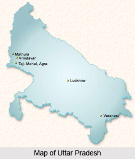
Introduction
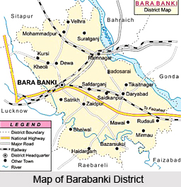
Barabanki District is an administrative district of Uttar Pradesh located in Awadh region. Barabanki District is situated about 29 kms in the east direction of Lucknow. Barabanki District lies between latitudes 26 degree 30 minutes north and 27 degree 19 minutes north and longitudes 80 degree 58 minutes east and 81 degree 55 minutes east. Barabanki District is surrounded by Faizabad District in the east, districts Gonda and Bahraich in the north east, Sitapur District in the north-west, Lucknow District in the west, district Rae Bareli in the south and district Sultanpur in the south east. Ghaghara River forms the north eastern boundary separating Barabanki from Bahraich and Gonda.
History of Barabanki District
History of Barabanki District states that there are several legends suggesting the origin of the name of this district. The most popular among them is that, due to the reincarnation of `Bhagwan Baarah` on this poise land, this place came to be known as `Baanhanya` which in course of time became Barabanki. Barabanki District was known as Dariyabad with its headquarters at Dariyabad town. It remained the district headquarter till 1858 AD. The district headquarter was shifted to Nawabganj in 1859 AD now known as Barabanki. This was done during the expansion of the district by the British, when Kursi from district Lucknow and Haidergarh from district Rae Bareli were added to it.
As the saying goes, in ancient times this district was part of the kingdom ruled by Suryavanshi kings, whose capital was Ayodhya. Further, according to the history of Barabanki District, it was under the rule of the Chandravanshi kings for a very long period. During the Mahabharata era, it was part of the `Gaurav Rajya` and this part of the land was known by the name Kurukshetra. Pandavas along with their mother Kunti had spent some time on the banks of Ghaghara River during their exile. `Parijaat` world`s unique tree, Kunteshwar Mahadev Temple on the banks of Ghaghara, Bazaar Dharam Mandi (Dhamedi), and the famous Lodheshwar Mahadeva`s Shivling, etc. are proof enough that this region had an important place even five thousand years ago during the Mahabharata period.
As per the historical documentation available, in 1030 AD this region was attacked by Sayyed Salar Masood, brother of Mahmud of Ghazni. In the same century Qutubuddin Gaha of Madina annexed the Hindu princely states. During the reign of Mughal emperor Akbar this district was dividedly under the sirkars of Awadh and Manikpur. Many kings opposed the expansion of British rule into this district by waging wars against them. During the British Raj, several kings fought for their independence. Raja Balbhadra Singh Chehlari along with about 1000 revolutionaries sacrificed their lives for independence from the British rule. The last battle of the First War of Indian Independence was fought in December 1858 AD here in this district.
In 1921 AD Gandhiji started the Non cooperation Movement, thereby igniting the flame of independence once again. Here too, the district opposed the arrival of Prince of Wales to India. During Khilafat Movement in 1922 and in 1942 the Quit India Movement, the people of this district actively participated in these movements. As a result, the District Congress office was sealed. But, the local leaders continued their protests remaining underground. Thus, Barabanki District largely contributed in the freedom movement of the country.
Geography of Barabanki District
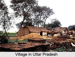
Geography of Barabanki District can be divided into three main regions. First Tarai region, the area in the north east towards Ghaghara River, second Gomti Par region, the wide area from south west to south east of the district. Third is called the Har region, which is situated at some height from the Gomti Par region. The whole tract is gently undulating land with gentle slope from the north-west to south east. The district lies in the plains of Uttar Pradesh and hence its climatic conditions are quite similar to the average climatic condition of the plains. It is very hot in summers, moderately cold during winters and quite humid and sultry during rainy season. Most of the rain occurs from June to September and often in November to January. The winter sets in November and continues till February end.
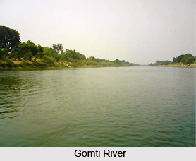
Further, the geography of Barabanki District is also characterised by river systems and water resources. The district is well fed by Ghaghara River, Gomti River and Kalyani River with their tributaries for major part of the year. Although some of them dry out during summers and create havoc during rainy season by causing floods. Ghaghara River is the most important river of the district. It, being a mountain river, is the main resource of water round the year. Ghaghara flows from the northern boundary of Barabanki District to the south east. Some portion of Tehsil Fatehpur and some portion of Tehsil Ram Sanehi Ghat are on its banks. Ghaghara forms the northern boundary separating Barabanki from Bahraich and Gonda. Gomti River is the second important river in the district; being a river with its origin in the plains itself flows, throughout the year. Gomti flows from Lucknow into this district and covers the northern part of tehsil Haidergarh and some portion of tehsil Ram Sanehi Ghat. Kalyani River is a small river of local origin. It flows through the district along with its tributaries, covering most of central portion of the district.
Geography of Barabanki District comprises huge part of the plains of the state and thus conforms to the same geological sequence as the plain itself. The soil structure of the district is composed of alluvial soil. The upper belt is called `Uparhar` and the soil texture is yellowish clay. The basin land of the rivers is mostly composed of sandy soil, and the land adjacent to the rivers is sandy loam. The only mineral resource found in the district is sand, which is available in sufficient quantity on river banks, and is used in construction works. Moreover, Barabanki District is also noted for its deposits of brick earth.
Interestingly, according to one of the sayings Barabanki District got its name due to excessive forests. However, with the passage of time, pressure of the increasing population and the need to grow more food ultimately became the reason for clearing of the majority of forest cover for cultivation. As of today, majority of the forest cover in Barabanki District is on uneven landscape and consists of a mixed variety of vegetation mainly bushes. The forests are small and scattered. The total area under forests is approximately 5308 hectares. Most of the forest cover is on the banks of the river Gomti and Kalyani.
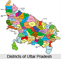
Administration of Barabanki District
Barabanki is one of the four constituent districts of Faizabad Division. Administration of Barabanki District is headed by Divisional Commissioner. Barabanki District has been divided into seven sub-divisions, popularly known as tehsils. The District Revenue Administration is headed by the District Collector, with office at the collectorate, and these tehsils are under the charge of sub-divisional Magistrates. The six tehsils are Nawabganj, Fatehpur, Ramsanehi Ghat, Haidergarh, Ram Nagar and Sirauli Ghauspur.
The district level developmental activities are coordinated by the Block Development Officers, who head each of the Development Blocks into which the district is sub-divided. Barabanki encompasses 15 development blocks. The 15 development blocks are Banki, Siddhaur, Masauli, Pure Dalai, Dewa, Nindura, Harakh, Trivediganj, Fatehpur, Ram Nagar, Haidergarh, Sirauli Ghauspur, Dariyabad, Banikodar and Suratganj. The Law and Order administration is jointly coordinated by the District Magistrate and the Superintendent of Police. The district is sub divided into 22 Police Stations. Further, Barabanki District has 14 urban administrative bodies for the administration and provision of civil amenities in towns.
Tourism in Barabanki District
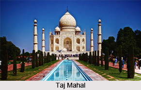
Tourism in Barabanki District offers visits to several ancient and religious sites. This district has a rich and glorious past and it is reflected through the various monuments and temples of the district. The tourist places of Barabanki District attract people from all parts of the country.
Some of the main tourist attractions of this district are mentioned below -
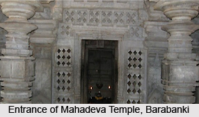
Mahadeva Temple: This ancient Shiva temple is situated at village Mahadeva in tehsil Ram Nagar of the district on the banks of Ghaghara River. This temple has ancient history associated with it. The Shivling in this temple is one of the exotic and rarest of the 52 Shivlings on the surface of earth. Huge fairs are organized on the occasion of Mahashivratri.
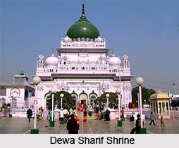
Dewa: The pilgrim town of Dewa is situated just 42 kms from Lucknow and 12 kms from the district headquarters of Barabanki in the heart of erstwhile `Awadh`. This is the birth place of Haji Waris Ali Shah.
Parijaat: Kintur village is about 38 kms east of district headquarters Barabanki was named after Kunti. There are several ancient temples around this place. There is a special tree called Parijaat in this village. There are a number of legends about this tree, which have popular acceptance. It is very true that this tree is from a very ancient background. Some botanists say that there is no such tree anywhere else in the world. There is another popular saying that, its branches do not break or dry out but shrink and disappear into the original trunk.
Siddhaur: It was initially known as Siddhpura, and as time passed by, it became Siddhaur. It is around 50 kms from district headquarter Barabanki. It is adorned by famous Siddheshwar Mahadev temple and here in the months of December and January each year a big fair is held on the occasion of Shivaratri. There is a mausoleum of Sufi Saint Qazi Qutub.
Badosarai: Badosarai around 9 kms northeast of Ram Nagar tehsil headquarters was established around 550 years. About 6 kms southeast of this place is the temple of Baba Jagjivan Das the founder of the `Satnaami` sect at Kotwa, popularly known as Kotwa Dham, with a very beautiful pond nearby.
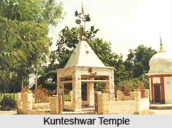
Kintur: Situated around two to three miles east of Badosarai, Kintur is named after Kunti as per the ancient sayings. Initially its name was Kuntapur. It is famous for Kunteshwar Temple, where people from all parts come and offer prayers.
Satrikh: It is said that its original name was Sapatrishi. It is the penance ground of great number of Saints and ascetics. It was the headquarters of Sayyed Salar Masood, brother of Mahmud of Ghazni. His father Salar Shah`s tomb is here and people in large numbers visit this monument.
Barabanki District since its inception has been the place for numerous saints and ascetics, sanctum sanctorum of 'Sadhna' for the literary intellectuals and battlefield for the freedom fighters.