 The state of Tripura is located in the north eastern part of India. This landlocked state is spread over an area of about 10,491 square kilometers (4,051 square miles). Its geographical terrain is characterized by hill ranges, valleys and plains and its climate is known to be tropical savanna climate. This state has palaces, temples, wildlife sanctuaries, hill station, eco parks, rock-cut carvings, stone images, etc, which have contributed in making Tripura a tourist destination of India. Lakes of Tripura are no exception in this regard. They too provide support to tourism in this state.
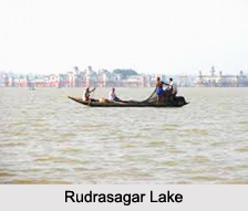
Rudrasagar Lake
Rudrasagar Lake is located in Melaghar. This lake can be defined as a natural sedimentation reservoir. It occupies a geographical area of about 2.4 square kilometers. It is fed by three perennial streams namely, Noacherra, Durlavnaraya Cherra and Kemtali Cherra. The Government of India`s Ministry of Environment and Forest has identified Rudrasagar as one of the wetlands of national importance for conservation. The endangered Baer`s Pochard and near-threatened Ferruginous Duck have been sighted at the lake site.
Dumboor Lake
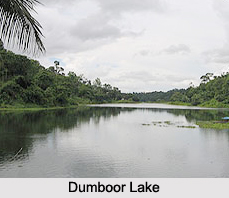 Dumboor Lake is located in Amarpur Sub Division, about 120 km away from Agartala. It has the appearance of a tabor shaped small drum and occupies an area of about 41square kilometers. In the middle of the lake there are 48 islands, lending beauty to it. This lake serves as a home to migratory birds and supports water sports.
Amarsagar Lake
Amarsagar Lake is located in the South Tripura District. This artificial lake was constructed in the 16th century. It occupies an area of about 20 hectares. A small town namely, Amarpur is located on the banks of Amarsagar. Amarpur serves as a picnic spot and is located about 78 km from Agartala.
Bijoy Sagar
Bijoy Sagar is a lake located in Udaipur. It was constructed during the intermediary period between Dhanya Manikya and Govinda Manikya"s reign. This lake has a length of about 750 feet and breadth of about 450 feet. Bijoy Sagar is utilized for bathing, washing, fishery etc. The water quality of this lake is known to be threatened by sewage and waste water through a drain located on the north-eastern side.
Kamalasagar
Built in the 15th century, Kamalasagar is an artificial lake of Tripura. King Dhanya Manikya of Tripura is credited with the establishment of this lake. This lake is utilized as a picnic spot. It is also known for a mela which is organized at the lake site during Navaratri.
Other Lakes of Tripura
Khowra Lake, Jagannath Dighi and Kalyan Sagar are the other Lakes of Tripura.


