 The state of Madhya Pradesh is located in central India. The geographical terrain of this state is characterized by a plateau streaked with the hill ranges of the Vindhyas and the Satpuras, rivers and dense forests. The natural beauty of Madhya Pradesh, along with world heritage sites, several cities, hill stations, national parks, etc. draw tourists to this state. Geographical feature called lakes also form part of Madhya Pradesh. These lakes are described below.
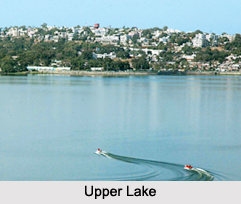
Upper Lake
Upper Lake, also known as Bhojtal is situated on the western side of Bhopal, the capital city of Madhya Pradesh. It has a catchment area of about 361 square kilometers and surface area of about 31 square kilometers. It has maximum length and width of about 31.5 km and 5 km respectively. Upper Lake functions as a drinking water source for the people living in Bhopal. An estimated amount of nearly 30 million imperial gallons (140,000 m3) of water per day is provided by this lake to about 40% of the people residing in Bhopal. The water quality of this lake is deteriorated by waste and drainage from the city.
Lower Lake
 Lower Lake or Pukhta-Pul Talao is also located in Bhopal. It has a catchment area of about 9.6 square kilometers, surface area of about 1.29 square kilometers, average depth of about 6.2 m and maximum depth of about 10.7 m. This lake is fed by seepage from Upper Lake and drainage from 28 sewage-filled nallahs. Patra rivulet forms the outlet of this lake through which its water enters the Halali River. There is a bridge separating the Lower Lake from the Upper Lake which is called "Pul Pukhta" or Lower Lake Bridge. This lake is threatened by pollution, which has rendered its water unsuitable for drinking. Upper Lake together with the Lower Lake has been declared a ramsar site for conservation and is called Bhoj Wetland.
Sakhya Sagar Lake
Sakhya Sagar Lake is located on the edge of the forests of Madhav National Park in Shivpuri District. It was established in the year 1918. There is a boat club on the shores of this lake. Marsh or mugger crocodile, Indian python and the monitor lizards are the faunal species evident here.
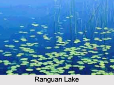
Ranguan Lake
Ranguan Lake is located at the confluence of Ken and Simri Rivers, about 20 km from Khajuraho in Chhatarpur District. This lake is open to boating and angling.
Benisagar Lake
Benisagar Lake is situated about 10 km from the town of Khajuraho. It serves as a local picnic spot and boating is a fun filled possibility on this lake.