 An estuary is a transition zone between river environments and maritime environments. More specifically, it is the tidal mouth of a large river or a partially enclosed body of water connected to the sea. It is the place where fresh and saltwater mix and river meets the sea. The word "estuary" is derived from the Latin word "aestuarium" meaning tidal inlet of the sea. Estuaries are considered to be the most productive natural habitats in the world. This is because the contents of both the sea water and fresh water deliver high levels of nutrients both in the water column and in sediment. India also has these productive habitats. The Indian Estuaries usually form at the mouth of the coastal rivers. Some of these estuaries are given below.
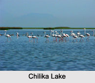
Chilika Lake
Chilika Lake can be defined as a brackish water lagoon. It is located in Puri, Khurda and Ganjam districts of the Indian state of Odisha. This lake has maximum length of about 64.3 km (40.0 mi), maximum depth of about 4.2 m (13.8 ft) and occupies an area of about 1,100 sq kms. It has the distinction of being the largest coastal lagoon in India and the second largest lagoon in the world.
Ennore Creek
Ennore Creek is located in Ennore, Chennai along the Coromandel Coast of the Bay of Bengal. This backwater is spread over an area of about 2.25 sq kms. It functions as an outlet for the excess water from the Poondi Reservoir. Being shallow near the mouth, the depth of the creek is known to vary from 1 to 2 m. Human activities have reduced the creek into patches at the fringes.
Kayamkulam Estuary
 Kayamkulam Estuary or Kayamkulam Kayal can be defined as a shallow brackish water lagoon. It is situated between Panmana and Karthikapally and is an outlet to the Arabian Sea at Kayamkulam barrage. Kayamkulam Boat Race is conducted in Kayamkulam Kayal.
St Inez Creek
St Inez Creek is located in Panjim in the Indian state of Goa. It has a length of about 3.7 kms (2 mi), surface area of about 65,750 square meters (707,700 sq ft) and an average width of about 12.6 meters (41 ft). It opens into the Mandovi River.
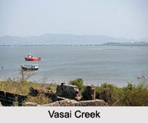
Vasai Creek
Vasai Creek is one of the two main distributaries of the Ulhas River in the Indian state of Maharashtra, the other being Thane Creek. This estuarine creek forms the northern boundary of Salsette Island and empties west into the Arabian Sea.
Panvel Creek
Panvel Creek is located close to the city of Panvel, near Mumbai. Unfortunately, debris is dumped into the creek and it is also used for dredging activity. About 1,500 hectares at Madh Island in Panvel creek near Navi Mumbai has been chosen by the Maharashtra Government and its City and Industrial Development Corporation (CIDCO) as an alternative site for a proposed international airport.
Baga Creek
Baga Creek is a tidal estuary situated near the town of Baga in the Indian state of Goa.
Other Estuaries of India
Some of the other Estuaries of India are Thekkumbhagam Estuary, Paravur Estuaries and Mahim Creek and Thane Creek.


