
 The state of Uttarakhand is located in the northern part of India. It has some of the holiest Hindu shrines, rivers, temples, monuments, forest reserves, national parks, hill stations and mountain peaks. They have not only beautified this state but have also made Uttarakhand one of the famous tourist destinations of India. Apart from the above mentioned attractions, Uttarakhand also has a number of lakes. Some of them are described below.
Sat Tal
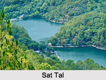
Sat Tal is a complex of seven lakes, situated in the Lower Himalayan Range near Bhimtal, a town in the Nainital district. In Hindi, Sat means seven and Tal means lake. The seven lakes forming a group are- Purna Tal, Ram Tal, Sita Tal, Laxman Tal, Nal Nal Damyanti Tal, Sukha Tal and Garud Tal. These lakes form one of the few unpolluted freshwater biomes in India.
Bhimtal Lake
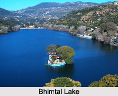
Bhimtal Lake is located in a town called Bhimtal. This lake is considered to be the largest lake in Kumaon region. It is a gravity masonry type of lake. Bhimtal Lake and the town in which it is located are named after Bhima, one of the Pandavas of the epic story of Mahabharata. It is believed that this place had been visited by Bhima.
Roopkund
 Roopkund is situated in Chamoli district. This lake is located at an altitude of about 5,029 m and provides ample scope for trekking. This shallow, glacial lake is about 2 meters deep. It has also been named the Mystery and Skeletons Lake due to the presence of human skeletons in it.
Kedartal
Kedartal or Shiva`s lake is located at an elevation of about 4,750m in the Garhwal Region of the Himalayas. Kedartal therefore provides ample scope for trekking. The source of this glacial lake is snowfall over Thalay Sagar, Meru, Bhrigupanth and other surrounding peaks. This lake in turn serves as a source of Kedar Ganga.
Naukuchia Tal
Naukuchia Tal is located at an elevation of about 1220 meters above sea level at the foothills of Kumaon Himalaya Mountains in Nainital district. It has a depth of about 175 feet. The length of the lake is near about 983 meters and its breadth has been estimated near about 693 meters.
Nainital Lake
Nainital Lake is located in Nainital district. Characteristically, it is a tectonic, freshwater, kidney shaped or crescent shaped lake. It has maximum length of about1, 432 m, maximum breath of about 457 m and surface area of about 48.76 ha.
Other Lakes in Uttarakhand
Dodital, Deoria Tal, Bhullatal Lake and Satopanth Tal are some of the other Lakes in Uttarakhand.









