
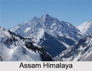
 Assam Himalaya is a traditional description for the portion of the Himalaya range between the Great Bend of the Tsangpo River to its east and the eastern border of Bhutan to the west. It is stated that the name `Assam Himalaya` is misleading because some parts of this particular range are in the south eastern Tibet, and some portion lies in the Indian state of Arunachal Pradesh. The mountains run eastward for 450 miles from the upper Tista River in the west to the great southward bend of the Brahmaputra River (there called the Tsangpo River) in the east.
Time has rendered this nomenclature outdated as the portion of this Himalayan range that is lying mainly in Bhutan is presently called Bhutan Himalaya, and the erstwhile mega-province of Assam has lost its Himalayan frontier to the state of Arunachal Pradesh. So, it is not known as Assam Himalaya any more. The Assam Himalayan range is still poorly surveyed and little visited by travellers.
Location of Assam Himalaya
Assam Himalayas are the eastern section of the Great Himalayas which is extending eastward across Sikkim and Bhutan, into northern Assam and Arunachal Pradesh and along with the border with the Tibet Autonomous Region (China).
Geography of Assam Himalaya
The major portion of Assam Himalaya is a low range by the Himalayan standards, between 5000 and 6000 metres high, and devoid of extensive mountaineering interest. There are two significant exceptions to this. Firstly, it is the Namcha Barwa section. The position and height of this `mysterious giant` was determined by British expeditions operating in the Abor and Mishmi tribal areas recently as 1912 metres.
However, its existence had been reported more than forty years earlier by the explorers. The following year it was approached and surveyed by Morshead during his exploration of the Tsangpo with Bailey. They also discovered Gyala Peri during this expedition. After a prolonged period of negligence, caused by geographical and political inaccessibility, Namcha Barwa was strongly receded by a Chinese team in the year 1983.
Notable Mountains of Assam Himalaya
Important peaks of Assam Himalaya consist of "Kula", "Chomo", and "Kangto". The highest is "Namjagbarwa" 25,445 feet in Tibet. The "Subansiri", "Manas", "Sankosh", "Raidak", and "Jaldhaka" rivers rise in the mountains and flow southward to join the Brahmaputra River.









