 The state of Punjab is located in the northern part of India. This state is beautified by rivers, historical palaces, ancient forts, architectural monuments, lakes, gurdwaras, museums etc. These spots along with places like Patiala, Chandigarh, Sri Anandpur Sahib, etc have made Punjab one of the famous tourist destinations of India. To reach Punjab, international as well as domestic airports have been established in the state.
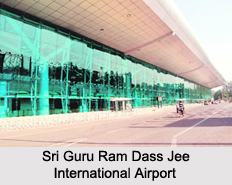
Sri Guru Ram Dass Jee International Airport
Sri Guru Ram Dass Jee International Airport is located about 11 kilometers northwest of the city of Amritsar. This public airport is operated by Airports Authority of India. The integrated terminal building of the airport can accommodate 1.46 million passengers, annually. Extension of its apron has been brought about in order to park a total of 14 aircrafts.
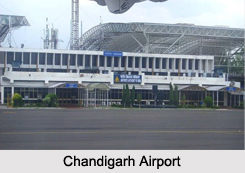
Chandigarh Airport
Chandigarh Airport is located in Mohali. This military and civil airport is operated by the Chandigarh International Airport Limited, Airports Authority of India and Indian Air Force. Its new terminal is eco-friendly and its runway 11/29 which has a length of about 2,700 m is equipped with a CAT 1 ILS system.
Sahnewal Airport
Sahnewal Airport is situated near the town of Sahnewal, about 5 km southeast of Ludhiana on the Grand Trunk Road. This public airport is a government property. It occupies more than 130 acres of land. The halls of the airport for arrival and departure have been designed to handle about 40 passengers.
Pathankot Airport
Pathankot Airport is located on the Pathankot - Majra Road, about 3 km from the nearest city, Pathankot and 7 km from Pathankot Railway Station. This civil airport is owned by the Government of India and operated by the Airport Authority of India. It occupies approximately 75 acres of land.
Bathinda Airport
Bathinda Airport is located near Virk Kalan village, about 20 kilometers northwest of Bhatinda. This civil enclave at the Bhisiana Air Force Station is owned by the Indian Air Force and operated by Airports Authority of India. It was inaugurated on 11th of December, 2016. The terminal building of this airport is made up of glass and steel. Its apron has been designed in a way so that two ATR 42 types of aircrafts can simultaneously be accommodated in it.
Adampur Air Force Base
Adampur Air Force Base is located in Adampur. This military airport is operated by the Indian Air Force. It has the distinction of being is the second largest military airbase of India.
Patiala Airport
Patiala Airport is situated in Patiala. This civil aerodrome is owned by the Government of Punjab.