Introduction
Bharatpur district in Rajasthan is famous for its historical fort and palaces like the Lohagarh fort, Fateh Burj and Jawahar Burj. This district in Rajasthan is also well known for its bird sanctuaries. The history of Bharatpur traces the rise and fall of the Jats in the eastern part of Rajasthan. Under rulers like Badan Singh and Suraj Mai the Jats were active during the late 17th century and served as one of their main centers. The present day Bharatpur has in total 9 Sub Division and ten Tehsils. There are more than 1500 villages which are inhabited.

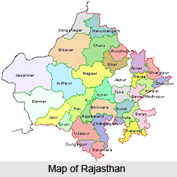
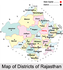
Location of Bharatpur District
Bharatpur is situated 100 metres above sea-level, between the north latitudes of 26 degrees 22 minutes and 27 degrees 83 minutes and the east longitudes of 76 degrees 53 minutes and 78 degrees 17 minutes.
History of Bharatpur District
The `Eastern Gateway of Rajasthan`, was founded by Suraj Mai in 1733AD. Suraj Mai`s first exploit was the capture of Fatehpur fortress (modern day Bharatpur). According to legends, Suraj Mai was blessed by a Naga hermit and, thus, constructed the magnificent fort of Bharatpur in the region formerly known as Mewat. .The untutored genius turned Fatehpur, a small mud-fort into a courage, shrewdness, dogged perseverance and an indomitable never-say-die spirit that would never accept defeat.

The place was named Bharatpur after Bharat, the brother of the Hindu mythological Lord Rama. The interesting part of the Bharatpur history is the dominion of Jats in the region since 17th century. They were the first Hindu people with whom the Arabs came into contact and all Hindus were known to the Arabs by the name Jat. The Jats were brought under the same roof and moulded into a force by leaders like Churaman and Badan singh. The Jats cast the final stone bringing about the downfall of the proud and dreaded colossus of Hindustan-the Grand Mughals defeat.
Geography of Bharatpur District
Geography of Bharatpur district is determined by its location in the state of Rajasthan.
Extension of Bharatpur
The northern border of the district touches the Rewari and Gurgaon district of Haryana, the eastern border touches the Mathura district, the Southern border touches the Agra district in the state of Uttar Pradesh and the Dholpur district of Rajasthan. It touches Dausa district in the South-west and Alwar district in the North-west. The district covers a total area of 5,066 Sq. Kms.
Rivers of Bharatpur
There are three main seasonal rivers in the district- Ban Ganga River, Rooparel and Gambhir River. The Ban Ganga starts from Ramgarh Dam of Jaipur district, passes from Bharatpur and meets in the River Gambhir near tehsil Bayana of Bharatpur district. Gambhir River starts from the Pachana Dam of Karoli district and after passing from Bharatpur meets Yamuna River in Uttar Pradesh. Rooparel River starts from the hills of Alwar district, and enters into Bharatpur from tehsil Kaman. Instead of this a Dam Bandh Baaretha is made near the village Baaretha on river Kakund which starts from the hills of the Karoli district. The water of this dam is used for drinking and irrigation purposes of the district. The capacity of this dam is 684.00 million cusses. Main minerals of the district are silica sand, sand, stone etc.
Culture of Bharatpur District
Bharatpur is referred to as the land of kings; therefore cuisine preparation was very important here. Bharatpur cuisine is highly influenced by the availability of raw material and war-like lifestyle of native inhabitants. The rise of the hotel industry invites visitors coming here. Indian, Continental and regional food of Rajasthan are popular among the visitors. The must have items of Rajasthani food is Dal Bati Churma. Sweets are an integral part of food here, which is served before the starting of food. There are various festivals celebrated in Bharatpur. Brij is celebrated in the month of February and March and Ras Leela is performed during this time. Jaswant Exhibition is being held every year during Dussehra. Gangaur Festival is celebrated in the month of March and April by married women dedicated to Gauri, the incarnation of Goddess Parvati. Teej is celebrated during July and August when the monsoons begin.

Bharatpur is the city of the migrants. Except indigenous groups like Tharus, Darai, Kumals and Chepangs, most people have emigrated from different parts of the country. Migration became easy after the eradication of Malaria. The Rapti Valley Development Project, in the sixties, promoted another surge of migration by distributing land. Due to the intermingling of culture there are varieties of castes and ethnic groups which dwell in the municipality. Among them, the Brahmins, Chhetries, Newars, Magars, Tamangs and Gurungs are major ethnic groups. In the downtown of municipality, Newar is the dominant caste. Indigenous tribes such as Chepangs, Tharus, Darais and Kumals can be found in the fringes of the municipality.
Economy of Bharatpur District
Economy of Bharatpur district is dependant to a large extent on agriculture. A variety of crops are produced here. Among the main crops grown here are millets, maize, wheat, barley and rice, and oilseeds like sesame, mustard, groundnut and tarameera. The major commercial crops grown in the district are cotton, sugarcane, tobacco, red chillies and potato.

Bharatpur district is known not only for agriculture production but for oil industries also. Mustard seeds and other agriculture products come to the market through mandies established by Krishi Upaj Mandi Samiti. These Krishi Upaj Mandies are in Bharatpur, Nadbai, Wair, Deeg, Kaman, Bayana, Roopwas and Bhusawar. In year 1999-2000 four new oil industrial units were set up with a total investment of Rs.570.84 lakhs. In terms of major oil industrial units Bharatpur has 50 units, Nadbai has 7, Deeg 2, Kumher, Jurhera and Bayana have one each. Rs. 1233.92 lakhs were invested in all these units. The total manpower of these units is 1600.
As regards the industrial scenario, the district of Bharatpur has been divided into five industrial areas. These are:
1. Old Industrial area
A total area of 175.66 akad land has been allotted to this industrial area. Out of this, 157 plots have been developed on 122 akad land, and 155 plots have been distributed among the entrepreneurs.
2. Brij Industrial Area
233.06 akad land has been allotted to this industrial area, out of which on 158.84 akad land 259 plots have been developed and 187 plots have been distributed to the entrepreneurs.
3. Industrial Area Bayana
53.22 akad land has been allotted to this industrial area, out of which on 32.56 akad land 107 plots have been developed and all plots have been distributed to the entrepreneurs.

4. Industrial Area Deeg
39.08 akad lands has been allotted to this industrial area, out of which on 21.20 akad land 89 plots have been developed and 87 plots have been distributed to the entrepreneurs.
5. Industrial Area Jurhera
40 akad land has been allotted to this industrial area, out of which on 25.30 akad land 54 plots have been developed and 31 plots have been distributed to the entrepreneurs.
People of Bharatpur District
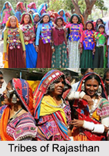
The Indian census of 2001 reads that the total population of Bharatpur district in Rajasthan, is 2, 04,560. Of this the percentage of males and females are 54 and 46 respectively and 15% of the population is below the age of 6years. The average literacy rate of Bharatpur is 66%, which is higher than the national average of 59.5%. The male literacy rate is much higher than the female literacy rate. Bhusawar serves both as a city and a municipality in Bharatpur district. The Jats and the Gujjars are the main agricultural communities which constitute the population of Bharatpur district. The region also comprises aboriginal people like the Banjaras, who are mainly artisans and tradesmen and live a nomadic life; the Minas (Mewatis) and the Gadia Lohars. The latter are another wandering tribe, who are engaged in the occupation of repairing household agricultural and implements.

The Jats have been the main inhabitants of the district of Bharatpur since their win over the Mughals in the late 17th century. The Jats represent a type, which is close to the traditional Aryan colonists of India. Their stature is usually tall, complexion fair, eyes dark, with plentiful of facial hair, a long head and a prominent nose. The Jat is still in the tribal stage of social evolution, knowing no rigid caste distinction. The language in this north eastern part of Rajasthan is predominantly Mewati, and Hindi is used as the official state language. English is also a commonly spoken language. The most popular religion that is practiced in the district of Bharatpur is Hinduism and it involves the worship of Lord Shiva , Lord Vishnu, Brahma and other gods and goddesses. The important religious centre for the Lord Krishna followers is Nathdwara. Arya Samaj has also attracted many followers with its reformed view on modern Hinduism. Jainism has recently gained popularity among the higher echelon of society. Islam ranks second to Hinduism and there has also been a considerable increase in the numbers of followers of Sikhism.
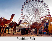
The culture of Bharatpur is quite fascinating. Men wear colourful clothes and women prefer heavy jewelleries. The festivals are celebrated with great pomp and show. The Brij festival is scheduled a few days before Holi and is celebrated in honour of lord Krishna. The villagers marked in hued clothes are seen performing the Raslila, a dance which celebrates the immortal love story of Radha and Krishna. On the eve of holi, the whole of Bharatpur comes to life all over again in the sound of folk melodies. Everyone including the young and old, rich and poor, grace the occasion with their lively participation. They take delight in splashing colours on each other. It is also a period of fun and frolic for the villagers and gives them a respite from their busy lives. Even the animals are decorated with great care. Besides this at Pushkar fair the piercing of camel"s nose is an important ritual. Camel race and camel beauty contests are spectacles to behold. It is believed that during this fair at Pushkar, all the gods visit here and bless the devotee.
People in the Bharatpur district are free to follow occupation of their choice, irrespective of their caste. The Jats mainly depend on agriculture for their livelihood. Due to scarcity of rainfall the growth of vegetables is not very favourable and so there is an increase in the cultivation of pulses, mainly, moong, moth and gram. Bharatpur district is well known for oil industries which provide employment to the people. There are 50 major oil industrial units in Bharatpur district. Minerals like silica sand, sand stone and masonry stone yield a huge income and contribute to the economy. The people of Bharatpur are known for their experimentation with food. The ethnic cuisine involves use of ghee in cooking. Dalia, which is prepared with broken wheat sautéed in ghee and sweetened, is a popular dish in this region. The dressing habits of the people of Bharatpur district is greatly influenced by the climate, economic status, and profession. The Hindu men wear traditional dresses like dhoti, dhabla, banda and khol and for the women it is saris, lehenga choli with a dupatta or patka. Muslim men and women wear achkans and burkhas respectively.
Tourism in Bharatpur District
The kingdom of Bharatpur was founded by Suraj Mai, the greatest ruler of the Jats, in the 18th century and till date it continues to fascinate the viewer with its splendid art and architecture. Though it has a mythological connection but Bharatpur has little to offer as a religious place. At present Bharatpur is also referred to as the "eastern gateway to Rajasthan" and is one of the most visited destinations in the country because of its famous forts and palaces and the renowned bird sanctuary.

Nature Tourism In Bharatpur District
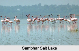
Bharatpur district is most admired for its bird sanctuary at the Keoladeo Ghana national park. It is listed as a world heritage site by the UNESCO. It is the paradise of the bird lovers and has more than 375 species of beautiful birds like the purple and grey heron, white ibis, spoonbill and night herons among others. Rare species of Siberian cranes come every year to spend the winter in the warmer climate of Bharatpur district. The animals that includes black buck, spotted dear and nilgais also make their presence felt. The area may be very small but Keoladeo Ghana national park is undoubtedly a bird lover's delight.
Leisure Tourism In Bharatpur District
Bharatpur district has a royal past and the forts and palaces are a storehouse of ancient exhibit that is almost six hundred years old. The architecture of Bharatpur district invites scholars and history lovers and even for simple tourist these forts and palaces are of immense delight. The Lohagarh fort also known as the iron fort is of great historical significance. It stood firmly in front of multiple British attacks. The chief monuments of this fort are Mahal Khas, Moti Mahal and Kishori Mahal. The Palace of Bharatpur district is an amalgamation of Rajput and Mughal architecture.
Monuments in Bharatpur District
Bharatpur kingdom under Suraj Mai, the great ruler of Bharatpur, witnessed the construction of several forts and palaces. The monuments of Bharatpur display profound influence of the architecture of the Rajputs and Mughals who were the contemporary of the Jats.
The most interesting part of the history of Bharatpur district is the authority of the Jats over this region during the late medieval times in the 17th century. Leaders like Churaman and Badan Singh consolidated the Jat Empire which was further strengthened under Suraj Mai, the son of Badan Singh. Suraj Mai was a connoisseur of art and architecture and had put the resources of his kingdom into good use by building several monuments in the kingdom of Bharatpur.
The Lohagarh fort is the most distinguishable monument of Bharatpur district. It is also referred to as the iron fort and was founded and designed by Suraj Mai, the ruler of Bharatpur, in 18th century A.D. It took nearly twenty years for the fort to be completed. The name suggests the invincible nature of the fort. It stood firmly in face of repeated attacks by the British. More than splendour or lavishness, it is the air of magnificence and might that is associated with it. The Lohagarh fort of Bharatpur district is one of the best architectural monuments in Rajasthan. There are two gates in the fort, the one facing the north is called the Ashtdhaatu that is eight metalled gate. It is decorated with paintings of elephants. The gate in the south is known as Chowburja or the four pillared gate.
There are also some enthralling towers and monuments inside the Lohagarh fort. The tower Jawahar Burj was erected to celebrate the triumph of the Jats over the Mughals and the Fateh burj tower marked the defeat of the British army in the year 1803 A.D. The monuments like the Kishori Mahal, Mahal khas, Kothi khas and Moti Mahal inside the Lohagarh fort adds to its grandeur.
The Lohagarh fort in Bharatpur district at present has been transformed into an extensive museum. Articles like swords, daggers and guns and antiques like hunted tigers, bear kids, wood articles, vessels, jewellery boxes and ornaments have been put into display for tourists. There are also some inscriptions and historical pieces that are exhibited. The Lohagarh fort is breathing evidence to the gallantry and courage of the Jat rulers of Bharatpur.
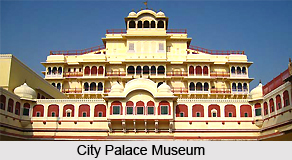
Another monument of Bharatpur is its palace. The Bharatpur Palace is next to Lohagarh fort in terms of magnificence and elegance. It is a medieval monument in the old city of Bharatpur in Rajasthan. It was built at different phases by different Jat maharajas of Bharatpur. The royal palace is a radiant combination of Rajput and Mughal architecture. The splendid apartments have beautiful carvings and are embedded with marvelously designed floor tiles. It gives us a vivid idea of the royal lifestyle of the Jat rulers.
Bharatpur palace houses a museum which has a collection of antique that dates back to 2nd century. These specimens provide important historical evidence of the ancient culture of the region. The palace is located near to the museum and is within easy reach of the tourists. The designer floor tiles and the stylish furnishings are all reflective of the grace and splendour of the majestic lifestyle of the Jats.

Besides these monuments, the Bayana town of Bharatpur district is also a store house of many historical monuments. The chief attraction is the Old fort which has an interesting blend of Hindu and Muslim relics. Only the outer walls and the huge watch tower stand firmly but the rest of the complex is in ruins. The Barah Khamboh Ki Chhatri and the Lodi Minar are also exiting monuments that speak volumes of its past glory. The Deeg palace located in Bharatpur district is related to the Jat rule in the 18th century. The mansions are referred to as the Bhawans like the Gopal Bhawan, Kishan Bhawan, Nand Bhawan, etc represent the architecture of Deeg, which to a great extent is influenced by the Mughal architecture. The colossal image of Yaksha at Noh, the Lal Mahal at Rupvaa, and the Ancient mound at Malah in Bharatpur district are among the other monuments which are distinguished for their artistic splendour and historic glory.
Places Around Bharatpur District
The places around Bharatpur are also popular amongst the travelers. Alwar is one of the historical districts, which the travelers can visit. The excursion tours from Bharatpur comprise of Deeg town, Deeg Fort, Bengal Chambers, Gopal Bhavan and others. Transportation is easily available for such tours.
Deeg: It is located at a distance of 34 kilometers north of Bharatpur. It is a charming garden town in Rajasthan. The fountains placed in the gardens make the town look striking. Once upon a time it was the summer retreat of the princes of Bharatpur. Deeg is primarily an agricultural town with a host of palaces and gardens.
Gopal Bhavan: This was built in 1760 and is one of the popular tourist attractions in Deeg. This too flaunts a beautifully laid garden. Gopal Bhavan is located beside the Gopal Sagar. In front of the main garden a raised terrace has been built. A marble arch had been constructed on the high pedestal in the shape of a swing. It was the place to repose for the kings and queens. this beautifully carved swing was the war reward of Jat King Raja Suraj Mal. this was brought from the Mughal court.
Another attraction within the bhavan is the banquet hall. Two rows of pillars, souvenirs, curios and Victorian paintings add beauty to the hall. Another room in the building has marble bed that is black in color. Though the artifact is centuries old yet it looks gorgeous. This too had been brought from Delhi.
Bengal Chamber: The royal chess room and the dining rooms are located here. Sporting a trellis design and painted in red they look amazing. The seating area of the dining room is furnished with cushions.
Deeg Fort: This fort was built by Raja Duraj Mal. the inaccessible fort is surrounded by moats, gateways and ramparts. Today, however, most part of it is in ruins. The watchtower has survived the ravages of time and still stands tall keeping a watch over the city of Deeg. The cannons in the fort are worth checking out. One of these was captured from Ahmad Shah Abdali in 1761. As the tourists explore different parts of the fort they will come across several interesting tales.
Dhaulpur: It is a significant historical city as it bears witness to several important battles. The red sandstone here is quite famous. It had been plundered many times. There are beautiful gardens, tombs, lakes and temples. Although it is considered a humble village yet its historical value make sit a place worth visiting.
Visiting Information
Bharatpur is accessible by road from Agra (55 km. or 34 miles) and Jaipur (185 km. or 115miles). It is 1,207 km. (750 miles) from Mumbai on the broad-gauge line of the Western Railway. All important places of Bharatpur are connected by roads. In the district, total length of roads is 1994.4 km. In the district 317 village panchayat and 911 villages are connected by roads.
How To Reach:
By Road: It is fifty-five km journey from Agra by road to Bharatpur district. It is also well connected with Delhi, Mathura and Jaipur from with the distance of 184, 39, 176 km respectively. Regular bus service is available for all the major cities.
By Air: Agra is the nearest airport to Bharatpur district at a distance of fifty five km. There are daily flights for Delhi, Varanasi, Lucknow and Mumbai.
By Rail: Bharatpur district lies on the main Delhi- Bombay line with regular connection to Mathura, Kota and Sawai Madhopur on the same route. It is also well connected with Agra.
Accommodation in Bharatpur District
Bharatpur in Rajasthan receives numerous tourists each year. Rajasthan has always been predominantly ruled by the Rajputs. Bharatpur is a little different in this respect, as here diverse clans have ruled. Mughals, Rajputs, Jats and finally the British. Hence an amalgamation of several cultures will catch the traveler`s attention. People from across the world come to Bharatpur. To cater to a varied crowd numerous accommodations have mushroomed in the district. The important places of interest Bharatpur include Wiir fort, Lohargarh Fort, Keoladeo Ghana National Park, Kumher fort and others.

The accommodations in Bharatpur are classified into heritage hotels, luxury hotels and budget hotels. The services in these hotels are quite impressive. Since districts are dependent a lot on tourism the best of the services are offered to the travelers. The heritage hotels in Bharatpur comprise of Chandra Mahal Haveli and Laxmi Vilas Palace Hotel. Undoubtedly the hotel amenities are outstanding. These hotels were once upon a time royal palaces and forts. Staying here will make the guests feel like Rajput kings and queens. In case one is looking for holidays in the lap of exquisite luxury then these accommodations in Bharatpur will be perfect.
The locations of almost all the hotels in Bharatpur are in favorable places. While some are located near the city center the others will help the tourists to reach the historic sites easily. The luxury hotels at Bharatpur are Kadamb Kunj, Udai Vilas Palace and The Bagh Resort. Most of these hotels organize sightseeing tours for the tourists. Excursions from Bharatpur are also arranged for. If the travelers want to keep a check on their pockets then they can always opt for the budget hotels.
Though there is a difference in the price range but the services are world class. These hotels are tastefully decorated. The list of accommodation in Bharatpur include:-
• Park Regency
• Bharatpur Forest Lodge
• Swaraj Resorts
• Birder`s Inn
• Crane Crib
• Hotel Eagles Nest
• Park Palace Hotel
• Pratap Palace Hotel
• Saras Hotel
• Sangam Hotel
• Shanti Kutir
• The Park
• Alora Motel
• Hotel Pelican
• Sun Bird Hotel