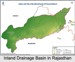
 Inland Drainage Basin Rivers are those Indian rivers which journey towards the interior parts India. A drainage basin is the catchment area of the river or a land area which accumulates water from rain or snow melt and drains downhill into a river, lake, reservoir, sea or ocean. The drainage basin acts like a funnel, collecting all the water within the area covered by the basin and channeling it into a waterway. Inland drainage basin is formed by rivers pouring their waters in a lake or an inland sea. Indian water bodies comprise of rivers like Himalayan Rivers, Deccan Rivers and Coastal Rivers. Most of the rivers enter the Bay of Bengal, while some rivers enter the Arabian Sea. Inland Drainage Basin Rivers do not enter a sea or ocean. They are present in different parts of India. The rivers located in north and south India are given below.
Ghaggar River
 Ghaggar River depends on monsoon rains to flow. It starts its journey from the Indian village of Dagshai in the Shivalik Hills of Himachal Pradesh at an elevation of about 1,927 meters above mean sea level. This intermittent river then flows through the Indian states of Punjab and Haryana into Rajasthan.
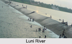
Luni River
Luni River is located in western Rajasthan. This river starts its journey from the Pushkar valley of the Aravalli Mountain Range, near Ajmer at a height of about 550m. It moves through the southeastern part of the Thar Desert and disappears in the marshy lands of Rann of Kutch in Gujarat. 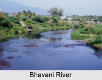
Musi River
Musi River is a tributary of Krishna River in the Deccan Plateau. It starts its journey from the Anantagiri Hills near Vikarabad in Ranga Reddy district in Telangana. The river moves through Telangana. For almost the entire length of its journey, the river moves due east. After traversing for a distance of about 240 km, the river meets the Krishna River at Vadapally in Nalgonda district in Telangana.
Bhavani River
Bhavani River in the Kongu Nadu region of Tamil Nadu is the state"s second longest river. This river starts its journey from the Nilgiri Hills of the Western Ghats Mountain Range in India. This perennial river traverses through the Silent Valley National Park in Kerala and journeys back towards Tamil Nadu.
Significance of Inland Drainage Basin in India
Inland Drainage Basin in India plays an important role in the hydrology of the country. It can become a logical unit for studying the movement of water within the hydrological cycle. Inland Drainage Basins are also considered to be important elements in ecology. When water flows over the ground and along the rivers it picks up nutrients, sediment and pollutants. These minerals get transported towards the outlet of the basin and affect the ecological processes. Moreover, these drainage basins are historically important too. They help in determining boundaries and enhance Indian trade through water.


