
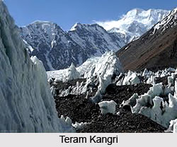
 The Teram Kangri is a group of mountain peaks. This group of peaks is located in the remote Siachen Muztagh, which is recognized as a sub range of the Karakoram Range. Siachen Muztagh is recognized as the parent range of Teram Kangri. The different peaks of Teram Kangri are Teram Kangri I, Teram Kangri II and Teram Kangri III. Globally, Teram Kangri can be pinpointed at coordinates 35 degrees 34 minutes 48 seconds north and 77 degrees 04 minutes 42 seconds east. These peaks are known to be controlled by India and China and are claimed by Pakistan. These peaks provide a beautiful view of the snow clad mountains.
Teram Kangri I
Teram Kangri I is the peak which is located on the boundary between China and the disputed Siachen Glacier region. More specifically, it is situated near the line of control (LOC) between India and Pakistan. The northeast side of the peak is in the Chinese-controlled territory and the southwest side is in the disputed Siachen area, currently controlled by India. The highest in the group of Teram Kangri Peaks is Teram Kangri I, which has a height of about 7,462 meters (24,482 feet) above mean sea level. The first ascent on Teram Kangri I was made on August 10, 1975, by a group of Japanese people. The leader of this Japanese expedition was a person named H. Katayama. This expedition received permission for the ascent from the Government of Pakistan. The Japanese people took the lengthier route via the Bilafond La (the Saltoro Pass), ascended the South West Ridge of Teram Kangri II and then took the East Ridge on their way to the summit of the mountain. Teram Kangri II was climbed on 12th and 13th of August by six Japanese climbers.
Teram Kangri II
Teram Kangri II has an elevation of about 7,407 m. It was ascended in the year1978. It was an expedition comprising members of the Indian Army to the mountain top. The leader of this expedition was Colonel Narendra Kumar. This expedition was first such attempt made by India in order to claim the Siachen Glacier area.
Teram Kangri III
Teram Kangri III has an elevation of about 7,382 m. It was first climbed in the year 1979 by the members of a Japanese expedition. This expedition was led by a person named S. Hanada. They also took the lengthier route via the Bilafond La (the Saltoro Pass) similar to the first ascent on Teram Kangri I.
Related Articles
Mountain Peaks of India
Indian Mountains
Himalayan Mountain Range, Indian Mountains
Gangotri group of mountains, Uttarakhand









