
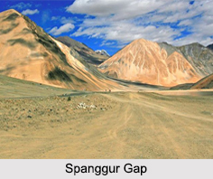
 Situated at an altitude of almost 4, 350 m, the Spanggur Gap is located to the east of the Spanggur Lake in western Tibet and to the south of the Pangong Lake. The Spanggur Gap is a part of the Himalayan Mountain Range and is known to be an international high mountain pass on the Line of Actual Control between India and China.
During the Indo- China conflict of 1962, there were Indian posts in the Spanggur Gap but the Indian Army later withdrew their forces from here in order to bolster defences of the nearby Indian village of Chushul.
This article is a stub. You can enrich by adding more information to it. Send your Write Up to content@indianetzone.com









