
 Kaimur District is one of the administrative districts of Bihar. Bhabua is the district headquarters. Kaimur District covers an area of about 340447 hectares. Kaimur District is bounded by Buxar District of Bihar and Ghazipur of Uttar Pradesh in the north, by Garhwa District of Jharkhand in the south and by Chandauli District and Mirzapur District of Uttar Pradesh in the west and by Rohtas District in the east. Administration of Kaimur District includes 14 police stations. This district consists of two sub-divisions, namely Bhabua and Mohania. Kaimur District has 11 Community Development Blocks and one town (Census Town) with district headquarters at Bhabua. According to the Census report of 2001, total population of Kaimur District is 1289074, out of which rural population is 1247299 and urban population is 41775. Population density of the district is 383.3 per km.
Kaimur District
Kaimur District is an administrative district of Bihar with its headquarters located at Bhabua. Kaimur District is inadequately industrialized and economy of this district is dependent of agriculture.
Introduction
Kaimur District is one of the administrative districts of Bihar. Bhabua is the district headquarters. Kaimur District covers an area of about 340447 hectares. Kaimur District is bounded by Buxar District of Bihar and Ghazipur of Uttar Pradesh in the north, by Garhwa District of Jharkhand in the south and by Chandauli District and Mirzapur District of Uttar Pradesh in the west and by Rohtas District in the east. Administration of Kaimur District includes 14 police stations. This district consists of two sub-divisions, namely Bhabua and Mohania. Kaimur District has 11 Community Development Blocks and one town (Census Town) with district headquarters at Bhabua. According to the Census report of 2001, total population of Kaimur District is 1289074, out of which rural population is 1247299 and urban population is 41775. Population density of the district is 383.3 per km.History of Kaimur District
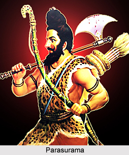 History of Kaimur District in Bihar is old and interesting. In pre-historic days, the plateau region of the district has been the abode of the aboriginals whose chief representatives now are Bhar, Chero tribe and the Savers. According to some legends, Kharwar Tribes were the original settlers in the hilly tracts of Rohtas District. The Oraon Tribe also claim that they ruled over the stretch falling between Rohtas and Patna. One local legend also connects Sasaram the present headquarters of Rohtas with king Sahasrarjun, who was killed by Saint Parshurama in a fight.
Early History of Kaimur District : According to the history of Kaimur District, this district formed part of Magadha Empire until 5th century AD, under the Maurya Empire and Gupta rulers of Magadha. In 7th century AD, Kaimur District came under the control of Harshavardhana, the ruler of Kannauj. An inscription in the Mundeshwari temple near Bhabua refers to the king Uday Sena as the ruling chief of the area. The area of this district successively came under the rulers of Shail dynasty of central India and Pala dynasty of Bengal.
Medieval History of Kaimur District : According to some Indian historians, the first ruler of Pala dynasty, Gopala controlled this region. Later on Chandauli controlled Varanasi-Chandawali and Kaimur District in the 12th century AD, as confirmed by the Tarachandi inscription near Sasaram. After the decline of the Gupta Empire, the district in all probability relapsed into the hands of the aboriginal tribes and came under the control of petty chieftains. The Rajputs who came from Ujjain and the province of Malwa Plateau had a series of conflicts with the aboriginals and it took them many hundred years to subdue the aboriginal completely. The Census report of 1961 describes that when Bakhtiar Khiliji attacked Bihar in 1193 AD, he found Shahabad in the hands of some Rajput chiefs often fighting among themselves. They were not united and strong enough to offer powerful resistance to the Muslim invaders. Hence, Bakhtiyar Khiliji had an easy victory over them and the district soon became a part of his kingdom. Later it was annexed, along with the rest of Bihar, to the kingdom of Jaunpur. A hundred year later, it passed under the direct control of Muslim empire of Delhi. In 1537, old Shahabad District witnessed advancement of Humayun and his subsequent conflict with Sher Shah Suri at Chausa known as Battle of Chausa. Later the district of Shahabad (which included Kaimur district also) was included in Akbar`s empire.
Modern History of Kaimur District : In 1764, old Shahabad district witnessed conflict for supremacy and the British rulers took over the area after defeating Mir Qasim, in the battle of Buxar. Lastly, the historic Sepoy mutiny had its impact in the district. Much after independence, in the year 1972 Rohtas District was formed out of the old Shahabad District and in the year 1991 Kaimur District was formed out of Rohtas District.
Geography of Kaimur District
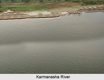 Geography of Kaimur District in Bihar can be distinguished into two parts - Hilly area and Plain area. The hilly area comprises of Kaimur plateau. The Karmanasha River and the Durgawati River flank the plain area on the western side. Kudra River lies on its eastern side.
Location of Kaimur District : Originating from the Kaimur range, the river Karmanasha passes through Mirzapur District of Uttar Pradesh and forms the western boundary of the district. River Kudra, which forms eastern boundary separating Rohtas District, is a branch of river Dhoba. River Durgawati originates from Kaimur hills and flows in the northern direction of the district. The Kudra River joins it before it merges finally into the Karmanasha River.
Demography of Kaimur District
According to the Census in 2011, Kaimur District had the total population of 1,626,900. Out of which the males and females were 847,784 and 779,116 respectively. The population of this district constituted 1.57 percent of total population of Kaimur District. The average literacy rate of Kaimur district in 2011 was 71.01 percent compared to 55.09 percent of 2001. The total literates in Kaimur District were 948,105 of which male and female were 568,197 and 379,908 respectively.
Climate of Kaimur District
The climate of Kaimur District is of extreme nature, which means it is very hot during the summer and somewhat cold during the winter season. January is the coldest month. At this time, the mean minimum temperature is approximately 4 degree Celsius. Temperature is at its peak in the month of May when the mercury reaches around 45 degree Celsius. Rain starts sometime in mid June and lasts till mid September. The district gets easterly winds from June to September, and from October to May wind direction reverses. It receives maximum rainfall in the months of July and August. Sometimes winter rains occur in January.
Agriculture of Kaimur District
The alluvial plain of this district extending up to the foothills of Kaimur ranges is extensively cultivated. Rice, Paddy, Wheat, Barley and Maize are the main cereal crops of the district. Among pulses, gram occupies the maximum area of cultivation. Sugarcane and potatoes are the main cash crops of the district. Out of the total geographical area of the Kaimur District 31.22 percent is covered by the forests, mainly in Adhaura, Chainpur and Bhagwanpur blocks. Durgawati and the Karmanasha rivers are the perennial sources of surface water. The southern part of Kaimur District has a number of canal systems such as Durgawati Main Canal, Garachaube canal, etc. In the hilly tracts of Adhaura, Chainpur and Bhagwanpur blocks, only ditches and ponds are used to conserve rainwater. New techniques of water conservation and harvesting practices are needed in plain as well as these hilly areas of the district to utilize rainwater.
Natural Vegetation of Kaimur District : The plateau is generally covered with long grasses. Sal trees of poor quality and vast stretches of bamboo are also found. Timber, Bamboo, Firewood, Chironji, and Kendu trees are the main forest produce while the minor produce consists of honey, and fodder grass. The number of fauna has gone down considerably with the increase in the area of cultivation due to increase in irrigation facilities.
Natural Vegetation of Kaimur District : The plateau is generally covered with long grasses. Sal trees of poor quality and vast stretches of bamboo are also found. Timber, Bamboo, Firewood, Chironji, and Kendu trees are the main forest produce while the minor produce consists of honey, and fodder grass. The number of fauna has gone down considerably with the increase in the area of cultivation due to increase in irrigation facilities.
Tourism in Kaimur District
 Tourism in Kaimur District in Bihar includes visits to places of religious, historical and archaeological importance. These tourist spots of the district attract people from all parts of the country. Some of the tourist attractions of this place are -
Adhaura: It is situated at a height of 2000 feet from the sea level on Kaimur plateau at a distance of 58 kms from Bhabua. Hills and surrounding forest make it an ideal tourist spot.
Baidyanath: Baidyanath village is situated at nine kilometres south of Ramgarh block headquarters. A Shiva temple built by the Pratihara dynasty is located here. Coins and valuables of historical importance have been unearthed here.
Bhagwanpur: Bhagwanpur is situated 11 kms south of Bhabua near the Kaimur hills. It was confiscated by Sher Shah Suri from Raja Shaliwahan but later restored to his successor during the reign of Akbar.
Chainpur: Situated 11 kms west of Bhabua headquarters ans is considered to have historical importance. The fort at Chainpur is a structure of Akbar period.
Chorghatia: Chorghatia village in Adhaura block is an excellent beauty spot with a waterfall amidst beautiful scenery.
Durauli: Durauli village situated 8 km northeast of Ramgarh contains two old temples built by the Cheros tribe.
Ramgarh: Ramgarh village in the Bhagwanpur block in Bhabua sub-division contains the famous Mundeshwari temple, built on a hilltop at a height of about 600 feet. Inscriptions of archaeological importance found here describe the temple to be old enough to have been built around the year 635 AD.
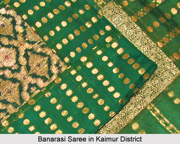
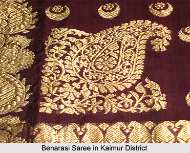
Banarasi Saree, Silk and some agricultural produces are the main articles, which are traded in and out of Kaimur District.
Recently updated articles in States of India

Bandare Waterfalls, Meghalaya
Bandare Waterfalls in South Garo Hills, Meghalaya, is a secluded natural attraction surrounded by dense subtropical forests and rugged mountain terrai...

History of Thissur District
Early History of Thissur District explains flourishing of the port cities. Now these port cities are transformed into archaeological sites.

Tippi Orchid Research Centre, Arunachal Pradesh
Tippi Orchid Research Centre in Arunachal Pradesh is renowned for its rich collection of exotic and endangered orchids. Surrounded by lush rainforest...

Tourism in Nashik District
Pilgrimage tourism in Nashik district involves visiting the various places of Hindu and Jain worship located here. Some of the holiest sites for Hind...

Mangadu, Kerala
Mangadu in Kerala’s Kollam district is a significant megalithic site known for its urn burials, cist burials, menhirs, and stone circles. Excavations...
Related articles in States of India

East Indian States
East Indian States comprises of Bihar, Jharkhand, West Bengal, Odisha and also the Union Territory of Andaman and Nicobar Islands. It defines the cult...

Purnia District in Bihar
Purnia District is located in Bihar and extends from River Ganga to Nepal. The district has a rich Hindu history and glorious past.

Hooghly district
Hooghly District along the bank of the river Hooghly is one of the principal trading ports of West Bengal.

Geography Of Chittoor District
Geography of Chittoor district is spread along the topography of the land which is divided into two natural divisions; Chittoor has a dry and healthy...

Districts of West Bihar
Districts of West Bihar is comprised of medieval monuments that were built by the different governors of Mughal era.