
 Rohtas District, which is a part of Patna Division, is one of the 38 administrative districts of Bihar. Sasaram is the district headquarters. Rohtas District is located at 24 degree 30 minutes to 25 degree 20 minutes north latitude and 83 degree 14 minutes to 83 degree 20 minutes east longitude. Total area covered by Rohtas District is 3847.82 sq kms. Average altitude of this administrative district is 107.78 meters above the sea level. Rohtas District has 3 sub-divisions and 19 blocks.
Rohtas District
Rohtas District was initially a part of Shahabad District. This administrative district of Bihar got its name from the name of Rohitaswa, son of Raja Harishchandra.
Introduction
Rohtas District, which is a part of Patna Division, is one of the 38 administrative districts of Bihar. Sasaram is the district headquarters. Rohtas District is located at 24 degree 30 minutes to 25 degree 20 minutes north latitude and 83 degree 14 minutes to 83 degree 20 minutes east longitude. Total area covered by Rohtas District is 3847.82 sq kms. Average altitude of this administrative district is 107.78 meters above the sea level. Rohtas District has 3 sub-divisions and 19 blocks.History of Rohtas District
 History of Rohtas District is quite interesting. In pre-historic days, the plateau region of the district has been the abode of aboriginals whose chief representatives now are the Bhar and the Oraon tribe. According to some legends, the Kharwar tribe was the original settlers in the hilly tracts near Rohtas. Oraon tribe also claims that they ruled over the area between Rohtas and Patna. The local legend also connects king Sahasrabahu with Sasaram, the headquarters of Rohtas District. It is believed that Sahasrabahu had terrible fight with Saint Parsurama, because of which Sahasrabahu was killed. The term Sasaram is supposed to have been derived from Sahasrabahu and Parsuram. Another historical legend connects Rohtas hill to Rohitaswa,son of Harishchandra, a famous king who was known for his piety and truthfulness.
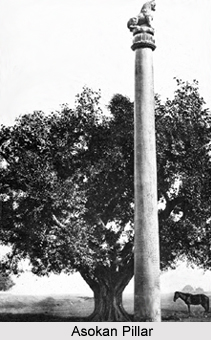
Further, history of Rohtas District states that this district formed a part of Magadh Empire since 6th century BC to 5th century AD. The minor rock edict of Ashoka, Mauryan Emperor at Chandan Sahid near Sasaram confirmed the Mauryan conquests of this district. In 7th century AD, this district came under the control of Harsha rulers of Kannauj. In 1529 Babur invaded Bihar. When Babur died, Sher Shah Suri took over the region. In 1537 Humayun seized his fortresses at Chunar and Rohtas. Humayun proceeded to Bengal and while on his return journey to Delhi Sher Shah defeated him at Chausa. This victory secured for Sher Shah the imperial throne of Delhi.
The next significant historical event, which shook Rohtas District, was the reign of Raja Chait Singh of Varanasi, his kingdom included large part of Shahabad and his control extended up to Buxar. At Chunar and Ghazipur, the English troops suffered defeat and the very foundation of the English power in India was shaken. But, Chait Singh lost eventually. Rohtas District had a very uneventful history till 1857 when Kunwar Singh revolted against the British Empire in line with the Mutineers of 1857. Most of the heroic details of Kunwar Singh are concerned with Bhojpur District. However, the mutiny had its impact and produced similar uprising and incidents throughout the region. The hilly tracts of the district offered natural escape to the fugitives of the Mutiny. During Independence movement the district had a substantiate contribution in the freedom movement of India. After Independence, Rohtas remained a part of Shahabad District but in 1972 Rohtas became a separate district.
Geography of Rohtas District
 Rohtas District is bounded by Bhojpur District and Buxar District in the north, Palamau District and Garhwa District in the south, by Aurangabad District and parts of Gaya District in the east and by Kaimur District in the west. Geographically, this district is divided in two parts - hilly area that comprises the plateau of Kaimur and plain area in the eastern side. The climate of Rohtas District is of extreme type.
It becomes quite hot during summer and cool during the winter. January is the coldest month when the minimum temperature comes down to approximately 10 degree. Winter seasons starts from the month of November and lasts until February. The temperature begins to rise in March and it reaches the peak in the month of May when the mercury touches about 45 degree. Rain sets in some time in June and lasts till mid September. There after the humidity begins to fall. There is slight rainfall in October, but November and December are quite dry. Some winter rain occurs in January and February. Normal average rainfall of the district is 975 mm.
Tourism in Rohtas District
 Tourism in Rohtas District includes visits to several places that reflect the rich past of the region. The tourism options in Rohtas District comprise several historical and religious sites, which are worth visiting. People from different parts of the country come and explore this district of Bihar.
Details of some of the noteworthy attractions of Rohtas District are mentioned below:
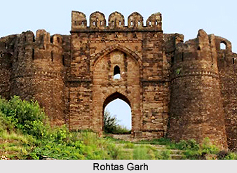
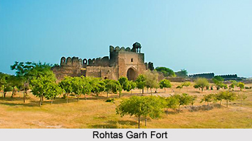
Rohtas Garh: It is situated 5 kilometres west of present block headquarter of Rohtas Block in Dehri sub-division. It is said to be after the name of Rohitaswa, son of Harishchandra. Rohitaswa is said to have settled and built a fort here. However, some local tribes say that Rohtas means dry land. Rohtas has a big fort. It is called Rohtasgarh fort. Sher Shah Suri took it into possession in 1538 AD. It was the headquarters of Akbarpur, There is a Majar (Grave) of Mohammedan saint named Sheikh Shah Babal (Pir). 1 km north of Rohtas Fort is Bawan Talab known for ancient temples. As the name indicates 52 ponds surrounded the village in the past. There is an ancient temple of Lord Shiva, locally known as Chaurasan Mandir said to have been built by King Harishchandra.
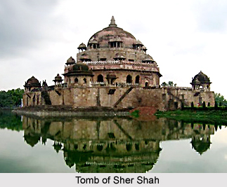
Sasaram: It is the headquarters of Rohtas District as well as Sadar sub-division. Sasaram is a place of historical importance. Grand Trunk Road passes through it. There are several monuments nearby town. It is famous for the Tomb of Sher Shah, which is hexagonal in shape and built of stone, it was built towards the middle of 16th century AD. It is the second highest tomb in India situated in the middle of a big tank. It is a fine specimen of the Pathan architecture and attracts tourists in large numbers. The tomb of Hasan Khan Suri, father of Sher Shah is also located in the town. This tomb is known as Sukha Roza. Ashoka inscription at Chand-tan-pir on a hill near Sasaram is also of historical value.
 Shergarh: The village is situated 13 kilometres south of Chenari. It was a military cantonment during the regime of Sher Shah Suri.
Tarachandi: There is a temple of Goddess Tarachandi and small inscription of Pratap Dhawal on the rock close to the temple of Chandi Devi. Devotees in large number assemble here to offer their prayers.
Dhurwan Kund and Gupta Dham: These are two attractive religious sites. These sites are situated in the Chenari Block of this district.
Bhaluni Dham: There is a famous temple of Goddess Durga, called "Yakshini Bhagwati". Every year devotees gather here in large numbers.
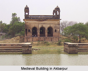
Akbarpur: It is situated at the foot of Kaimur hills five kms form Rohtas Garh. The name of this place has originated from the name of Mughal ruler Akbar. It is very near to the present blockhead quarters of Rohtas.
Deo Markandey: Situated 18 kms east of Nasriganj in Bikramganj sub-division, it is famous for temple of Lord Vishnu and Lord Surya.
Rehal: It lies in Rohtas Block and is situated at a height of 2400 feet. The main inhabitants of this district are Chero tribe and Kharwar tribe.
Dharklandha and Dehri (industrial town of the district) are other main tourist attractions of Rohtas District.
Recently updated articles in States of India

Bandare Waterfalls, Meghalaya
Bandare Waterfalls in South Garo Hills, Meghalaya, is a secluded natural attraction surrounded by dense subtropical forests and rugged mountain terrai...

History of Thissur District
Early History of Thissur District explains flourishing of the port cities. Now these port cities are transformed into archaeological sites.

Tippi Orchid Research Centre, Arunachal Pradesh
Tippi Orchid Research Centre in Arunachal Pradesh is renowned for its rich collection of exotic and endangered orchids. Surrounded by lush rainforest...

Tourism in Nashik District
Pilgrimage tourism in Nashik district involves visiting the various places of Hindu and Jain worship located here. Some of the holiest sites for Hind...

Mangadu, Kerala
Mangadu in Kerala’s Kollam district is a significant megalithic site known for its urn burials, cist burials, menhirs, and stone circles. Excavations...
Related articles in States of India

East Indian States
East Indian States comprises of Bihar, Jharkhand, West Bengal, Odisha and also the Union Territory of Andaman and Nicobar Islands. It defines the cult...

Purnia District in Bihar
Purnia District is located in Bihar and extends from River Ganga to Nepal. The district has a rich Hindu history and glorious past.

Hooghly district
Hooghly District along the bank of the river Hooghly is one of the principal trading ports of West Bengal.

Geography Of Chittoor District
Geography of Chittoor district is spread along the topography of the land which is divided into two natural divisions; Chittoor has a dry and healthy...

Districts of West Bihar
Districts of West Bihar is comprised of medieval monuments that were built by the different governors of Mughal era.