
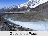
 The Goecha La Pass is situated at an elevation of 4, 940 m in the Himalayan Mountain Range and is known to be a high mountain pass in the north eastern state of Sikkim. From the Goecha La Pass, the trekkers and hikers can see the southeast face of Mt. Kanchenjunga, which is the world"s third highest peak and currently serves as the base camp for aspiring trekkers who wants to scale the mountain. The view from this pass is so mesmerizing that the first time the government officials saw it, they were so enamoured by it that they decided to feature it on the Rs.100 note.
Goecha La Pass Trek
With the verdant Himalayan forests, meandering rivers, meadows, rhododendrons, the Goecha La Pass trek stands tall overlooking the massive structure of the Kanchenjunga and offers the view of 12 beautiful peaks visible from the Dzongri top. The list of Himalayan peaks seen on this Goecha La Pass trek is as follows:
Kanchenjunga (8586 m)
Talung (7349 m)
Rathong (6679 m)
Kabru N (7353 m)
Koktang (6147 m)
Simvo (6812 m)
Kabru S (7318 m)
Kabru Dome (6600 m)
Kabru Forked (6100 m)
Pandim (6691 m)
Tenchenkhang (6010 m)
Jupono (5650 m)
The Goecha La Pass trek has some of the key highlights which attract trekkers from all around. The trekking trail initiates from the Yuksom town, which is a prominent destination in Sikkim for its historical significance and then eventually moves on to the rhododendron forests in Tshoka.
At about 13, 000 ft, the trail leads to Phedang from where the trekkers can view the snow covered peaks of Kanchenjunga with amazing green landscapes and lush meadows at the foothills. Breathtaking views of Mount Pandim, Kabru, Rotang are both astounding and captivating that forces the trekkers to visit the destination again and again.
The ideal time to go through with the Goecha La Pass trek is between the months of October to November and March to April. Compared to the Himalayan standards, the Goecha La Pass trek is fairly accessible but can still be challenging in terms of distances to be covered in a day.









