 Geography of Shajapur district is spread over an area of six thousand one hundred and ninety six square kilometers. The district of Shajapur is a part of the Central Madhya Pradesh Plateau; Ratlam plateau Micro region as per the present scheme of regional delineation. The district is located in the north-western part of the state and is situated in between thirty two degree six minutes and twenty four degree nineteen minutes to the North Latitudes and seventy five degree forty one minutes and seventy seven degree two minutes to the East Longitudes.
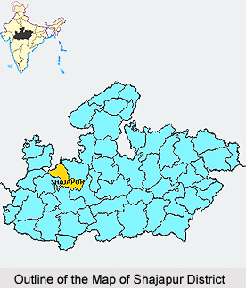
The district of Shajapur shares its borders with Ujjain to the west, Dewas and Sehore district to the South, Rajgarh to the East and Jhalawar district of Rajasthan to the north. Shajapur district in the Ujjain division was brought during the 1981 census. The district is identified from the headquarter town Shajapur named after the great Mughal Emperor Shah Jahan, who halted here in the year 1640. It is said that the original name was Shahjahanpur, which subsequently became Shajapur. Since the formation of the Gwalior state, it has remained a district.
The physio-cultural diversities in Shajapur resulted in the sub-division of the district into the following sub-micro regions called Agar plateau, Kali Sindh Basin, Shajapur Upland and Shajapur Forested Upland.
The district of Shajapur is a part of the Deccan Trap of Cretaceous Eocene age. The alluvium of ecent period is, however, found along the Parbati River in a narrow strip. The district has deep black and shallow black brown and alluvial soils of the northern region. Physio-cultural diversities in this district have led to sub-divide it into the following sub-micro regions called Agar plateau, Shajapur Forested Upland, Kali Sindh Basin and Shajapur Upland. Agar Plateau is a region which is delineated over the western part of the district covering the major areas of Agar tehsil. There is a hill tract in the west of Badod town showing scattered hillocks in the north-south direction. The presence of hills in the centre has affected the drainage pattern. The height of this tract varies between five hundred to five hundred and forty five meters above the mean sea level. The slope of this region is towards the north. Kachhol and Dudhaliy are the main streams on the west which originate from the hill tract and drain towards the west Chhoti Kali Sindh, which is the main perennial stream of the region, flows northwards on the western border of the region.
Shajapur Forested Upland stretches from north to south in the center of Shajapur covering significant portions of Shajapur and Agar tehsils and small patches of Susner tehsil. It is a part of Malwa plateau with typical topography. A continuous chain of hills is there in the entire region. The region`s height varies between four hundred and fifty and five hundred and thirty meters above the mean sea level. The height of the surface decreases towards the north. Since it is an upland area, several seasonal streams originate from this zone and drain mostly towards the east.
Ahu and Lakundar are the main streams flowing from south to north in this region. The streams, which join Lakundar River on its left bank, originate from this hill tract. Ahu River drains along the western border of the region. The hilly terrain is covered with the forests.
Kali Sindh Basin is elongated between the southern and northern limits of Shajapur. It covers the major portions of Susner and Shajapur tehsils and fewer parts of Agar tehsil. The region`s southern part is hilly whereas northern part has plain land characteristics. The hills slowly decrease in height from south to north. There are some scattered hillocks in the northern and central parts also. The altitude of the region varies between four hundred and fifty and five hundred and twenty eight meters above the mean sea level. Several streams originate from the hilly area and dissect the surface. The main River is Kali Sindh River, which traverses through the hills and flows further on the eastern border of the district. Lakundar is the main rivulets of Kali Sindh which flows northwards. Geologically, the entire region forms a part of the Deccan Trap of Creataceous Eocene period.
Shajapur Upland extends over the eastern part of the Shajapur district covering the entire Shujalpur tehsil and also a small patch of Shajapur tehsil. Being a part of Malwa plateau, it presents the dissected topography. A hill range enters this region from the north and runs towards the south. The southern part of the region is an upland area and northern portion is relatively low lying. In the south, the hills are scattered and are eroded by several streams. The height varies between four hundred and thirty five and five hundred and seven meters above the main sea level. The four hundred and fifty meters contour encircles the area along Newaj River where the small hills are spread. The Newaj River dissects these hills. The eastern part of the region is low and water dividing line of the western part can be decided by the tributaries of Newaj. The Newaj River and Parbati River drains the region. Parbati River flows northwards on the eastern border of this region in Shajapur district while Newaj River flows in the middle of the region. Both the rivers are perennial.


