
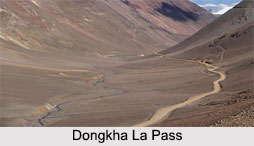
 Situated at an altitude of 5,486 m in North Sikkim, the high mountain pass of the Dongkha La Pass connects Sikkim in India with Tibet in China. It is a part of the Himalayan Mountain Range Range and offers a view of the Tibetan Plateau. Located nearby is the Tso Lhamo Lake which is considered to be one of the origins of Teesta River along with the glacial lake of Khangchung and Gurudongmar Lake which is about 10 to 12 km away from the Dongkha La Pass.
With a close proximity to the Tibet border, the Dongkha La Pass is controlled by the Indian Army and tourists need to get a special permit to visit this mountain pass.
This article is a stub. You can enrich by adding more information to it. Send your Write Up to content@indianetzone.com









