
 As the name suggests, the Arwa Group is a group of three Himalayan peaks which are named as `Arwa Tower`, `Arwa Crest` and `Arwa Spire`. The group is situated in the Chamoli district of Uttarakhand. The peaks are positioned on the south side of the southwest branch of Arwa Valley in the south of the dry lake Arwa Tal and northwest of Badrinath. In the south direction lies the Bhagirath Kharak Glacier. The three peaks lie close to each other and share a base camp. Located near Tibet, the peaks are not easily accessible.
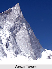
Arwa Tower
The Arwa Tower is a rocky ridge with a steep granite wall. It is situated at a height of 6,532 meters (20,840 feet) above mean sea level.
 The geographic coordinates of the peak are 30 degree 52`12 North, 79 degree 16`48 East. It was first scaled by Britons Mick Fowler and Steve Sustad in the year 1999, via the northwest face. The various routes through which it can be accessed are North West Face, South Face - French Route, North West Buttress - Pilier Guilhem Chaffiol, North Face/East Ridge and South Face - French route.
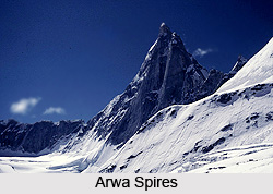
Arwa Spires
The Arwa Spires are rocky spires which are difficult to access. The spires comprise of two main peaks, namely the east and west peaks. They are located southwest of the Arwa Tower. The geographic coordinates of this peak are 30 degree 48`36 North, 79 degree 21`36 East. They are situated southwest of the Arwa Tower at a height of 6,193 metres (20,318 feet) above mean sea level.
 The east spire was first climbed in the year 2000 by a British expedition led by Kenton Cool, via the East Ridge. The various routes for accessing them include North East Ridge, North Face- Right Hand Couloir, North East Ridge, North Face- Fior di Vite, East Ridge - English route and Capisco to West Summit.
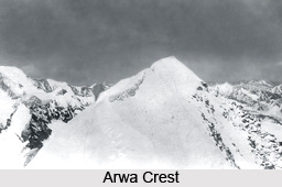
Arwa Crest
The crest like peak in this Arwa area is the Arwa Crest which is situated to the west of Arwa Tower at a height of 6,250 meters (20,505 feet) above mean sea level. The geographic coordinates of this peak are 30 degree 52`12 North, 79 degree 15`36 East. It was first scaled in the year 2002 by a French team including Philippe Renard, Gregory Muffat Joly, Laurent Miston, and Antoine de Choudens. The peak can be climbed via French route (North Face) and East Ridge.









