Home > Travel > States of India > Districts of Santhal Pargana division
Districts of Santhal Pargana division
Districts of Shantal Parganas Divisions are now seeing the development in their education and life style with the help of various governmental and non-governmental organizations.

Share this Article:

Districts of Santhal Pargana division, JharkhandDistricts of Shantal Parganas Divisions constitute one of the five administrative units known as the divisions of Jharkhand. Some of the districts in Shantal Divisions are Godda district, Deoghar district, Dumka district, Jamtara district, Sahibganj district and Pakur District

Godda District
Godda district is one of the twenty-four districts of Jharkhand state in eastern India. It lies in the northeastern part of the state. The geographical area that now comprises Godda district used to be part of the erstwhile Santhal Parganas district. Godda town is the headquarters of Godda district. Godda district is 2110 km.sq., with a population of around 861,000. The district is without any rail link, the nearest railway station being Barahat. The main economic activity of the people is agriculture, and major crops are paddy, wheat and maize. Godda is the land of a tribe called Santhals. Godda is not only a land of tribes; the local inhabitants also include the non-tribal and urban people.

Deoghar District
Deoghar district is one of the twenty-four districts of Jharkhand state in eastern India, and Deoghar town is the administrative headquarters of this district. This district is known for the Baidyanath Jyotirlinga shrine. This district is part of Santhal Pargana division.

Dumka District
Dumka District is one of the twenty-four districts of Jharkhand state in eastern India, and Dumka is the administrative headquarters of this district.
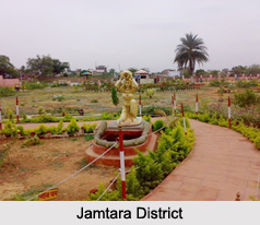
Districts of Santhal Pargana division, Jharkhand

Jamtara District
Jamtara district is one of the twenty-four districts of Jharkhand state in eastern India. Jamtara town is the administrative headquarters of this district. The district is situated between 23 degree 10 minutes and 24 degree 05 minutes north latitudes and 86 degree 30 minutes and 87 degree 15 minutes east longitudes.

Sahibganj District
Sahibganj district is one of the twenty-four districts of Jharkhand and Sahibganj is the administrative headquarters of this district.

Pakur District
Pakur district is one of the twenty-four districts of Jharkhand and Pakur is the administrative headquarters of this district. The district, with a population of 899,200, and covering an area of 686.21 square km, is situated on the north-eastern corner of Jharkhand state. The district is bounded on the north by Sahebganj district, on the south by Dumka district, on the west by Godda district, and on the east by the Murshidabad district of West Bengal. Pakur is famous for black stone. It has six blocks and a nagar panchayat.


Share this Article:

Related Articles

More Articles in States of India


East Indian States
East Indian States comprises of Bihar, Jharkhand, West Bengal, Odisha and also the Union Territory of Andaman and Nicobar Islands. It defines the cultural heritage, rich historical background and the linguistic unity.
Erode District
Erode District is one of the districts in the state of Tamil Nadu. The district of Erode is having a land-locked area with no sea coast.
Purnia District in Bihar
Purnia District is located in Bihar and extends from River Ganga to Nepal. The district has a rich Hindu history and glorious past.
South Delhi District
South Delhi District is the third largest district of Delhi as far as its area is concerned. South Delhi District is known for its economic, historical, cultural and social significance.
North Indian States
North Indian States formed the cultural and religious unity in spite of having many foreign invasion and the political disturbances from the early era till the British gained supremacy in Indian sub continent.
Kendujhar District
Kendujhar District, spread over an area of 8,240 sq kms, is as varied as the whole of Orissa with waterfalls roaring gorges, mountains and minerals. The manifold expressions of nature in Kendujhar District are considered as unique.
Hooghly district
Hooghly District along the bank of the river Hooghly is one of the principal trading ports of West Bengal.
Districts of South Tamil Nadu
Districts of South Tamil Nadu consist of many tourism destinations like archaeological sites and the history of Pandyas and Cholas. Considering their proximity to the sea, many districts also boast of serene beaches and coastal beauty.
Flora of Arunachal Pradesh
Flora of Arunachal Pradesh includes infinite species and is a subject of great interests for the botanists.
Districts of South Gujarat
Districts of South Gujarat are the epicenter of Jain pilgrimages and the early Hindu kingdoms.
North West States of India
North West States of India consist of three states, which are Rajasthan, Punjab and Haryana. All of them are culturally and traditionally diverse and they have been ruled by different dynasties in historical time.
Geography Of Chittoor District
Geography of Chittoor district is spread along the topography of the land which is divided into two natural divisions; Chittoor has a dry and healthy climate.
Districts of North Rajasthan
District of Northern part of Rajasthan is dotted with ancient forts and medieval villages.
Districts of North Odisha
District of North Odisha has Bengal boundary and shares the same culture. These are reachable if one pays a weekend visit to Digha.
Districts of West Bihar
Districts of West Bihar is comprised of medieval monuments that were built by the different governors of Mughal era.
Districts of South Haryana
Districts of South Haryana consists of many cities of industrial excellence. These districts are dotted with popular tourism destinations.
Medieval History of Assam
Medieval history of Assam narrates the advent and rule of a number of kingdoms in the region. The prominent dynasties of the kingdom left an everlasting imprint on the socio cultural heritage of India.
Geography of Meghalaya
The suitable climate, highland plateaus, rivers and the flora and fauna together forms the geography of Meghalaya.
Districts of Rayalaseema
Districts of Rayalaseema in Andhra Pradesh state has urban population and rural settlements as well.
Districts of South Punjab
Districts of Southern part of Punjab depict medieval history of Punjab and the rise of Sikhs.