
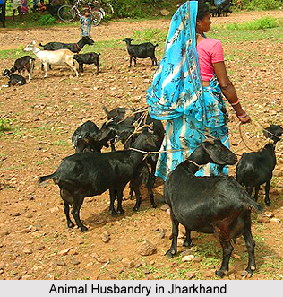
 Godda District in Jharkhand came into existence as 55th district of undivided Bihar on 25th May, 1983 and became the 18th district of Jharkhand. Prior to its up-gradation to the status of a district it was a sub-division of Santhal Pargana district since 1855. In absence of basic infra-structure the district is still undeveloped. Godda District has a total area of 2110 sq kms and this district is having the height of 100.414 meters from the sea level. Godda District is situated between 24 degrees 47 minutes to 25 degrees 23 minutes northern latitude and between 87 degrees 8 minutes to 87 degree 48 minutes eastern longitude. The district is bounded by the district of Sahebganj District in the north, Dumka district in the south, Pakur district in the east and Banka District and Bhagalpur of Bihar in the west. The administrative headquarter of the District is Godda.
Godda District
Godda District is one of the administrative districts of Jharkhand with its headquarters located at Godda. Initially, this district was a part of Bihar.
Introduction
Godda District in Jharkhand came into existence as 55th district of undivided Bihar on 25th May, 1983 and became the 18th district of Jharkhand. Prior to its up-gradation to the status of a district it was a sub-division of Santhal Pargana district since 1855. In absence of basic infra-structure the district is still undeveloped. Godda District has a total area of 2110 sq kms and this district is having the height of 100.414 meters from the sea level. Godda District is situated between 24 degrees 47 minutes to 25 degrees 23 minutes northern latitude and between 87 degrees 8 minutes to 87 degree 48 minutes eastern longitude. The district is bounded by the district of Sahebganj District in the north, Dumka district in the south, Pakur district in the east and Banka District and Bhagalpur of Bihar in the west. The administrative headquarter of the District is Godda.History of Godda District
History of Godda District dates back to the Stone Age. A plethora of stone weapons have been found in this region including hammers, axes, arrow-leads, agricultural implements etc, especially in the Santhal Pargana. The state however lacks proper historical documents. Various evidences also states that the district had civilization during Vedic period too.
 Indica, which is the travel account of megasthenes, contains the records of inhabitants of this region. In 302 B.C, the court of Chandragupta Maurya was visited by the megasthenes at Pataliputra. They identified and named the race dwelling in this region as Maller or Sauria Paharia tribe. In 645 AD, Hiuen Tsiang, a Chinese pilgrim, visited Champa and the history of Godda district before this era is still unknown. During this time the region of Santhal Pargana was under the Pal region. The inhabitants belonging to this region were great patrons of Buddhism. Vajrayan Sect of Buddhism was at height during this period. Deep impact of Tantric sect and Buddha religion is evident from the various signs of Devi worship. After this era, no evidences have been found about the history for several centuries. However, Bhavishyat Puran which was written in the 15th or 16th century A.D. in its Brahmanda Section holds some of the facts about the history of the district.
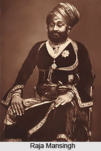
During Turko-Afgan period, the administrators of the district were Sher Shah Suri and his heirs. The region of Godda District served as a significant centre during the conquest of Bengal. Later, during the era of Mughal Dynasty the territory was granted to Viceroy Raja Mansingh. However the development of the district in terms of civilization and culture was commenced in the British era. The forest areas of the district were hugely exploited to make strategic and economic development of the district. Initially this forest exploitation was hindered by the aboriginal Paharia tribe. To counter these hindrances, the British brought the Santhal tribe in 1717 who were previously settled in Chotanagpur region. Santhal tribe however became the victim of British policies and began their rebellion in 1885. This rebellion was termed as `Hul`. This tremendous rebellion forced the British to grant Santhal tribe the district and separated it from Birbhum district and Bhagalpur district. The district protected the basic facilities, economy and traditions of tribal folks.
Indica, which is the travel account of megasthenes, contains the records of inhabitants of this region. In 302 B.C, the court of Chandragupta Maurya was visited by the megasthenes at Pataliputra. They identified and named the race dwelling in this region as Maller or Sauria Paharia tribe. In 645 AD, Hiuen Tsiang, a Chinese pilgrim, visited Champa and the history of Godda district before this era is still unknown. During this time the region of Santhal Pargana was under the Pal region. The inhabitants belonging to this region were great patrons of Buddhism. Vajrayan Sect of Buddhism was at height during this period. Deep impact of Tantric sect and Buddha religion is evident from the various signs of Devi worship. After this era, no evidences have been found about the history for several centuries. However, Bhavishyat Puran which was written in the 15th or 16th century A.D. in its Brahmanda Section holds some of the facts about the history of the district.
During Turko-Afgan period, the administrators of the district were Sher Shah Suri and his heirs. The region of Godda District served as a significant centre during the conquest of Bengal. Later, during the era of Mughal Dynasty the territory was granted to Viceroy Raja Mansingh. However the development of the district in terms of civilization and culture was commenced in the British era. The forest areas of the district were hugely exploited to make strategic and economic development of the district. Initially this forest exploitation was hindered by the aboriginal Paharia tribe. To counter these hindrances, the British brought the Santhal tribe in 1717 who were previously settled in Chotanagpur region. Santhal tribe however became the victim of British policies and began their rebellion in 1885. This rebellion was termed as `Hul`. This tremendous rebellion forced the British to grant Santhal tribe the district and separated it from Birbhum district and Bhagalpur district. The district protected the basic facilities, economy and traditions of tribal folks.
Geography of Godda District
Geography of Godda district said that this district is situated at an elevation of about 100 metre from sea level between 870.08` to 870.48` Eastern Longitude and between 240.47` to 250.23 Northern Latitude. The district is abundantly covered with trees in rural as well as urban areas which play an important role in the economy of the district. Trees of the district exhibit a great variety including Mango, date-palm, plum, Jacktree, wood apple, custard apple, black plum, shisham, sal, bamboo and many more. Besides this, a number of medicinal plants are also found in the district. Many of these medicinal plants have been identified to be useful in the medication of several incurable diseases. Most of the plants are found in the tribal areas of Godda district.
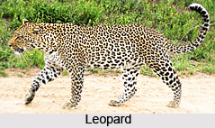 A vast variety of fauna is also found in the district. Common fauna include wild animals like monkey, pig, rabbit, jackal etc. A plethora of birds are also prevalent in the district. Apart from this peacock, leopard, bear are also found. Poisonous species like krait, cobra and scorpions are also common.
Godda district has a tropical climate with cool winters, abundant rainfall and hot dry summer. Thunder storms and severe squalls are common during pre monsoon months. In the month of April and May dust storms can also be seen. The district hosts the typical climate of tropical belt.
A vast variety of fauna is also found in the district. Common fauna include wild animals like monkey, pig, rabbit, jackal etc. A plethora of birds are also prevalent in the district. Apart from this peacock, leopard, bear are also found. Poisonous species like krait, cobra and scorpions are also common.
Godda district has a tropical climate with cool winters, abundant rainfall and hot dry summer. Thunder storms and severe squalls are common during pre monsoon months. In the month of April and May dust storms can also be seen. The district hosts the typical climate of tropical belt.
Demography of Godda District
According to the Population Census in the year 2011, Godda District had population of 1,311,382 of which male and female were 678,504 and 632,878 respectively. The population of Godda District constituted 3.98 percent of total population of Jharkhand. The population density of Godda district shows 622 people per sq. km. The average literacy rate of Godda District in 2011 was 57.68 percent compared to 43.13 of 2001. If things are looked out at gender wise, male and female literacy were 69.56 percent and 44.90 percent respectively. The total literates in Godda District were 620,968 of which male and female were 388,324 and 232,724 respectively.
Recently updated articles in States of India

Bandare Waterfalls, Meghalaya
Bandare Waterfalls in South Garo Hills, Meghalaya, is a secluded natural attraction surrounded by dense subtropical forests and rugged mountain terrai...

History of Thissur District
Early History of Thissur District explains flourishing of the port cities. Now these port cities are transformed into archaeological sites.

Tippi Orchid Research Centre, Arunachal Pradesh
Tippi Orchid Research Centre in Arunachal Pradesh is renowned for its rich collection of exotic and endangered orchids. Surrounded by lush rainforest...

Tourism in Nashik District
Pilgrimage tourism in Nashik district involves visiting the various places of Hindu and Jain worship located here. Some of the holiest sites for Hind...

Mangadu, Kerala
Mangadu in Kerala’s Kollam district is a significant megalithic site known for its urn burials, cist burials, menhirs, and stone circles. Excavations...
Related articles in States of India

East Indian States
East Indian States comprises of Bihar, Jharkhand, West Bengal, Odisha and also the Union Territory of Andaman and Nicobar Islands. It defines the cult...

Purnia District in Bihar
Purnia District is located in Bihar and extends from River Ganga to Nepal. The district has a rich Hindu history and glorious past.

Hooghly district
Hooghly District along the bank of the river Hooghly is one of the principal trading ports of West Bengal.

Geography Of Chittoor District
Geography of Chittoor district is spread along the topography of the land which is divided into two natural divisions; Chittoor has a dry and healthy...

Districts of West Bihar
Districts of West Bihar is comprised of medieval monuments that were built by the different governors of Mughal era.