 Godda District in Jharkhand came into existence as 55th district of undivided Bihar on 25th May, 1983 and became the 18th district of Jharkhand. Prior to its up-gradation to the status of a district it was a sub-division of Santhal Pargana district since 1855. In absence of basic infra-structure the district is still undeveloped. Godda District has a total area of 2110 sq kms and this district is having the height of 100.414 meters from the sea level. Godda District is situated between 24 degrees 47 minutes to 25 degrees 23 minutes northern latitude and between 87 degrees 8 minutes to 87 degree 48 minutes eastern longitude. The district is bounded by the district of Sahebganj District in the north, Dumka district in the south, Pakur district in the east and Banka District and Bhagalpur of Bihar in the west. The administrative headquarter of the District is Godda.
History of Godda District
No concrete historical evidences of Godda District are available. However, a number of stone weapons and tools such as axes, hammers, arrow-leads or agricultural implements found in the Santhal Pargana obviously confirmed the fact that like other parts of the world this region too had experienced the Stone Age. During the period of Turko-Afghan rule when Shershah Suri and his heirs were the administrators, this area was of strategic significance in course of getting possession over Bengal. The British rulers understood the strategic and economic importance of the area and exploited the area completely. In the beginning, the aboriginal Paharia Tribe proved an obstacle to such economic exploitation of the British rulers. Eventually, the people of Santhal tribal community rebelled against the British East India Company in 1855. This rebellion was so strong that it compelled them to accord Santhal Pargana the status of a district separating it from Bhagalpur District and Birbhum District.
Geography of Godda District
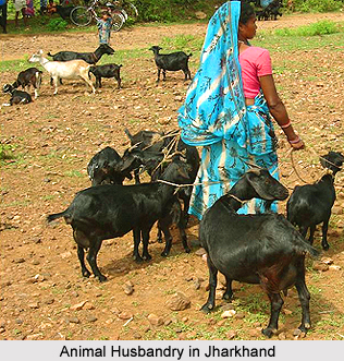
Geography of Godda District comprises hilly tracks, plains and vast forest lands. The eastern part from north to south is covered with forests whose area is near about 239.34 sq kms and is a hilly track. Its western side is plain. The climate of the district is of tropical region with hot dry summer, a good rainy season and cool winter. Maximum temperature is as high as 44 degree Celsius and the lowest is 5.8 degree Celsius. Thunder storms occur in pre-monsoon months. Dust storms also occur occasionally in the months of April and May. The average rainfall of the district is 1094 mm. Thus, the climate of the district has all characteristics of tropical belt. The soil is of poor quality comparatively and is not well suited for cultivation except that of north - west part of the district owing to undulating topography. In Godda District, the primary occupation of the aboriginal tribes is hunting, sheep - rearing, animal husbandry and agriculture.
Demography of Godda District
According to the Population Census in the year 2011, Godda District had population of 1,311,382 of which male and female were 678,504 and 632,878 respectively. The population of Godda District constituted 3.98 percent of total population of Jharkhand. The population density of Godda district shows 622 people per sq. km. The average literacy rate of Godda District in 2011 was 57.68 percent compared to 43.13 of 2001. If things are looked out at gender wise, male and female literacy were 69.56 percent and 44.90 percent respectively. The total literates in Godda District were 620,968 of which male and female were 388,324 and 232,724 respectively.


