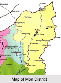
 The northernmost district of Nagaland, the Mon district spreads over an area of 1,786 sq. km. It is bounded by the state of Arunachal Pradesh to its north, Assam to its west, Myanmar to its east, Longleng district to its south west and Tuensang district to its south. The town of Mon is its district headquarters.
Numerous surveys have revealed that the Mon district is one of the 250 most backward districts in the country. It is one of the three districts in Nagaland currently receiving funds from the Backward Regions Grant Fund Programme (BRGF).
History of Mon District
The Mon district was not brought under the Civil Administration till 1948. In the beginning of the 19th century, a vast tract of land lying between the administered areas of Assam and Myanmar was not brought under the Civil Administration by the British. By the year 1914, the Foreign and Political Department of the Government of India, extended the Assam Frontier Tract Regulation of 1880 to the Hills, which were either inhabited or frequented by the tribes of Abors, Mishmis, Singphos, Nagas, Khamptis, Bhutias, Akas and Daflas. It is by this extension that the Government of India brought the area under some administration in 1914 and the area was named as the North East Frontier Tract. Hence, the present Mon district was also brought under the same notification.
Demographics of Mon District
As per the reports of Census India 2011, the total population of Mon district was 250,260. The district had a sex ratio of 898 females for every 1000 males with a literacy rate of about 57 percent.
Tourism in Mon District
Some of the popular places of tourist attraction in Mon district are as follows:
Shanghyu Village: This village ruled by the Chief Angh is a prominent village in Mon district. There is a wonderful wooden monument measuring 8 ft in height and 12 ft in breadth, believed to be constructed by heavenly angels. Human beings and other creatures are carved on this monument. Memorial stones are also found in front of the Angh`s palace. History records that good and friendly relationship existed between the Shangnyu and the Ahom Kings of Assam. Shangnyu Angh used to collect taxes from all the villages under his domain-extending from Sibasagar in Assam to the Wanchos in Arunachal Pradesh.
Longwa Village: It is among the biggest village in the district. As the village straddles the international boundary line, one half of the Angh`s house falls within the Indian Territory and the other half lies in Myanmar. However the whole village is controlled by the Angh and the Village Council Chairman. An interesting feature of this village is that the Angh of the village has 60 wives and his jurisdiction extends up to Myanmar and Arunachal Pradesh.
Veda Peak: Known to be the highest peak in Mon district, the Veda peak is approximately 70 km east of the Mon district headquarters. From this peak, one can have a clear view of both Brahmaputra River and Chindwin on a clear day. There is a waterfall on the precincts of this peak and this area is also considered as one of the best locations in the whole of Konyak countryside.
Naganimora: Formerly known as Lakhan, is a subdivision in Mon district and is situated in Kongan village land. The only coalfield in Nagaland, founded by British East India Company in 1907 is at Borjan near Naganimora.
Visiting Information on Mon District
The nearest railway station is at Kohima at a distance of 319 km and the Jorhat Airport is the closest at a distance of 48 km from the Mon district.
Mon District
A newly formed district in the year 1973, the Mon district is one of the 250 most backward districts in the country.


