 India experiences diverse climatic conditions. The Thar Desert and the Himalayas greatly manipulate India`s climatic conditions. Various climatic zones are prevalent in India and are influenced by different features like location, surface conditions and varied topography. Given below are the climatic zones and climatic seasons of India.
Climatic Zones of India
Four types of climatic zones are found in India namely, Arid Zone, Tropical Zone, Subtropical Zone and Alpine Zone.
•Arid Zone - The Arid Zone is mainly dominant in vast areas of Rajasthan and the western regions of the country. The special feature of the arid zone is low levels of rainfall accompanied by high temperature, which generally reaches up to 50 degree Celsius.
•Tropical Zone - The Tropical Zone is divided into two different types namely, Tropical Dry and Tropical Wet Monsoon. The Tropical Dry Zone experiences low rainfall and high temperature. Whereas, in the Tropical Wet Zone, temperature is relatively average within 18 degree Celsius and includes high levels of rainfall.
•Subtropical Zone - The Subtropical Zone is mainly found in northern India and features usual Indian climatic conditions. Summers are defined by high temperatures along with rainfall, whereas winters are extremely dry and cold.
•Alpine Zone - The climatic conditions of the Alpine Zone are experienced in the high regions of the Himalayas. Here, due to the disparity in altitude, climatic conditions vary frequently. In the elevated regions, the Alpine Tundra Zone is prevalent.
Climatic Seasons of India
India generally experiences four types of Climatic Seasons namely, Summer Season, Rainy or Monsoon Season, Retreating or Post-Monsoon Season and Winter Season.
•Summer Season - The Summer Season lasts from the month of March to the month of July. Temperature rises the most during April in southern and western regions, when the Indian Subcontinent faces the sun vertically. In the northern regions, temperature rises the most in the month of May. The average temperature ranges from 32 degree Celsius to 40 degree Celsius.
•Rainy or Monsoon - In India, monsoons generally last from the month of June to the month of September, which is the same time period for most parts of the country. From the end of May, southwest summer monsoon gradually dictates the season across the nation. Monsoon laden winds generally announce the arrival of monsoon accompanied by lightning and thunderstorms. Maximum rainfall is typically recorded in the southern regions of the country.
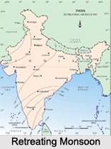
•Retreating or Post-Monsoon - After the monsoons, the Rainy Season begins to recede from the months of September and October. This period generally lasts up to December, after which the winter arrives. Most parts of the nation experience pleasant cloudless weather, particularly in north-western India. Monsoon usually retreats from most of the regions, except for south India.
•Winter - The Winter Season lasts from the month of December to the month of February, but continues up till April in certain parts of the country. During this period, it is basically cold, with temperatures ranging from 10 to 15 degree Celsius around the north-western areas and 20 to 25 degree Celsius towards the south-eastern regions. Winters in India are typically dry and December and January are the coldest months.
Usefulness of Indian climate
The Indian climate is largely responsible for the varied kinds of flora and fauna in the country. In cool temperatures, one may find orchids, sal, palm and different medicinal herbs,
Adverse Impacts on Indian Climate and it"s Consequences
Currently, pollution and unrestrained industrialization is adversely affecting the Indian Climate, bringing about severe changes in the seasonal cycle. This has resulted in recurrent climatic catastrophes like floods, drought and global warming. Deforestation has directly effected in drought and landslides. Floods in various parts of the country have now become a serious concern, due to loss of numerous life and assets. Injurious and harmful gases such as sulphur dioxide, carbon dioxide, methane, carbon monoxide and others from various polluting agents have given rise to global warming thus adversely affecting and altering the Indian Climate.
Indian Climate
Indian Climate is extremely diverse and is affected by diverse topography.


