Home > Travel > States of India > Mau District
Mau District
Mau District forms a part of Azamgarh Division of Uttar Pradesh. This district came into existence in the year 1988 and before that Mau was an important town of Azamgarh District.

Share this Article:

Mau District, Uttar Pradesh
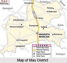
Mau District is one of the administrative districts of Uttar Pradesh is situated in its south-eastern part. It has its headquarters located at Mau town. This district is located at 83 degree 17 minutes to 84 degree 52 minutes east longitude and 25 degree 47 minutes to 26 degree 17 minutes north latitude. Mau District occupies a total area of 1,71,459 hectares. Mau District is bounded in the south by Ghazipur District, in the east by Ballia district and in the west by Azamgarh District. The northern boundary of the district is bounded by Ghaghara River.

History of Mau District
Many myths are popular regarding history of Mau District. In common opinion Mau is considered as a Turkish word, which means `Garh`, `Padav`, `Chavani`. No historical records are available regarding early habitants of Mau. Some historical accounts suggest that Akbar passed through Mau, on his way towards Allahabad. During his reign Sher Shah Suri visited Kolhuvavan (Madhuban) to meet sufi saint Syed Ahmad Wadva. Various developmental works were undertaken by Sher Shah during his reign towards economic development of Mau region. Further, as per history of Mau District, during the period of freedom struggle of the country, residents of Mau had given their full support to the movement. Mahatma Gandhi came here in Dohrighat on 3rd of October, 1939. In salt law breaking movement and during 1942, Quit India Movement Mau District had actively taken part. Mau was an important township of Azamgarh District before its creation. On 19th of November, 1988 it was made a district, largely due to the effort of Late Kalpnath Rai, who was a Member of Parliament from Ghosi Parliamentary seat.

Mau District is basically agriculture based district. However, the main industrial setup here is of cloth making by power loom due to presence of a large number of weavers in the district.


Share this Article:

Related Articles

More Articles in States of India


East Indian States
East Indian States comprises of Bihar, Jharkhand, West Bengal, Odisha and also the Union Territory of Andaman and Nicobar Islands. It defines the cultural heritage, rich historical background and the linguistic unity.
Erode District
Erode District is one of the districts in the state of Tamil Nadu. The district of Erode is having a land-locked area with no sea coast.
Purnia District in Bihar
Purnia District is located in Bihar and extends from River Ganga to Nepal. The district has a rich Hindu history and glorious past.
South Delhi District
South Delhi District is the third largest district of Delhi as far as its area is concerned. South Delhi District is known for its economic, historical, cultural and social significance.
North Indian States
North Indian States formed the cultural and religious unity in spite of having many foreign invasion and the political disturbances from the early era till the British gained supremacy in Indian sub continent.
Kendujhar District
Kendujhar District, spread over an area of 8,240 sq kms, is as varied as the whole of Orissa with waterfalls roaring gorges, mountains and minerals. The manifold expressions of nature in Kendujhar District are considered as unique.
Hooghly district
Hooghly District along the bank of the river Hooghly is one of the principal trading ports of West Bengal.
Districts of South Tamil Nadu
Districts of South Tamil Nadu consist of many tourism destinations like archaeological sites and the history of Pandyas and Cholas. Considering their proximity to the sea, many districts also boast of serene beaches and coastal beauty.
Flora of Arunachal Pradesh
Flora of Arunachal Pradesh includes infinite species and is a subject of great interests for the botanists.
Districts of South Gujarat
Districts of South Gujarat are the epicenter of Jain pilgrimages and the early Hindu kingdoms.
North West States of India
North West States of India consist of three states, which are Rajasthan, Punjab and Haryana. All of them are culturally and traditionally diverse and they have been ruled by different dynasties in historical time.
Geography Of Chittoor District
Geography of Chittoor district is spread along the topography of the land which is divided into two natural divisions; Chittoor has a dry and healthy climate.
Districts of North Rajasthan
District of Northern part of Rajasthan is dotted with ancient forts and medieval villages.
Districts of North Odisha
District of North Odisha has Bengal boundary and shares the same culture. These are reachable if one pays a weekend visit to Digha.
Districts of West Bihar
Districts of West Bihar is comprised of medieval monuments that were built by the different governors of Mughal era.
Districts of South Haryana
Districts of South Haryana consists of many cities of industrial excellence. These districts are dotted with popular tourism destinations.
Medieval History of Assam
Medieval history of Assam narrates the advent and rule of a number of kingdoms in the region. The prominent dynasties of the kingdom left an everlasting imprint on the socio cultural heritage of India.
Geography of Meghalaya
The suitable climate, highland plateaus, rivers and the flora and fauna together forms the geography of Meghalaya.
Districts of Rayalaseema
Districts of Rayalaseema in Andhra Pradesh state has urban population and rural settlements as well.
Districts of South Punjab
Districts of Southern part of Punjab depict medieval history of Punjab and the rise of Sikhs.