
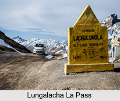
 The high mountain pass of the Lungalacha La is situated at an altitude of 5, 059 m above sea level along the Leh- Manali Highway. The pass is around 54 km away from Sarchu and 24 km from Pang. Lachulung La is on the border of Himachal Pradesh and Jammu and Kashmir and also, it separates the valleys of Tsarap Chu and Tozay.
This mountain pass is considered to be one of the easier passes that can be travelled easily by moving along the nala on both sides. However, due to elevation, the adventure enthusiasts may face high altitude sickness if they have not undergone acclimatization.
This article is a stub. You can enrich by adding more information to it. Send your Write Up to content@indianetzone.com









