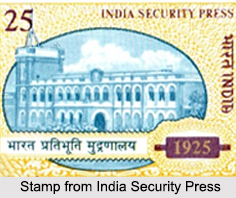
 The India Security Press of Nashik is a government press and a subsidiary of the Security Printing and Minting Corporation of India Limited (SPMCIL). The India Security Press was set up from 1926 onwards, where all the printing and overprinting of postage stamps of India was conducted. It was set up in the city of Nashik in the Indian state of Maharashtra.
History of India Security Press
Before the World War I, the possibility of printing postage stamps and other security items in India could not be pursued. Following this issue in 1922, the then master of the Bombay Mint along with the Controller of Printing, Stationery and Stamps reviewed the feasibility of the matter. And in 1923, with their combined favourable reports and successful demonstration of production techniques in Delhi, the government lead to a decision to establish a security press at Nashik.
This was called the India Security Press, whose establishment was entrusted to Thomas De La Rue, the London firm which already had a 6 decade long association with Indian stamps. The construction of the building began in 1924 at an original estimate of 27½ lakhs rupees and was completed in 1925.
Stamps of India Security Press
In 1925, after the establishment of the India Security Press, the printing of stamps began in Nashik and the first stamps produced were the definitive series of George V. These stamps were printed using typography of the same plates that were used earlier in England by De La Rue and had a different watermark, which was changed by the Press to multiple stars. The India Security Press used typography for most stamps.
The concept of lithography was re- introduced and the first stamps printed using this technique were the first Air Mail series of 1929. This process of lithography was only used for most important commemorative issues, like the 1931 series commemorating the inauguration of New Delhi as the seat of government that year. Lithography was used even after Independence but the first definitive series to be issued was the misnamed "Archaeological" series of 16 values, where the top 4 values were produced by lithography and the remaining values by typography.
In 1952, a new technique of photogravure printing was installed and in the same year in October, a series of 6 values was produced based on the theme of Saints and Poets. However, these were not the first photogravure stamps of India, the first being the Gandhi series of 1948, which were printed by Courvoisier of Geneva. Since then, photogravure has been used to produce all Indian stamps; typography and lithography being reserved for service labels only.
In present times, the India Security Press is charged with the task of printing passports, visas, postage stamps, post cards, inland letters, envelopes, non-postal adhesives, court fees, fiscal, and Hundi stamps in the country.